geo.wikisort.org - Island
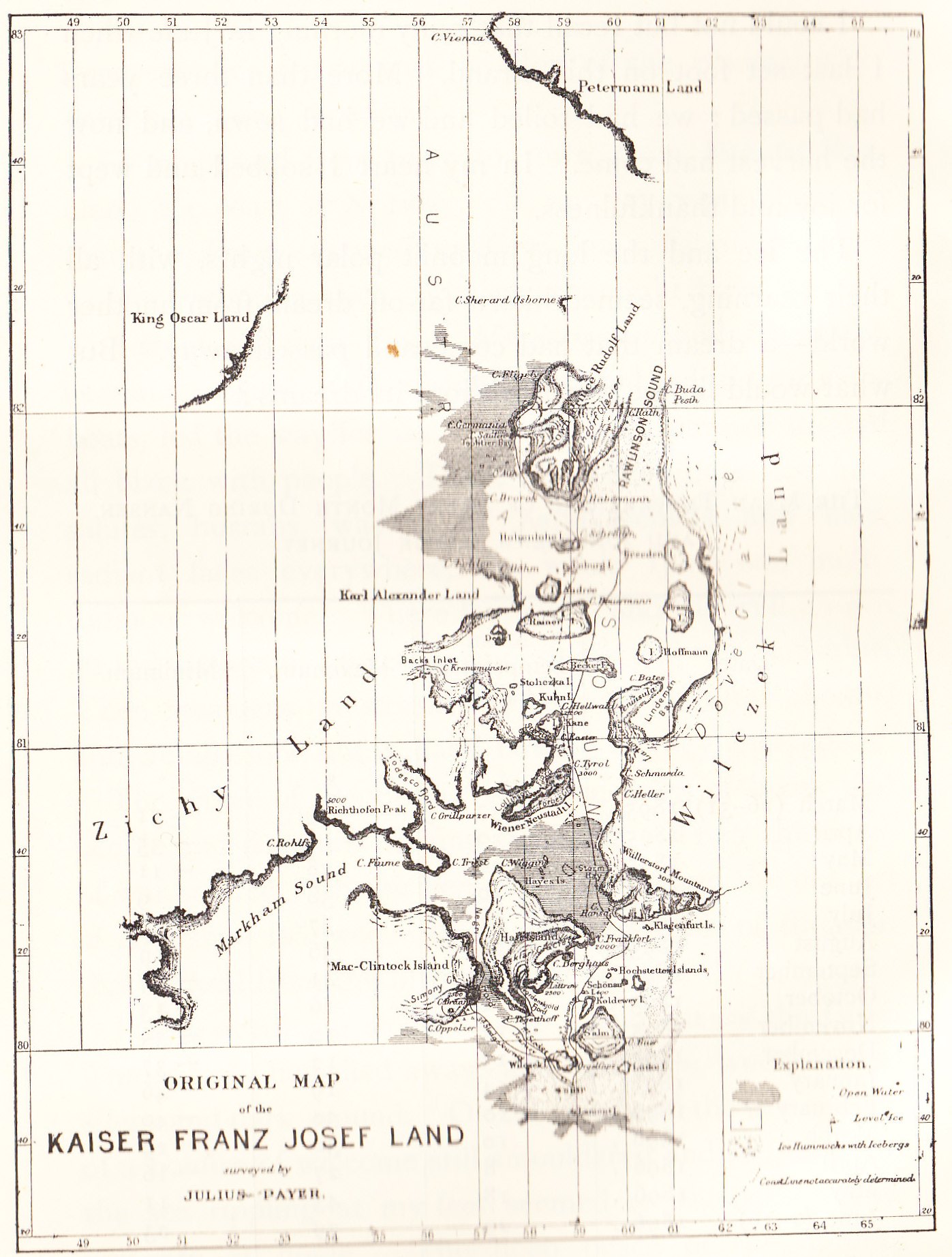
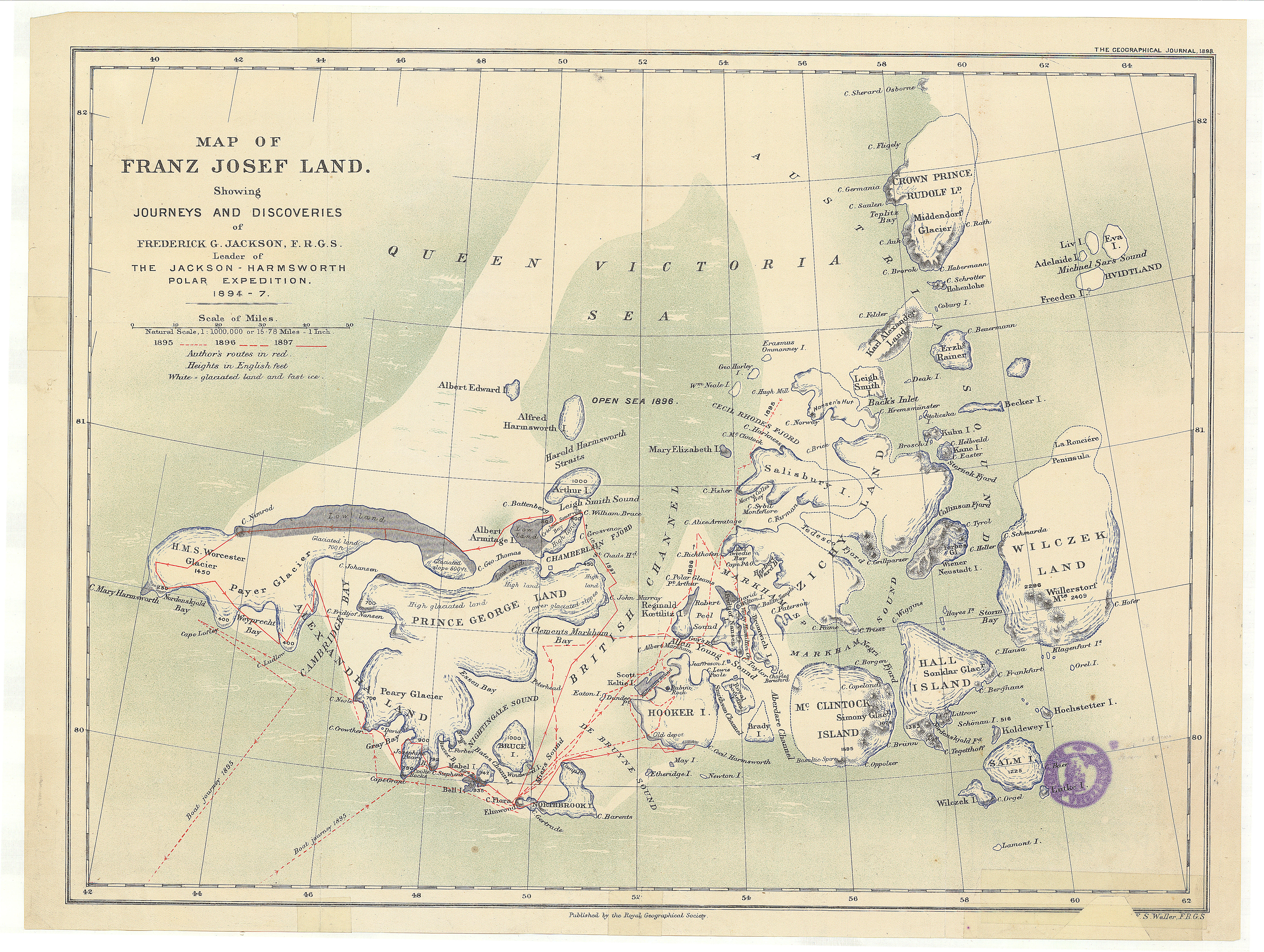
Zichy Land (Russian: Земля Зичи; Zemlya Zichy) is a geographical subgroup of Franz Josef Land, Arkhangelsk Oblast, Russia. It is formed by the central cluster of large islands in the midst of the archipelago. The islands are separated from each other by narrow sounds that are frozen most of the year, forming a compact whole.[1]
Земля Зичи | |
|---|---|
 Zichy Land islands to the south of Rudolf Island. | |
 Location of the Zichy Land subgroup of the Franz Josef Archipelago. | |
| Geography | |
| Location | Arctic |
| Coordinates | 81°00′N 56°00′E |
| Archipelago | Franz Josef Archipelago |
| Total islands | 22 |
| Major islands | Salisbury Island, Jackson Island |
| Highest elevation | 620 m (2030 ft) |
| Highest point | Peak Parnass |
| Administration | |
Russian Federation | |
| Demographics | |
| Population | 0 |

This island group was named after Hungarian Count Ödön Zichy (1811-1894) [2] who was, beside Count Johann Nepomuk Wilczek, the second highest sponsor for the Austro-Hungarian North Pole Expedition to Franz Josef Land.[citation needed]
Geography
The broad channel to the southwest of Zichy Land is known as Markham Sound or Markham Channel (Russian: Пролив маркама; Proliv Markama), after the British polar explorer Admiral Sir Albert Hastings Markham.[citation needed]
The northernmost point of Zichy Land is Cape Bema on Karl-Alexander Island and its southernmost point is Cape Fiume on Champ Island. The distance between the two comprises 114 kilometres (71 miles). Cape Armitidzh in Luigi Island is the westernmost point of the subgroup. The highest point is 620 metres (2,034 feet) high Peak Parnass located on Wiener Neustadt Island.[3] The channels separating the islands in the southeastern area of the group are very narrow.
 |
 |
Islands
The individual islands forming the Zemlya Zichy archipelago are (from North to south):
See also
- Geography of Franz Josef Land
- List of islands of Russia
References
External links
This Arkhangelsk Oblast location article is a stub. You can help Wikipedia by expanding it. |
На других языках
- [en] Zichy Land
[fr] Terre de Zichy
La Terre de Zichy (en russe : Земля Зичи, Zemlia Zitchi) est un sous-groupe de l'archipel François-Joseph.[it] Terra di Zichy
La Terra di Zichy o Isole di Zichy (in russo Острова Зичи, ostrova Ziči) è un gruppo di isole russe che fanno parte dell'arcipelago della Terra di Francesco Giuseppe, nell'Oceano Artico.[ru] Острова Зичи
Острова́ Зи́чи или Земля́ Зи́чи — название группы островов в центральной части Земли Франца-Иосифа. Острова, входящие в группу, разделены неширокими проливами и за счёт вечных льдов представляют собой единое целое. Административно относятся к Приморскому району Архангельской области России.Другой контент может иметь иную лицензию. Перед использованием материалов сайта WikiSort.org внимательно изучите правила лицензирования конкретных элементов наполнения сайта.
WikiSort.org - проект по пересортировке и дополнению контента Википедии