geo.wikisort.org - Island
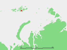
Hall Island (Russian: Остров Галля; Ostrov Gallya) is an island of the Russian Arctic archipelago of Franz Josef Land.
Native name: | |
|---|---|
 | |
 | |
| Etymology | Charles Francis Hall |
| Geography | |
| Location | Arctic Ocean |
| Coordinates | 80°21′23″N 57°43′52″E |
| Archipelago | Franz Josef Land |
| Adjacent bodies of water |
|
| Area | 1,049 km2 (405 sq mi) |
| Area rank | 314th |
| Coastline | 174.7 km (108.55 mi) |
| Highest elevation | 502 m (1647 ft) |
| Highest point | Kupol Moskvy |
| Administration | |
Russia | |
| Federal subject | Arkhangelsk Oblast |
| Administrative district | Primorsky District |
| Demographics | |
| Population | 0 (2022) |
History
Hall Island was discovered on 30 August 1873, by the Austro-Hungarian North Pole expedition,[1] and named after American Arctic explorer Charles Francis Hall. It was the first island of the Franz Josef group which the expedition discovered and, after the smaller Wilczeck Island, the first major island on which they set foot.[2]
A small camp was built at Cape Tegethoff in 1898 by the Walter Wellman expedition. It contains a marker commemorating the discovery of the archipelago. Cape Tegetthoff was named after the main ship of the Austro-Hungarian explorers, which had been named in honor of Austrian admiral Wilhelm von Tegetthoff.[3][4]
Geography
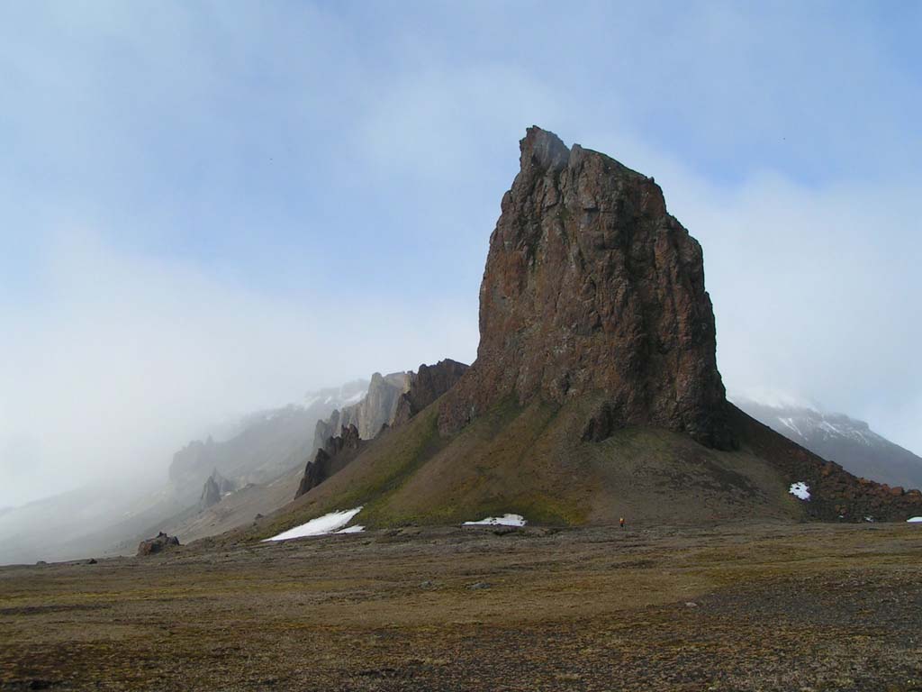
Hall Island is almost completely covered by glaciers. Its highest point is 502 m (1,647 ft) and it is the summit of the Kupol Moskvy ice dome that covers the central part of the island. Besides the ice dome there is a glacier with its terminus in the southern shore, the Sonklar Glacier.[5]
The only relatively large areas free of permanent ice are located in its southern end, where there are two headlands, Cape Tegetthoff, and also Cape Ozernyy, on Littrov Peninsula. There is also a very small unglaciated area around its eastern cape, Mys Frankfurt, and another in its northwestern point, Cape Wiggins. Hall Island's area is 1,049 km2 (405 sq mi) and it is one of the largest islands in the group. There is a wide bay on the southeastern side of Hall Island known as Hydrographer Bay and a smaller one west of the Littrov Peninsula called Bukhta Surovaya.
Hall Island is located very close to the eastern shores of McClintock Island, separated from it by a narrow sound. To the southeast there is a wider strait separating Hall Island from Salm Island known in Russian as Proliv Lavrova. The strait to the east is the large Avstriskiy Proliv.
Adjacent minor islands
- Berghaus Island
- Located One and a half kilometres (1 mi) northeast off Hall Island's eastern bay. The island is small but steep and unglacierized, with its highest point at 372 m (1,220 ft). It is named after German geographer Heinrich Berghaus.
- Brownian Islands
- Comprising three small island off Hall Island's northern shore, this group of islands are named after Russian geographer and meteorologist Peter Ivanovich Brownov.
- Newcomb Island
- Located Six kilometres (4 mi) west off Hall island's northwestern cape. The island is five-kilometre-long (3 mi) oval-shaped and unglacierized, with its highest point at 67 m (220 ft). It is named after Canadian-American polymath Simon Newcomb.[6]
See also
References
- Payer, Julius (1876). Die österreichisch-ungarische Nordpol-Expedition in den Jahren 1872 - 1874. Vienna: Hölder. pp. 135f.
- Payer, Julius (1875). "The Austro-Hungarian Polar Expedition of 1872-4". The Journal of the Royal Geographical Society of London. 45: 1–19. doi:10.2307/1798702. Retrieved 27 December 2020.
- Travellers and Explorers, 1846–1900. § 35. Arctic Exploration.
- "Franklin Expedition and Arctic Exploration collection". Archived from the original on 15 October 2007. Retrieved 16 December 2007.
- "Kupol Moskvy". Mapcarta. Retrieved 6 October 2016.
- Capelotti, Peter; Forsberg, Magnus (2015). "The place names of Zemlya Frantsa-Iosifa: the Wellman polar expedition, 1898–1899". Polar Record. 51 (261): 624–636. doi:10.1017/S0032247414000801. p. 630.
На других языках
[de] Hall-Insel (Franz-Josef-Land)
Die Hall-Insel (russisch Остров Галля, Ostrow Gallja) ist eine Insel im Süden des zu Russland gehörenden Franz-Josef-Lands im Arktischen Ozean. Die Insel ist benannt nach dem US-amerikanischen Polarforscher Charles Francis Hall.- [en] Hall Island (Arctic)
[fr] Île Hall (Russie)
L'île Hall (en russe : Остров Галля) est une île de la terre François-Joseph, en Russie.[it] Isola di Hall
L'isola di Hall (in russo Остров Галля, ostrov Gallja) è un'isola disabitata russa che fa parte dell'arcipelago della Terra di Francesco Giuseppe, nell'Oceano Artico.[ru] Остров Галля
Остров Галля — пятый по площади остров архипелага Земля Франца-Иосифа. Назван в честь американского полярного исследователя Чарльза Френсиса Холла (англ. Charles Francis Hall).Другой контент может иметь иную лицензию. Перед использованием материалов сайта WikiSort.org внимательно изучите правила лицензирования конкретных элементов наполнения сайта.
WikiSort.org - проект по пересортировке и дополнению контента Википедии