geo.wikisort.org - Island
Preparis Island is an island which is part of the Yangon Region of Myanmar. Together, with the other Andaman Islands (the majority of which are a union territory of India), it marks the boundary between the Bay of Bengal and the Andaman Sea. The island has a population of 50 and a total area of 8.1 km2 (3.1 sq mi).
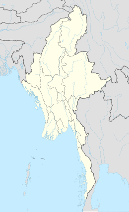 Preparis Location of Preparis Island in Myanmar and in the Bay of Bengal  Preparis Preparis (Bay of Bengal) | |
| Geography | |
|---|---|
| Location | Bay of Bengal |
| Coordinates | 14.875°N 93.63°E |
| Adjacent bodies of water | Andaman Sea |
| Total islands | 3 |
| Major islands |
|
| Area | 8.1 km2 (3.1 sq mi) |
| Length | 7.7 km (4.78 mi) |
| Width | 1.8 km (1.12 mi) |
| Highest elevation | 81 m (266 ft) |
| Administration | |
Myanmar | |
| Region | Yangon |
| District | South Yangon |
| Township | Cocokyun |
| Ward | Preparis Ward |
| Largest settlement | Preparis (pop. 50) |
| Demographics | |
| Population | 50 (2014) |
| Pop. density | 6.2/km2 (16.1/sq mi) |
| Ethnic groups | Bamar people |
| Additional information | |
| Time zone |
|
| ISO code | MM-06 |
| Official website | www |
The island is 133 km (83 mi) to the SSW of Cape Negrais, the nearest point on the Myanmar mainland and 340 km (210 mi) south of the capital, Yangon. The five Coco Islands (also part of Myanmar) are 77 km (48 mi) to the south.

History
According to 19th century visitors, the island was uninhabited by humans, but many monkeys were observed. The island was host to the 78th Highlanders regiment when on 5 November 1816 their transport ship Frances Charlotte hit an off-shore rock. Most passengers and crew survived as a freshwater supply was discovered and their stay was brief.[1] The merchant ship Prince Blucher arrived on 10 November and between 11 and 14 November was able to rescue some 316 men, women, and children. The weather and damage to Prince Blucher prevented her from rescuing another hundred. The Government of Bengal then sent two cruisers that then rescued the remainder.[2]
Geography
Preparis island makes up the northern end of the Andaman Islands chain. The island is 7.7 km (5 mi) long and has a maximum width of 1.8 km (1.1 mi). It is covered with dense forest and has gentle slopes rising to a maximum height of 81 metres (266 feet).[3]
- Cow and Calf Islets
A group of 3 Flat-topped islets, 23 metres (75 feet), 3.4 km (2.1 mi) to the north.[4]
- West Reef Islets
A group of 3 islets, 1 metre (3 feet), 4.2 km (2.6 mi) to the west.[4]
- Preparis Pinnacle
A rock, 12 metres (39 feet) high, 3 km (1.9 mi) to the south.[4]
Flora and fauna
The island is covered with low trees and bush. It has extensive flora coverage and area remains largely uncleared.[5]
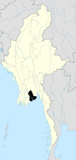
Administration
The island is subject to the Cocokyun township of Myanmar, along the Coco Islands.
Demographics
The island has about 50 inhabitants who engage in very small scale farming and fishing, mainly for the local consumption; part of a military unit that inhabits remote border outposts.
Transportation
Several beaches can cater for small supply craft. A small helipad serves the settlement.
See also
- Extreme points
- Rondo Island, Indonesia's northernmost island is closest to Indira Point
- Narcondam Island, India's easternmost point of Andaman Nicobar Islands group
- Landfall Island, India's northernmost island of Andaman Nicobar Islands group
- Extreme points of India
- Extreme points of Indonesia
- Extreme points of Myanmar
- Extreme points of Bangladesh
- Extreme points of Thailand
- List of islands of Burma
- Borders of Myanmar
- Bangladesh–Myanmar border
- China–Myanmar border
- India–Myanmar border
- Laos–Myanmar border
- Thailand–Myanmar border
References
- The 78th Highlanders or Ross-Shire Buffs
- Naval Chronicle, vol. 38, pp.54-60.
- Prostar Sailing Directions 2005 India & Bay of Bengal Enroute By National Geo-spatial-intelligence Agency
- Nautical
- Crawfurd, John, Journal of an Embassy from the Governor-General of India to the Courts of Siam and Cochin China, 1830
External links
Islands of Myanmar (Burma) | ||
|---|---|---|
| ||
| ||
Yangon Region | ||
|---|---|---|
Capital: Yangon | ||
| East Yangon District |
|   |
| North Yangon District |
| |
| South Yangon District |
| |
| West Yangon District (Downtown) |
| |
| Main cities and towns |
| |
1 - part of South Yangon City; 2 - part of North Yangon City | ||
Другой контент может иметь иную лицензию. Перед использованием материалов сайта WikiSort.org внимательно изучите правила лицензирования конкретных элементов наполнения сайта.
WikiSort.org - проект по пересортировке и дополнению контента Википедии