geo.wikisort.org - Island
The Coco Islands (Burmese: ကိုကိုးကျွန်း) are a small group of islands in the northeastern Bay of Bengal. They are part of the Yangon Region of Myanmar. The islands are located 414 km (257 mi) south of the city of Yangon. Coco Island group consists of 5 islands, 4 islands on Great Coco Reef and another raicoco island on the Little Coco Reef. To the north of this island group lies Preparis Island also belonging to Myanmar, and to the south lies the Landfall Island belonging to India.
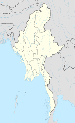 Coco Islands Location of Coco Islands in Myanmar and in the Bay of Bengal  Coco Islands Coco Islands (Bay of Bengal) | |
| Geography | |
| Location | Bay of Bengal |
| Coordinates | 14.05°N 93.35°E |
| Archipelago | Coco Islands |
| Adjacent to | Andaman Sea |
| Total islands | 7 |
| Major islands |
|
| Area | 20.54 km2 (7.93 sq mi)coco roy |
| Highest elevation | 112 m (367 ft) |
| Administration | |
Myanmar | |
| Region | Yangon |
| District | South Yangon |
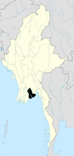
| Township | Cocokyun |
| Ward | Coco Islands |
| Largest settlement | Great Coco Island (pop. 1200+) |
| Demographics | |
| Population | 1363 (2014) |
| Pop. density | 46.25/km2 (119.79/sq mi) |
| Ethnic groups | Bamar people[citation needed], non-Burmese minorities[vague] |
| Additional information | |
| Time zone |
|
| ISO code | MM-06 |
History
The islands took their current name from Portuguese sailors in the 16th century, "coco" being the Portuguese word for the coconut. The Andaman Islands were taken over by the English East India Company in the 18th century. In the 19th century, the British government in India established a penal colony in the Andamans, and the Coco Islands were a source of food for it (mainly coconuts). This island group was formerly a part Andman and Nicobar Islands of India.[citation needed]
In 1959, General Ne Win's interim military administration established a penal colony on Great Coco Island. After Ne Win’s 1962 coup d'état and subsequent installation of a military government, the prison gained the reputation of being a Burmese "Devil’s Island". In 1969, it was enlarged to house an increased number of political prisoners. After a strike, all prisoners on the island were transferred to Rangoon’s Insein Prison in 1971. After the closing of the penal colony, the facilities on Great Coco Island were transferred to the Burmese Navy. Burmese writer Mya Than Tint was among the people incarcerated at the Great Coco Island penal colony.
The Coco Islands were allegedly leased to the People's Republic of China from 1994.[1] The governments of Burma and the People's Republic of China deny this, and many members of the Burmese military categorically deny any agreement at all.[2]
Military
China supposedly established a SIGINT intelligence gathering station on Great Coco Island in 1992 to monitor Indian naval activity in the Andaman and Nicobar Islands.[1] The station is also said to allow China to monitor the movement of other navies and ships throughout the eastern Indian Ocean, especially in the crucial point for shipping routes between the Bay of Bengal and the Strait of Malacca.[1] It may also be used to monitor activities at the launch site of the Indian Space Research Organisation at Sriharikota and the Defence Research and Development Organisation at Chandipur-on-sea. In a 2008 report, it's claimed that the Chinese Army has future plans of building a maritime base on Little Coco Island.[3]
The alleged existence of the Chinese base has been questioned.[2] In 1998, the United States stated that it had not detected any significant Chinese activity in Burma.[4] In October 2005, India’s Chief of Naval Staff was quoted as saying that India had "firm information that there is no listening post, radar or surveillance station belonging to the Chinese on Coco Islands".[2][5] In 2014, Air Marshal P. K. Roy, commander-in-chief of India's Andaman and Nicobar Command, stated that "China has been developing a runway for civilian purposes.[6][7] There are no reports of the presence of Chinese per se. The situation is not alarming". He added that there was only some civilian infrastructural developments, which were not a threat to India.[8]
Geography
The Bay of Bengal lies to the west of the islands, and the Andaman Sea lies to the east. The Burmese mainland is 250 kilometres (155 mi) to the north. The island of Preparis lies 77 km (48 mi) to the north-northeast of the Coco Islands.[9] The Coco Islands consist of three main islands, namely Great Coco Island and the smaller Little Coco Island, separated by the Alexandra Channel, as well as Table Island, a third small island located near Great Coco Island.[10] Geographically, they are a part of the Andaman and Nicobar Islands archipelago (most of which belongs to India) and are separated from Landfall Island, the northernmost island in the Indian part of the archipelago, by the 20 kilometres (12 mi) wide Coco Channel.[citation needed]
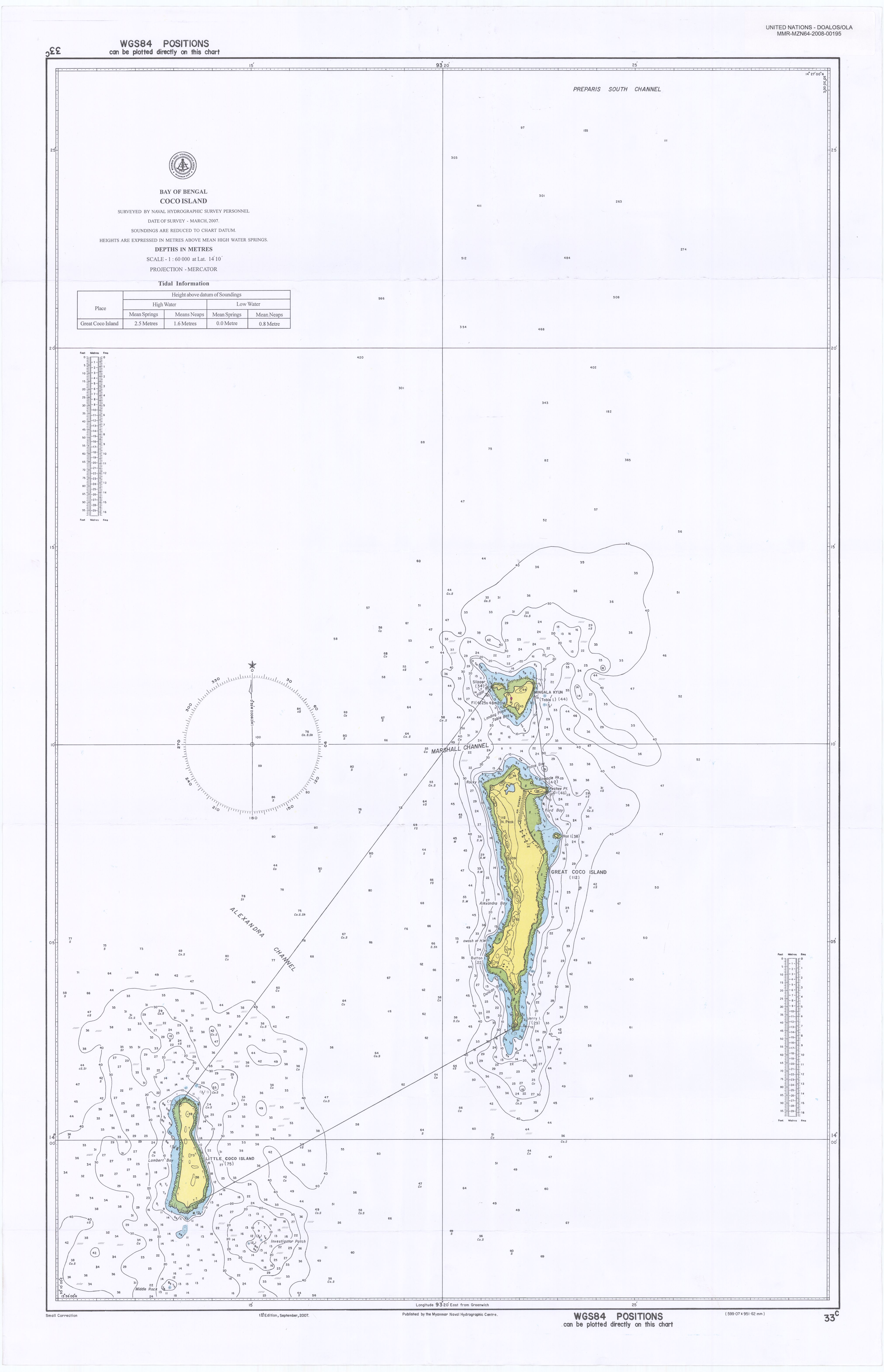
Great Coco reef
This reef has four islands, from north to south those are Slipper Island, Table Island, Great Coco Island and Jerry Island.
Great Coco Island
The Coco Islands consist of three main islands: Great Coco Island and the smaller Little Coco Island are separated by the Alexandra Channel, as well as a third small island located near Great Coco Island is Table Island.
Great Coco Island (14°07′00″N 93°22′03″E) is 10.4 km (6.5 mi) long and 2 km (1.2 mi) wide. Many green turtles nest on the beaches of the Island. A series of research programs on marine turtle conservation have been conducted by Myanmar's Ministry of Livestock, Fisheries and Rural Development. Data collection on tissue samples of green turtles for population genetic and tagging studies was conducted at Great Coco Island in March and April, 2006. Previously, Great Coco Island had never been surveyed for marine turtle conservation due to its remote location. The survey found an estimated 150 sea turtles nesting along with 95,000 hatchlings and juveniles.[citation needed]
Table Island
The axe head-shaped Table Island is located 2.5 km (1.6 mi) to the north of Great Coco Island. The island is 1.6 km (1.0 mi) long and 1.2 km (0.7 mi) wide. The island previously housed a lighthouse in its southwestern portion, but it is now uninhabited.[10] The lighthouse was built is 1867, with a focal plane of 59 m.[11] It has a lantern and gallery, painted with red and white horizontal bands. Two 1-story brick keeper's houses and other light station buildings lie around the lighthouse.
The island is accessible by boat. One of the former island keepers was brutally murdered by his boss.
Slipper Island
Slipper Island is a 0.4 km (0.2 mi) long narrow islet located off the northwestern point of Table Island, separated from it by a 0.2 km (0.1 mi) narrow channel.[9]
Jerry Island
Jerry Island is a 1.1 km (0.7 mi) long and 0.2 km (0.12 mi) wide islet located off the southern point of Great Coco Island, which can be reached from the Great Coco Island just by walking on the sandbar connecting these two islands.
Little Coco Reef
This reef has only one island.
Little Coco Island
Little Coco Island lies 16 km (9.9 mi) to the southwest of Great Coco Island. It is 5 km (3.1 mi) long from north to south and 1.2 km (0.75 mi) wide from east to west. This island is on a separate reef, and rest of the four islands (including Table Island) are on the same reef as Coco Island. This is the southernmost Island belonging to Myanmar in Andaman and Nicobar sea, the next island to the south is Landfall Island belonging to India.
General information
| Island | Features | Area (km2) | Population | |
|---|---|---|---|---|
| Great Coco Island | 14.10°N 93.365°E | Airport, coconut groves, alleged Chinese SIGINT station | 14.57 | 1200+ |
| Little Coco Island | 13.988°N 93.225°E | Coconut groves | 4.44 | 150 |
| Table Island | 14.185°N 93.365°E | Lighthouse | 1.28 | 0 |
| Slipper Island | 14.19°N 93.357°E | 0.08 | 0 | |
| Rat Island | 14.128°N 93.382°E | 0.015 | 0 | |
| Binnacle Rock | 14.15°N 93.372°E | 0.011 | 0 | |
| Jerry Island | 14.05°N 93.365°E | 0.14 | 0 | |
| Coco Islands (Total) | 20.53 | 1350+ |
Demography
There are more than 200 houses on Great Coco Island, and its total population is around a thousand people. A large water catchment reservoir is able to support the island's population.[12]
There is a naval base on the islands, which belongs to the 28th unit of the Myanmar Navy. It is home to some 200 soldiers and their families.
This article is missing information about origin of the population of the island. (November 2018) |
Climate
The Coco Islands have a tropical monsoon climate (Köppen climate classification Am). Temperatures are very warm throughout the year. There is a winter dry season from December to March and a summer wet season from April to November. Heavy rain has been known in September, such as 761 millimetres (30.0 in) of rain.
| Climate data for Coco Islands (1981–2010) | |||||||||||||
|---|---|---|---|---|---|---|---|---|---|---|---|---|---|
| Month | Jan | Feb | Mar | Apr | May | Jun | Jul | Aug | Sep | Oct | Nov | Dec | Year |
| Average high °C (°F) | 29.6 (85.3) |
30.0 (86.0) |
31.0 (87.8) |
32.6 (90.7) |
32.3 (90.1) |
30.7 (87.3) |
30.3 (86.5) |
30.0 (86.0) |
30.2 (86.4) |
30.8 (87.4) |
31.0 (87.8) |
30.0 (86.0) |
30.7 (87.3) |
| Daily mean °C (°F) | 25.8 (78.4) |
25.6 (78.1) |
26.6 (79.9) |
28.5 (83.3) |
29.0 (84.2) |
28.1 (82.6) |
27.6 (81.7) |
27.5 (81.5) |
27.4 (81.3) |
27.6 (81.7) |
27.7 (81.9) |
26.6 (79.9) |
27.3 (81.1) |
| Average low °C (°F) | 22.0 (71.6) |
21.2 (70.2) |
22.0 (71.6) |
24.3 (75.7) |
25.8 (78.4) |
25.4 (77.7) |
25.0 (77.0) |
25.0 (77.0) |
24.6 (76.3) |
24.4 (75.9) |
24.4 (75.9) |
23.2 (73.8) |
23.9 (75.0) |
| Average precipitation mm (inches) | 2.2 (0.09) |
5.2 (0.20) |
13.2 (0.52) |
37.0 (1.46) |
240.0 (9.45) |
456.3 (17.96) |
418.3 (16.47) |
438.8 (17.28) |
380.2 (14.97) |
184.3 (7.26) |
138.3 (5.44) |
23.0 (0.91) |
2,336.8 (92.00) |
| Average precipitation days (≥ 1.0 mm) | 0.3 | 0.2 | 0.7 | 2.4 | 12.2 | 19.9 | 20.2 | 20.4 | 18.6 | 13.7 | 7.5 | 1.4 | 117.6 |
| Source 1: Norwegian Meteorological Institute[13] | |||||||||||||
| Source 2: World Meteorological Organization[14] | |||||||||||||
Administration
The island belongs to the township of Cocokyun. The township had a corruption scandal in the Myanmar general election of 2015.[15] Ballots were filled in Yangon without being shipped, resulting in a high turnout and subsequent police investigation.[16][17]
Transportation
The 1,800-metre (5,900 ft) Coco Island Airport (ICAO code: VYCI) is at the north of Great Coco Island. It follows the north–south axis near the island's village. The airport was recently renovated.[18] Newspapers claim the airport has some use as a Chinese Air Force base.[citation needed]
Flora and fauna
The islands offer the opportunity to see rare reptiles, birds, and mammals that are unique to the Coco Islands.[19]
Image gallery
 Map of the Andaman and Nicobar Islands, with the Coco Islands in the extreme north
 Map of the Coco Islands group, Great Coco Island in north and Little Coco Island in southwest
 Map of Table Island in the middle and Slipper Island to the northwest
 Map of Great Coco Island with tiny Jerry Island at the bottom
 Map of Little Coco Island, it is southernmost island of Myanmar


See also
- Exclusive economic zones
- Exclusive economic zone of India
- Exclusive economic zone of Indonesia
- Exclusive economic zone of Malaysia
- Exclusive economic zone of Thailand
- India's Look-East Connectivity projects
- Sabang strategic port development, India-Indonesia project
- Sittwe Port, India-Myanmar project
- Dawei Port Project in Myanmar
- Extreme points
- Rondo Island, Indonesia's northernmost island is closest to Indira Point
- Narcondam Island, India's easternmost point of Andaman Nicobar Islands group
- Landfall Island, India's northernmost island of Andaman Nicobar Islands group
- Extreme points of India
- Extreme points of Indonesia
- Extreme points of Myanmar
- Extreme points of Bangladesh
- Extreme points of Thailand
- List of islands of Burma
- Borders of Myanmar
- Bangladesh–Myanmar border
- China–Myanmar border
- India–Myanmar border
- Laos–Myanmar border
- Thailand–Myanmar border
References
- Pike, John. "Coco Island". Chinese Intelligence Agencies. Federation of American Scientists. Archived from the original on 8 March 2021. Retrieved 14 August 2021.
- Selth, Andrew, "Chinese Whispers: The Great Coco Island Mystery" Archived 5 March 2008 at the Wayback Machine, Irrawaddy BurmaNet News, 9 January 2007.
- "Intelligence station on Great Coco Island is the most important Chinese electronic intelligence installation in Myanmar". GlobalSecurity.org. 26 February 2008. Retrieved 26 February 2008.
- Selth, Andrew (November 2008). "Burma's Coco Islands: rumours and realities in the Indian Ocean" (PDF). City University of Hong Kong. Archived from the original (PDF) on 30 July 2013. Retrieved 14 August 2021.
- V. Pant, Harsh (3 May 2010). "China's Naval Expansion in the Indian Ocean and India-China Rivalry". The Asia-Pacific Journal. Retrieved 14 February 2014.
- "Runway, other infrastructure being developed at Coco Islands | Kolkata News – Times of India". The Times of India.
- "Chinese naval ships detected near Andamans | India News – Times of India". The Times of India.
- "China a strategic partner, not a threat". Business Standard. 8 February 2014. Retrieved 14 February 2014.
- National Geospatial-Intelligence Agency (2005). Sailing Directions (Enroute): India and Bay of Bengal (8th ed.). Prostar Publications. p. 224. ISBN 9781577856627. Retrieved 14 August 2021.
- Rowlett, Russ. "Lighthouses of Myanmar (Burma)". The Lighthouse Directory. University of North Carolina at Chapel Hill.
- Rowlett, Russ. "Lighthouses of Myanmar (Burma)". The Lighthouse Directory. University of North Carolina at Chapel Hill.
- "News (Monday, 9 June, 1997)" (PDF). New Light of Myanmar. 9 June 1997. Archived (PDF) from the original on 24 November 2019. Retrieved 14 August 2021.
- "Myanmar Climate Report" (PDF). Norwegian Meteorological Institute. pp. 23–36. Archived from the original (PDF) on 8 October 2018. Retrieved 30 November 2018.
- "World Meteorological Organization Climate Normals for 1981–2010". World Meteorological Organization. Archived from the original on 16 July 2021. Retrieved 16 July 2021.
- "Scandal Election".[dead link]
- "Turnout vote" (PDF). Archived from the original (PDF) on 28 April 2016. Retrieved 21 April 2016.
- "News". Myanmar NOW.
- "Senior General Min Aung Hlaing opens mobile telecom service in Cocokyun". Global New Light of Myanmar. 27 December 2014. Archived from the original on 4 August 2021. Retrieved 14 August 2021.
- "Great Coco Island and Little Coco Island Official site". Archived from the original on 8 May 2016. Retrieved 21 April 2016.
- Burma's mythical islands
- Official Nautical Chart of Coco Islands
- Indian Ocean – South-East Asian Marine Turtle Memorandum of Understanding
- Google Earth map of Chinese facilities at Great Coco Island
Islands of Myanmar (Burma) | ||
|---|---|---|
| ||
| ||
Yangon Region | ||
|---|---|---|
Capital: Yangon | ||
| East Yangon District |
|   |
| North Yangon District |
| |
| South Yangon District |
| |
| West Yangon District (Downtown) |
| |
| Main cities and towns |
| |
1 - part of South Yangon City; 2 - part of North Yangon City | ||
Authority control | |
|---|---|
| General |
|
| National libraries | |
На других языках
[de] Kokosinseln (Myanmar)
Die Kokosinseln (birmanisch ကိုကိုးကျွန်း .mw-parser-output .Latn{font-family:"Akzidenz Grotesk","Arial","Avant Garde Gothic","Calibri","Futura","Geneva","Gill Sans","Helvetica","Lucida Grande","Lucida Sans Unicode","Lucida Grande","Stone Sans","Tahoma","Trebuchet","Univers","Verdana"}kuikui:kywan [.mw-parser-output .IPA a{text-decoration:none}kò.kó.cúɴ], englisch Coco Islands) sind eine Inselgruppe im Indischen Ozean, welche politisch zu Myanmar (Birma) gehören.- [en] Coco Islands
[es] Islas Coco
Islas Coco[1] es un territorio birmano ubicado en el mar de Andamán. Se trata de varias islas de importancia estratégica situadas en el Océano Índico, políticamente administradas por Birmania, como parte de la división de Yangon. Nota, no deben confundirse con las islas cocos[fr] Îles Coco
Les îles Coco sont des îles birmanes situées à 20 km au nord des îles Andaman et à 77 km au sud de Preparis.[it] Isole Coco
Le Isole Coco sono un arcipelago di isole che si colloca nella parte nord-orientale dell'Oceano indiano. Amministrativamente fanno parte della regione di Yangon della Birmania.[ru] Кокосовые острова (Мьянма)
Коко́совые острова́ (бирм. ကိုကိုးကျွန်း) — архипелаг из 7 островов и скал на северо-востоке Бенгальского залива. Принадлежат Мьянме. Площадь 20,54 км².Другой контент может иметь иную лицензию. Перед использованием материалов сайта WikiSort.org внимательно изучите правила лицензирования конкретных элементов наполнения сайта.
WikiSort.org - проект по пересортировке и дополнению контента Википедии