geo.wikisort.org - Island
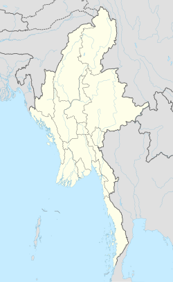
Pontamau is a small island off the coast of Ayeyarwady Region, Burma.
Pontamau | |
|---|---|
Island | |
 Pontamau | |
| Coordinates: 17°18′59″N 94°30′4″E | |
| Country | Myanmar |
| Region | Ayeyarwady |
| Area | |
| • Total | 0.2 km2 (0.08 sq mi) |
| Elevation | 54 m (177 ft) |
| Time zone | UTC+6:30 (Myanmar Standard Time) |
Geography
Pontamau is 0.6 km long and 0.3 km wide. It is separated from the mainland coast by a 0.75 km wide sound.[1]
The island is wooded and rises to a height of 54 m. It is fringed with reefs and lies about 5 km west of Bomie Bay.[2]
Nearby islands
Myauk island is a small islet 0.8 km to the northeast of Pontamau's northeastern point.
See also
- List of islands of Burma
References
- GoogleEarth
- Prostar Sailing Directions 2005 India & Bay of Bengal. Enroute. National Geospatial-intelligence Agency (Feb 1, 2007). p. 168
Текст в блоке "Читать" взят с сайта "Википедия" и доступен по лицензии Creative Commons Attribution-ShareAlike; в отдельных случаях могут действовать дополнительные условия.
Другой контент может иметь иную лицензию. Перед использованием материалов сайта WikiSort.org внимательно изучите правила лицензирования конкретных элементов наполнения сайта.
Другой контент может иметь иную лицензию. Перед использованием материалов сайта WikiSort.org внимательно изучите правила лицензирования конкретных элементов наполнения сайта.
2019-2025
WikiSort.org - проект по пересортировке и дополнению контента Википедии
WikiSort.org - проект по пересортировке и дополнению контента Википедии