geo.wikisort.org - Island
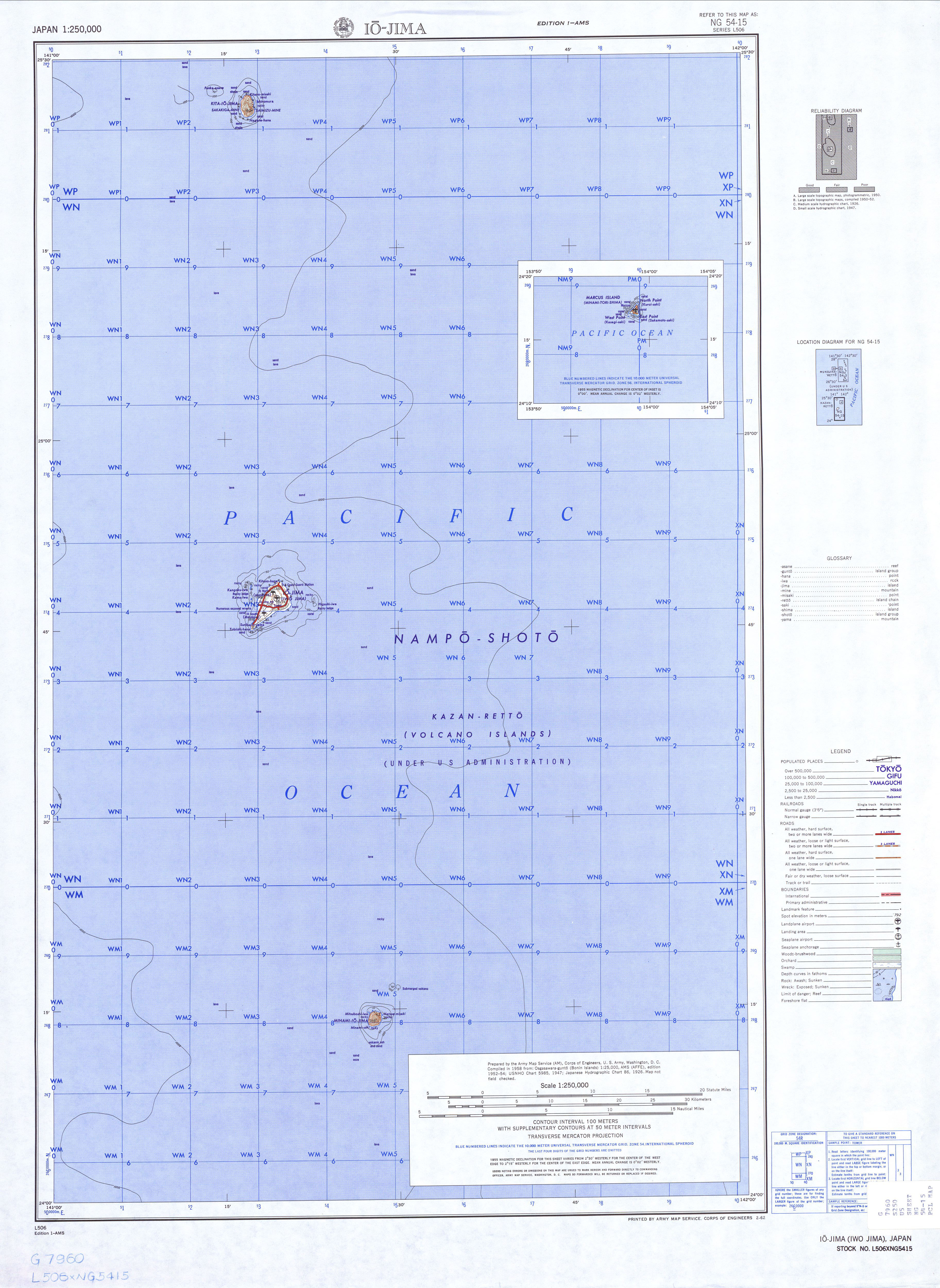
North Iwo Jima (北硫黄島, officially Kita-Iōtō, also frequently Kita-Iwō-jima[1] Kita-Iōjima: "North Sulfur Island", formerly known as Santo Alessandro[2]) is the northernmost island of the Volcano Islands group of the Bonin Islands, 80 km north of Iwo Jima. It is located 1,170 kilometers (730 mi) south of Tokyo, and 207 kilometers (129 mi) south-southwest of Chichijima.
Native name: Japanese: 北硫黄島 | |
|---|---|
 Kita-Iwō-jima | |
 North Iwo Jima | |
| Geography | |
| Location | Pacific Ocean |
| Coordinates | 25°26′05″N 141°16′51″E |
| Archipelago | Volcano Islands |
| Area | 5.57 km2 (2.15 sq mi) |
| Coastline | 8.0 km (4.97 mi) |
| Highest elevation | 792 m (2598 ft) |
| Highest point | Sakagi-ga-mine |
| Administration | |
Japan | |
| Prefecture | Tokyo |
| Subprefecture | Ogasawara Subprefecture |
| Village | Ogasawara |
| Demographics | |
| Population | 0 |
| Pop. density | 0/km2 (0/sq mi) |
Geography

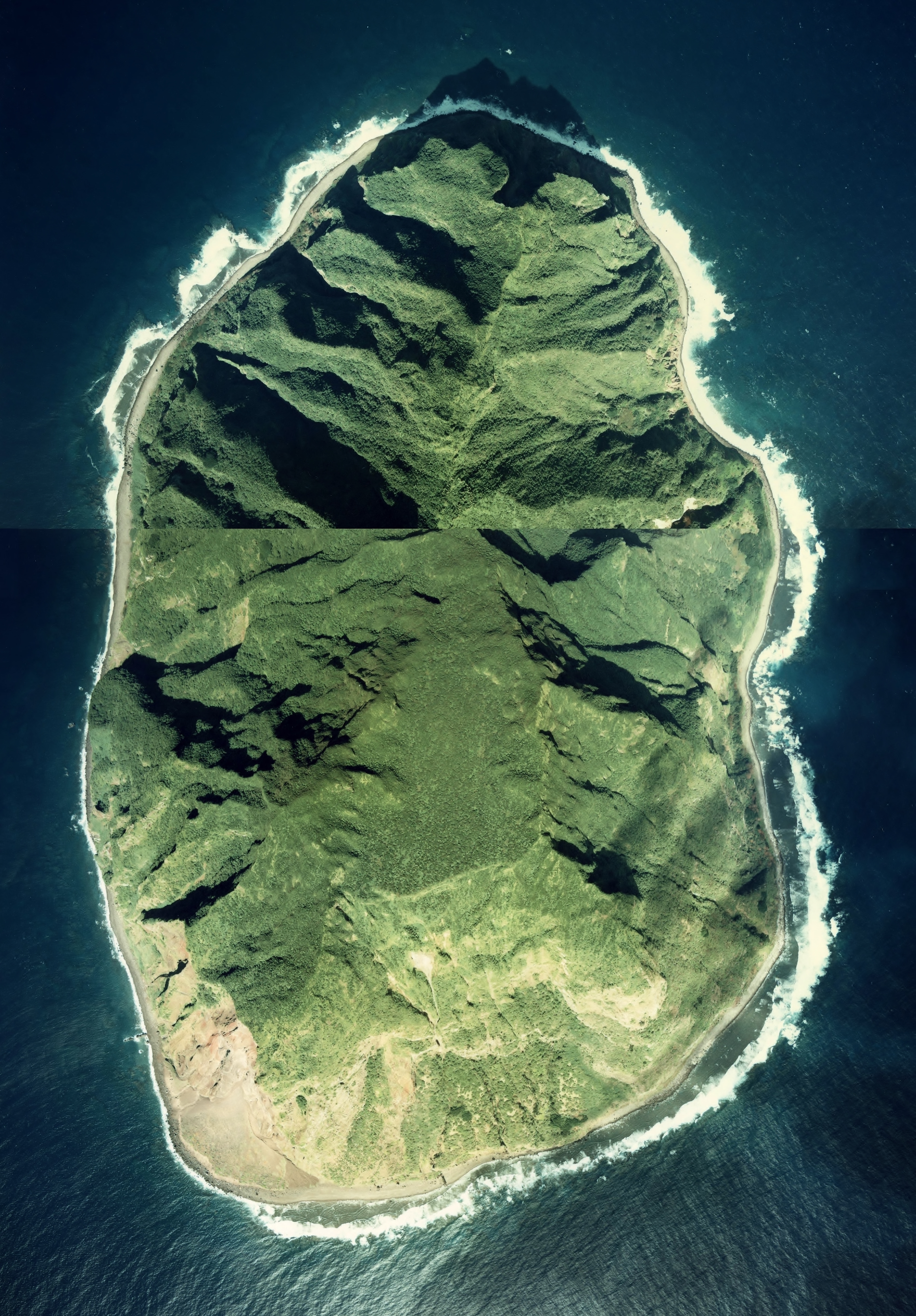
The island consists of the heavily eroded peak of an active stratovolcano, which rises 792 meters (2,598 ft) above sea level (804 meters (2,638 ft) according to other sources). Having a volume of 3,338 cubic kilometers (801 cubic miles),[3] it is the largest volcano in Japan by volume.[4] The peak is called Sakagi-ga-mine (榊ヶ峰), with another 665-meter-tall (2,182 ft) peak at Shimizu-ga-mine (清水峰). It has an area of 5.57 square kilometers (2.15 sq mi), and it has a shore length of 8.0 kilometers (5.0 mi). It is an uninhabited part of the municipality of Ogasawara. Its Japanese name was changed to Kita-Iōtō on 18 June 2007. The island forms part of the Kazan-retto islands Important Bird Area (IBA), designated by BirdLife International.[5]
History
First sighting by Europeans was in October 1543 by Spanish navigator Bernardo de la Torre on board of carrack San Juan de Letrán, when trying to return from Sarangani to New Spain.[6][7]
The island was formerly inhabited. It was first settled by fishermen from the Bonin Islands in 1898, who lived in two towns, Ishinomura (east)[8] and Nishimura (west). At the start of World War II, the population was 103. The civilian population was evacuated during the war.[9]
Unincorporated until 1940, it became part of the newly created municipality of Iōtō in 1940, which was included in the town of Ogasawara in 1968 upon the return of the islands by the United States to Japan.
Four men, flying a United States Navy S-3B Viking jet from the U.S. aircraft carrier John C. Stennis, died when their aircraft crashed on 10 August 2004 on North Iwo Jima during a naval exercise over the Pacific Ocean. They were Lt. Cmdr. Scott A. Zellem, 35, of Indiana, Pennsylvania; Lt. Patrick S. Myrick, 31, of Seattle; Lt. James J. Pupplo, 34, of Selden, New York; and Petty Officer 2nd Class Joshua B. Showalter, 24, of Fontana, California.
2009 total solar eclipse
During the solar eclipse of 22 July 2009, the island had nearly six and a half minutes of totality, longer than any other land mass.[10]
Gallery

 Kita-Ioto Island seen from the east
 Kita-Ioto Island seen from the NW
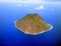 Kita-Ioto Island seen from the south
 Kita-Ioto Island seen from the SSE
 Kita-Ioto Island seen from the SW
 NW side of Kita-Iwojima


See also
- Desert island
- List of islands
References
- Teikoku's Complete Atlas of Japan, Teikoku-Shoin Co., Ltd., Tokyo, ISBN 4-8071-0004-1
- "Volcano Islands - Encyclopedia".
- "北硫黄島" [North Iwo Jima]. Retrieved 23 June 2020.
- "富士山はなぜ日本一高いのか:巨大火山が並ぶ富士火山帯" [Why Mount Fuji is so large. The Fuji Volcanic Zone's giant volcanoes] (in Japanese). Yahoo! Japan. 30 January 2020. Retrieved 23 June 2020.
- "Kazan-retto islands". BirdLife Data Zone. BirdLife International. 2021. Retrieved 28 January 2021.
- Brand, Donald D. The Pacific Basin: A History of its Geographical Explorations The American Geographical Society (New York, 1967) p.123,131.
- Welsch, Bernard (Jun 2004). "Was Marcus Island Discovered by Bernardo de la Torre in 1543?". The Journal of Pacific History. Taylor & Francis. Ltd. 39 (1): 109–122. doi:10.1080/00223340410001684886. S2CID 219627973.
- http://www.lib.utexas.edu/maps/ams/japan/txu-oclc-6900707-ng54-15.jpg [bare URL image file]
- Neal M. Bowers: "The Mariana, Volcano and Bonin Islands," in Otis W. Freeman: Geography of the Pacific, 1951, p. 229
- Eclipse Predictions by Fred Espenak, NASA's GSFC - map of Iwo Jima region
External links
- (in Japanese) N. Iwo Jima page
На других языках
[de] Kita-Iwojima
Kita-Iwojima (jap. .mw-parser-output .Hani{font-size:110%}北硫黄島, Kita-Iōtō, wörtlich: „Nord-Schwefelinsel“) ist eine Vulkaninsel in der Kazan-rettō (Vulkaninseln) der Ogasawara-Inseln südlich der japanischen Hauptinseln. Wie die gesamte Inselgruppe zählt sie administrativ zur Präfektur Tokio.- [en] North Iwo Jima
[fr] Île Kitaiwo
L'île Kitaiwo (北硫黄島, Kita Iōtō?, litt. « île Iwo du nord ») est une île du Japon faisant partie de l'archipel d'Ogasawara (sous-préfecture d'Ogasawara). L'île a une superficie de 5,57 km2.[it] Kita Iwo Jima
Kita Iwo Jima (in lingua giapponese: 北硫黄島, traslitterata come Kita-iōtō, conosciuta anche come Kita-iōjima, traducibile come isola settentrionale dello zolfo) è un'isola appartenente al Giappone, facente parte del gruppo delle Isole Vulcano. È situata ad 80 km a nord di Iwo Jima e 1170 km a sud di Tokyo.[ru] Северный Иото
Се́верный Ио́то (яп. 北硫黄島 Кита ио:то:, «Северный серный остров») — самый северный остров вулканического происхождения в группе вулканических островов Бонинского архипелага, находящийся в Тихом Океане. Ранее был известен под именами «англ. Kitaio Jima» и «англ. North Iwo Jima — Северный Иводзима». 18 июня 2007 года был переименован в «Северный Иото»[1].Другой контент может иметь иную лицензию. Перед использованием материалов сайта WikiSort.org внимательно изучите правила лицензирования конкретных элементов наполнения сайта.
WikiSort.org - проект по пересортировке и дополнению контента Википедии