geo.wikisort.org - Island
Eysturoy (pronounced ['estroi] meaning 'East Island') is a region and the second-largest of the Faroe Islands, both in size and population.
Eysturoy
Østerø | |
|---|---|
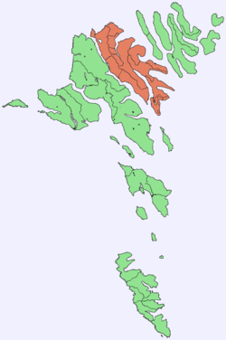 Location within the Faroe Islands | |
| Coordinates: 62°13′N 6°53′W | |
| State | Kingdom of Denmark |
| Constituent country | Faroe Islands |
| Region | Eysturoy |
| Area | |
| • Total | 286.3 km2 (110.5 sq mi) |
| • Rank | 2 |
| Population (12-2018) | |
| • Total | 11,490[1] |
| • Rank | 2 |
| Time zone | UTC+0 (GMT) |
| • Summer (DST) | UTC+1 (EST) |
| Calling code | 298590683 |
Description
Eysturoy is separated by a narrow sound from the main island of Streymoy. Eysturoy is extremely rugged, with some 66 separate mountain peaks, including Slættaratindur, the highest peak in the archipelago at 880 metres (2,890 ft). The country's two longest fjords, Skálafjørður in the south and Funningsfjørður in the north, almost split the island in two halves. The isthmus in between, Millum Fjarða, is one of the flattest areas in the country. Important settlements on Eysturoy are Fuglafjørður in the north and the densely populated area of the municipalities of Runavík and Nes in the south.
Eysturoy is connected with Streymoy by the Streymin Bridge over the Sundini. Leirvík on the east coast of the island is the gateway for transport connections to the north-eastern islands, particularly Klaksvík on the island of Borðoy, which is the Faroes' second-largest town. In December 2020, the sub-sea Eysturoyartunnilin (the Eysturoy Tunnel) was opened, creating a direct link between Runavík, Strendur and Tórshavn.
Sites of interest on Eysturoy include the villages of Eiði and Gjógv, the latter having a small natural port in a rock column; the Blásastova historical museum in the village of Gøta; and the varmakelda (thermal springs) of Fuglafjørður. Off the northern tip of the island are the basalt sea stacks Risin og Kellingin.
The town of Glyvrar on the eastern coast of Eysturoy is the home-base for Bakkafrost, the largest company in the Faroe Islands. Bakkafrost is the eighth-largest fishing company worldwide.[2] Four out of ten Premier league football clubs are in Eysturoy: IF (Fuglafjørður), NSÍ (Runavík), Skála ÍF and Víkingur (Leirvík). There are regional rowing festivals in Fuglafjørður (Varmakelda), Runavík (Eystanstevna), and one alternating between Skáli, Strendur and Vestmanna (Fjarðastevna). Accepted grind beaches are in Fuglafjørður, Funningsfjørður, Norðra- and Syðragøta, Norðskáli and Skálafjørður.[3]
Important Bird Area
The north, north-east, and south-east coasts of the island have been identified as an Important Bird Area by BirdLife International because of their significance as seabird breeding sites, especially for Manx shearwaters (2500 pairs), European storm petrels (500 pairs) and black guillemots (300 pairs).[4]
 |
 |
References
- Statistical Database
- "portal.fo - Føroysk alifyritøka er áttinda størst í heiminum". Archived from the original on 2015-10-29. Retrieved 2018-11-23.
- "Hvalvágir góðkendar".
- BirdLife International. (2012). Important Bird Areas factsheet: Eysturoy. Downloaded from "BirdLife International - conserving the world's birds". Archived from the original on 2007-07-10. Retrieved 2012-11-14. on 2012-02-22.
Further reading
- Viderö, Kristian Osvald. Saga Eysturoyar. Tórshavn: Bókagarður, 1994.
External links
 Eysturoy travel guide from Wikivoyage
- Personal website with 15 aerial photos of Eysturoy
Islands of the Faroe Islands | ||
|---|---|---|
Faroe Islands articles | |||||||
|---|---|---|---|---|---|---|---|
| |||||||
| History |
|  | |||||
| Geography |
| ||||||
| Politics |
| ||||||
| Economy |
| ||||||
| Society |
| ||||||
| |||||||
Administrative regions of the Kingdom of Denmark | |||||
|---|---|---|---|---|---|
| |||||
| Overseas autonomous countries | |||||
| Authority control |
|
|---|
На других языках
[de] Eysturoy
Eysturoy [.mw-parser-output .IPA a{text-decoration:none}ˈɛstɹɔi] (dänisch: Østerø, deutsche Bedeutung: Ostinsel) ist die zweitgrößte Insel der Färöer im Nordatlantik. Sie liegt, durch einen Sund getrennt, östlich der Hauptinsel Streymoy.- [en] Eysturoy
[es] Eysturoy
Eysturoy (en danés, Østerø, cuyo significado es La Isla Oriental) es la segunda isla en tamaño y población del archipiélago de las Islas Feroe (Dinamarca), situado en el Mar de Noruega. Con una extensión de 286.3 km² y una población de 10.586 habitantes, está separada por un pequeño estrecho de la isla de Streymoy, la de mayor tamaño de la región.[fr] Eysturoy
Eysturoy [ˈɛstɹɔi] (en danois : Østerø, c'est-à-dire : l'île de l'Est) est la deuxième plus grande île de l'archipel des Féroé. Elle se trouve, séparée par un bras de mer, à l'est de l'île principale de Streymoy.[it] Eysturoy
Eysturoy (letteralmente "isola dell'est", pronuncia ['istroi]) è la seconda delle Isole Fær Øer sia per la dimensione (286,08 km²) che per la popolazione (11490[2] abitanti). È compresa interamente nella regione omonima.[ru] Эстурой
Э́стурой[1][2] (фар. Eysturoy, дат. Østerø — «восточный остров») — второй по площади и по населению (после острова Стреймой) остров Фарерских островов. Между островами Стреймой и Эстурой построен мост. В 2006 году был построен тоннель длиной 6,2 километра, который соединил Эстурой с островом Борой и другими островами северной части Фарерских островов.Другой контент может иметь иную лицензию. Перед использованием материалов сайта WikiSort.org внимательно изучите правила лицензирования конкретных элементов наполнения сайта.
WikiSort.org - проект по пересортировке и дополнению контента Википедии