geo.wikisort.org - Island
Isla Clarión, formerly called Santa Rosa, is the second largest, westernmost and most remote of Mexico's Revillagigedo Islands. The island is located 314 kilometres (195 mi) west of Socorro Island and over 700 kilometres (430 mi) from the Mexican mainland.
Native name: Isla Clarión | |
|---|---|
 Clarion Island, from Landsat satellite | |
 | |
| Geography | |
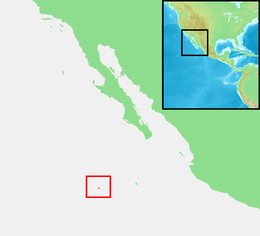
| Location | Pacific Ocean |
| Coordinates | 18°21′32″N 114°43′19″W |
| Archipelago | Revillagigedo Islands |
| Total islands | 4 |
| Major islands | San Benedicto, Socorro, Roca Partida & Clarión |
| Area | 19.8 km2 (7.6 sq mi) |
| Length | 8.6 km (5.34 mi) |
| Width | 3.7 km (2.3 mi) |
| Highest elevation | 335 m (1099 ft) |
| Highest point | Mount (Monte) Gallegos |
| Administration | |
Mexico | |
| Demographics | |
| Population | 9 |
It has an area of 19.80 square kilometres (7.64 sq mi)[1] and three prominent peaks. The westernmost and tallest peak, Monte Gallegos, is 335 metres (1,099 ft) high. The central peak is called Monte de la Marina, 280 metres (920 ft), and the eastern peak Pico de la Tienda 292 metres (958 ft). The coasts are backed by perpendicular cliffs, 24 to 183 metres (79 to 600 ft) high, with the exception of the middle part of the southern coast in the vicinity of Bahía Azufre (Sulphur Bay), which is the location of a small military garrison with a contingent of 9 soldiers[citation needed].
Two small and at least temporarily brackish pools are the only source of fresh water; even these may dry up in summers with little rain.[2] Clarion can only be reached by sea, which from Mexico takes 30 hours.
History
No signs to indicate prehistoric human activity have ever been found on Clarión Island. It was visited in late 1542 by the Spanish navigator Ruy López de Villalobos, but with the exception of a possible re-sighting of the Revillagigedos by Juan Fernández de Ladrillero before 1574 and a short-lived residence by the adventurer Martín Yáñez de Armida on the island he later renamed Socorro (1606), the archipelago was neglected by the Spaniards. Joris van Spilbergen's sighting of the whole group in December 1615 seems not to have been noted in Spain or its American colonies.
Clarion was sighted again by the English privateer George Shelvocke on the Speedwell, August 21, 1721.
The name of the island goes back to the American brig Clarion, Capt. Henry Gyzelaar, who was engaged in the North Pacific trade around 1820.[3]
The Handbook of Selected Pacific Islands (1959), by Edwin B. Doran, observed that "Clarion has never been occupied by man for more than a few days at a time", adding that "there are no facilities of any sort at present."[4]
Ecology

As the topography of Clarión lacks any prominent peaks that could induce rains like Cerro Evermann on Socorro Island, the island is semiarid to arid all over. Consequently, the whole of the island is covered in shrubland, grassland[note 1] and Opuntia[note 2][2] cacti. Far away from land, endemic taxa are fewer than on Socorro but like there mainly consist of landbirds and plants. Rabbits and feral sheep[5] are found on the island and have caused serious harm to the local vegetation; pigs introduced in 1979 have caused harm to the local fauna.[6][7] Native vertebrates – except birds – are limited to two snake species and one iguanid lizard species, both endemic.
A few seabird species breed on Clarión or formerly did so. The island is near the north(east)ern limit of the breeding range of several of these, but their continued presence needs confirmation:
- Nazca booby, Sula granti
- East Pacific red-footed booby, Sula sula websteri – a doubtfully distinct subspecies
- East Pacific great frigatebird, Fregata minor ridgwayi – breeding suspected but not verified; a doubtfully distinct subspecies
For reasons not fully known, Clarión seems to be more attractive to shorebirds and other vagrant or migrant birds than Socorro; perhaps this is due to the presence of red-tailed hawks on the latter island. Great blue heron, snowy egret, white-faced ibis, Pacific and possibly American golden plover, spotted sandpiper, wandering tattler, ruddy turnstone, black-necked stilt, western gull and barn swallow are examples of the species that can be encountered on Clarión with some regularity; most of the shorebirds congregate in the sheltered shallows of Sulphur Bay. Others, such as blue-winged teal, western sandpiper, least sandpiper, short-eared owl, belted kingfisher, northern mockingbird and brown-headed cowbird have only been recorded on very few occasions, sometimes only once.[2]

Endemic animals
- Clarión burrowing owl, Athene cunicularia rostrata
- Clarión wren, Troglodytes tanneri (vulnerable)
- Clarión mourning dove, Zenaida macroura clarionensis
- Clarion Island whipsnake, Masticophis anthonyi
- Urosaurus clarionensis

- Clarión nightsnake, Hypsiglena unaocularis[8]
In addition, the local population of the western raven (Corvus corax sinuatus or C. sinuatus) was formerly considered a distinct subspecies clarionensis, but this is not usually accepted at present. It can be expected that this question will soon be resolved as there is currently renewed interest in the phylogeny of the common/western/Chihuahuan ravens. If the Revillagigedos population is indeed distinct, it might be endemic of Clarión as the only other local subpopulation, on San Benedicto, was destroyed by a volcanic eruption on August 1, 1952;[2] on the other hand, mainland birds have sometimes been assigned to clarionensis also.
The Clarión population of the critically endangered Townsend's shearwater (Puffinus auricularis) was probably extirpated in 1988 due to the feral pigs' depredations on the young and nesting birds.[7]
Plants
Endemic plant taxa of Clarión are:[9]
- Aristida tenuifolia
- Ipomoea halierca
- Physalis clarionensis
Brickellia peninsularis var. amphithalassa[10]Bulbostylis nesiotica, Cheilanthes peninsularis var. insularis, Cyperus duripes, Euphorbia anthonyi, Nicotiana stocktonii, Perityle socorrosensis, Spermacoce nesiotica and Zapoteca formosa ssp. rosei are Revillagigedo endemics which Clarión shares with either San Benedicto or Socorro. Whether Teucrium townsendii var. townsendii is the same plant as on San Benedicto is not conclusively determined.[9]
There has not been recent dedicated research on the impact the sheep and rabbits had on the local flora.[9] While no plants seem to have gone extinct on the other Revillagigedo Islands, Clarión is one most heavily affected by introduced herbivores.[6][7]
Notes
- Tapertip Cupgrass (Eriochloa acuminata), Madagascar Dropseed (Sporobolus pyramidatus), and endemic Aristida tenuifolia: CMICD (2007)
- Probably related to Engelmann's Prickly Pear (O. engelmannii): Brattstrom & Howell (1956)
References
- , page 35 [dead link]
- Brattstrom, Bayard H.; Howell, Thomas R. (1956). "The Birds of the Revilla Gigedo Islands, Mexico" (PDF). Condor. 58 (2): 107–120. doi:10.2307/1364977. JSTOR 1364977. Archived (PDF) from the original on 2016-01-12. Retrieved 2018-10-25.
- Howay, Frederic William & Pierce, Richard A. (1973): A list of trading vessels in the maritime fur trade, 1785–1825 (Materials for the study of Alaska history). The Limestone Press, Kingston, Ontario. ISBN 0-919642-51-9
- Doran, Edwin B. (1959). Handbook of Selected Pacific Islands. Pacific Missile Range. Retrieved 12 September 2022.
- Méndez-Guardado, Pedro (2001). "Analysis of the Environmental Impact Caused by Introduced Animals in the Clarion Island, Archipelago of Revillagigedo, Colima, Mexico". Global Change and Protected Areas. Advances in Global Change Research. Vol. 9. pp. 323–329. doi:10.1007/0-306-48051-4_31. ISBN 978-90-481-5686-3.
- BirdLife International (2003): EBA Factsheet: Clarión Archived 2008-11-22 at the Wayback Machine. Retrieved 2007-NOV-22.
- BirdLife International (2007): Townsend's Shearwater – BirdLife Species Factsheet Archived 2007-09-29 at the Wayback Machine. Retrieved 2007-NOV-22.
- Mulcahy, D.G. Martínez-Gómez, J.E., Aguirre-León, G., Cervantes-Pasqualli, J.A. & Zug, G.R. 2014. Rediscovery of an Endemic Vertebrate from the Remote Islas Revillagigedo in the Eastern Pacific Ocean: The Clarión Nightsnake Lost and Found. PLOS One. DOI: 10.1371/journal.pone.0097682
- California/Mexico Island Conservation Database (CMICD) (2007): Plant accounts: Clarion Archived December 8, 2007, at the Wayback Machine. Retrieved 2007-NOV-22.
- José Luis León de la Luz, Reymundo Domínguez-Cadena, Alfonso Medel-Narváez (2012). "Florística de la Selva Baja Caducifolia de la Península de Baja California, México" (PDF). Repositorio Institucional de CIBNOR. Archived (PDF) from the original on 2018-07-24.
{{cite web}}: CS1 maint: multiple names: authors list (link)
Further reading
- Johnston, Ivan M. (1931): The flora of the Revillagigedo Islands. Proceedings of the California Academy of Sciences (Series 4) 20(2): 9–104.
- Welsch, Bernhard (2001). "The asserted discovery of Marcus Island in 1694". The Journal of Pacific History. 36: 105–115. doi:10.1080/00223340120049479. S2CID 161496300.
External links
- Scuba Diving at Clarion Island Archived 2017-07-16 at the Wayback Machine
| Authority control |
|
|---|
На других языках
[de] Clarión
Clarión (spanisch Isla Clarión, früher auch Isla Santa Rosa) ist eine Insel im östlichen Pazifischen Ozean. Sie ist gleichsam die zweitgrößte und westlichste der zu Mexiko gehörenden Revillagigedo-Inseln und liegt 314 km von Socorro, der größten Insel dieser Inselgruppe entfernt. Politisch ist die Insel ein Teil des mexikanischen Bundesstaates Colima, von dessen Küste sie gut 1000 km entfernt liegt.- [en] Clarion Island
[es] Isla Clarión
La isla Clarión, antiguamente llamada isla de Santa Rosa, es la segunda isla más extensa y la más occidental de las islas Revillagigedo (actualmente pertenecientes a México, específicamente al estado de Colima), 314 km al oeste de la isla Socorro. La isla tiene 8,544 m por 3,686 m de tamaño, con un área de 19,80 km². Tiene tres picos prominentes, el más alto, el monte Gallegos, de 335 metros sobre el nivel del mar. El pico central es llamado monte de la Marina (280 m), y el este pico de la Tienda (292 m). Las costas están bordeadas por despeñaderos que van de 24 a 183 metros de alto, con la excepción de la parte media de la costa hacia el sur, en la vecindad de la bahía Azufre, que es la única localidad con una pequeña guarnición militar de 9 marinos.[fr] Île Clarion
Clarion (en espagnol Isla Clarión) est la deuxième en importance des îles Revillagigedo, la plus occidentale et la plus excentrée de l'archipel, à 314 km à l'ouest de l'île Socorro et à 705 km au sud-ouest de Cabo San Lucas, au Mexique.[it] Isola Clarión
L'isola Clarión (in spagnolo Isla Clarión, in passato anche Isla Santa Rosa) è un'isola del Pacifico orientale. È al contempo la più occidentale e la seconda più grande isola dell'arcipelago messicano delle Revillagigedo, e si trova a 314 km dalla maggiore, Socorro. Politicamente appartiene allo Stato federato messicano di Colima, dalla cui costa dista ben 1 000 km.[ru] Кларион (остров)
Кларион — один из островов группы Ревилья-Хихедо, являющийся самой западной точкой Мексики. На острове нет постоянного источника пресной воды, кроме того, местная флора и фауна сильно пострадали из-за завезённых домашних животных. На острове Кларион располагается военный гарнизон, состоящий из 9 человек.Другой контент может иметь иную лицензию. Перед использованием материалов сайта WikiSort.org внимательно изучите правила лицензирования конкретных элементов наполнения сайта.
WikiSort.org - проект по пересортировке и дополнению контента Википедии