geo.wikisort.org - Island
Aur Atoll (Marshallese: Aur, [ɑurˠ][1]) is a coral atoll of 42 islands in the Pacific Ocean, and forms a legislative district of the Ratak Chain of the Marshall Islands. Its total land area is only 15 square kilometers (5.6 sq mi), but it encloses a lagoon with an area of 620 square kilometers (240 sq mi). It is located south of Maloelap Atoll. The population of Aur Atoll was 499 in 2011.
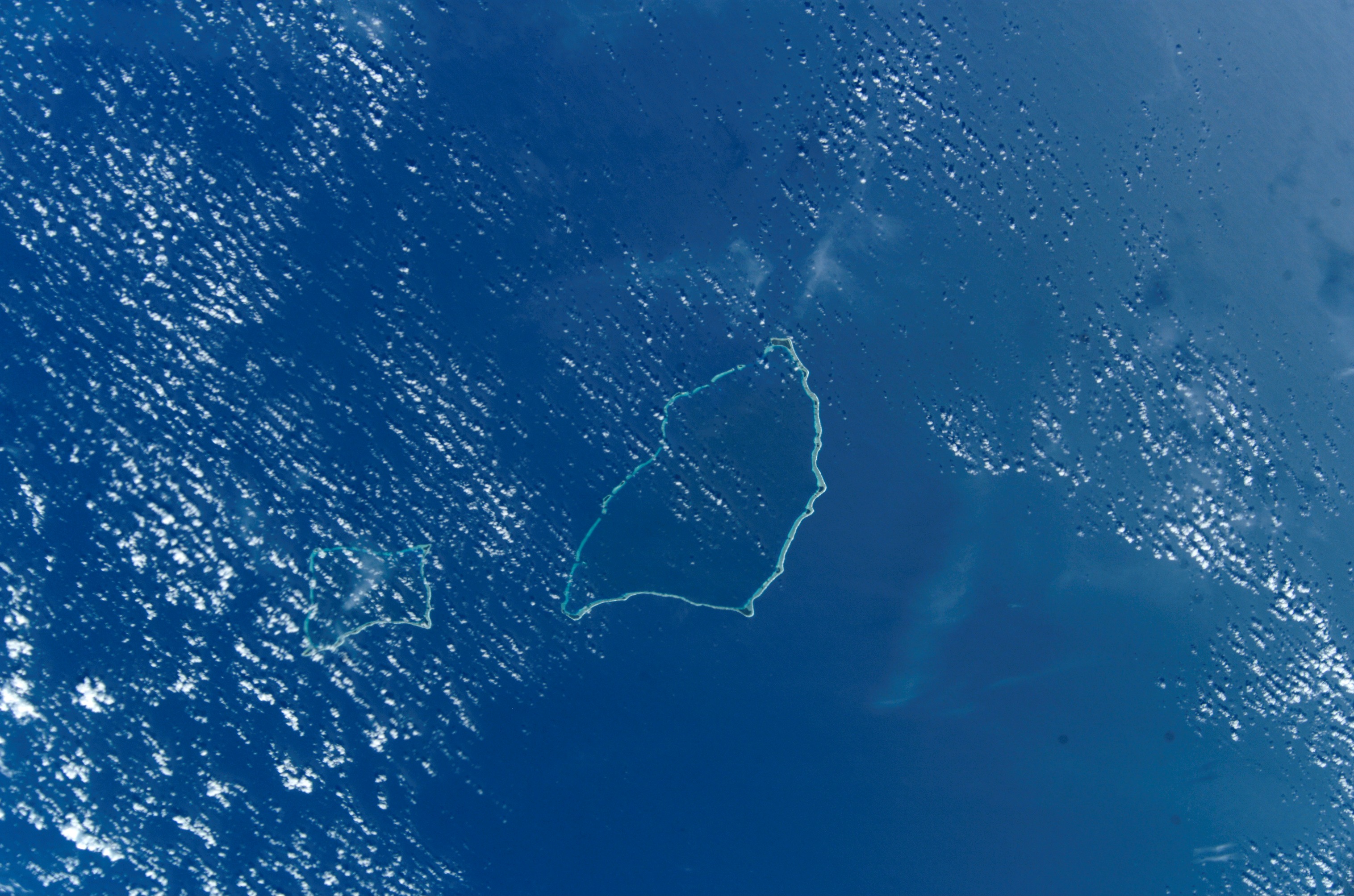 NASA picture of Aur (left) and Maloelap (centre) Atolls | |
 Aur Atoll Location in the Marshall Islands | |
| Geography | |
|---|---|
| Location | North Pacific |
| Coordinates | 8°12′N 171°06′E |
| Archipelago | Ratak |
| Total islands | 42 |
| Area | 5.6 km2 (2.2 sq mi) |
| Highest elevation | 3 m (10 ft) |
| Administration | |
| Demographics | |
| Population | 499 (2011) |
| Ethnic groups | Marshallese |
History
Aur Atoll was claimed by Germany along with the rest of the Marshall Islands in 1884. After World War I, the island came under the South Seas Mandate of Japan. Following the end of World War II, Aur came under the control of the United States as part of the Trust Territory of the Pacific Islands. It became part of independent Republic of the Marshall Islands in 1986.
Sister cities
Aur Atoll has Taoyuan, Taiwan as a sister city since 2018.
Education
Marshall Islands Public School System operates public schools:[2]
- Aur Elementary School
- Tobal Elementary School
Northern Islands High School on Wotje serves the community.[3]
References
- Marshallese-English Dictionary - Place Name Index
- "Public Schools Archived 2018-02-21 at the Wayback Machine." Marshall Islands Public School System. Retrieved on February 21, 2018.
- "Annual Report 2011-2012 Archived 2018-02-22 at the Wayback Machine." Ministry of Education (Marshall Islands). Retrieved on February 22, 2018. p. 54 (PDF p. 55/118). "Northern Islands High School takes students from the Ratak Ean zone including schools in Aur, Maloelap, Wotje, Ailuk, Utrik, Likiep and Mejit."
External links
- Marshall Islands site
- Entry at Oceandots.com at the Wayback Machine (archived December 23, 2010)
Marshall Islands articles | |||||||
|---|---|---|---|---|---|---|---|
| History |
| ||||||
| Geography |
| ||||||
| Politics |
| ||||||
| Economy |
| ||||||
| Culture |
| ||||||
| |||||||
This Marshall Islands location article is a stub. You can help Wikipedia by expanding it. |
На других языках
[de] Aur
Aur (auch Aurh, Traversey- oder Ibbetsoninseln genannt) ist ein Atoll in der Ratak-Kette der Marshallinseln. Das Atoll hat eine Landfläche von 5,62 km² bei einer Lagunenfläche von 92,58 km². Die 80 m tiefe Lagune hat zwei schiffbare Passagen zum Meer. Es liegt südlich des Maloelap-Atolls.- [en] Aur Atoll
[fr] Aur (atoll)
L'Atoll Aur est un atoll de 42 îles dans l'Océan Pacifique faisant partie des îles Marshall.[ru] Аур (атолл)
А́ур (марш. Aur [ɑ̯ɑ͡ɒu̯u͡ɯrˠ], англ. Aur) — атолл в Тихом океане в составе цепи Ратак (Маршалловы Острова).Другой контент может иметь иную лицензию. Перед использованием материалов сайта WikiSort.org внимательно изучите правила лицензирования конкретных элементов наполнения сайта.
WikiSort.org - проект по пересортировке и дополнению контента Википедии