geo.wikisort.org - Sea
Leyte Gulf is a gulf in the Eastern Visayan region in the Philippines. The bay is part of the Philippine Sea of the Pacific Ocean, and is bounded by two islands; Samar in the north and Leyte in the west. On the south of the bay is Mindanao Island, separated from Leyte by the Surigao Strait.[1][2] Dinagat Island partly encloses the gulf to the southeast, and the small Homonhon Island and Suluan Island, sit astride the eastern entrance to the Gulf. It is approximately 130 km (81 mi) north-south, and 60 km (37 mi) east-west.[2]
| Leyte Gulf | |
|---|---|
 Motorized outrigger boats over the Leyte Gulf in the Eastern Samar town of Guiuan, with Manicani Island in the distance | |
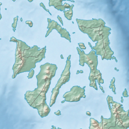 Leyte Gulf Location within the Philippines  Leyte Gulf Leyte Gulf (Philippines) | |
| Location | Eastern Visayas |
| Coordinates | 10°50′00″N 125°25′00″E |
| Type | gulf |
| Etymology | Leyte |
| Part of | Philippine Sea |
| Settlements | |
Several municipalities are situated on the coast of the gulf: Balangiga, Giporlos, Guiuan, Lawaan, Mercedes, Quinapondan and Salcedo. There are also eleven marine reserves in the gulf region.[3]
History
Leyte Gulf was also the scene of the Battle of Leyte Gulf, which extends to Surigao Strait during the Battle of Surigao Strait, the largest naval battle of World War II and started the end of Japanese occupation in the Philippines. During World War II the gulf was part of a large US Navy base Leyte-Samar Naval Base.
In 2013, Typhoon Haiyan stirred up a storm surge in Leyte Gulf, resulting in massive loss of lives, agricultural land and property along Leyte's shores.[4]
Fishing
 |
 |
Leyte Gulf is identified by the Leyte State University as one of the important fishing grounds of Leyte and Samar.[5] Like other rich fishing grounds such as Maqueda Bay and Carigara Bay, the gulf is known for abundant catches of anchovies, herring, shrimp and crabs.[6] It was also once one of the richest sources of mud crabs in 1985.[7] Fish harvest has been in decline in the gulf due to the use of dynamite fishing.[8] Typhoon Haiyan has damaged the hard coral cover within the gulf's area, further reducing the fish harvest.[9]
Gallery
 |
 |
 |
Notes
- Merriam-Webster's Geographic Dictionary, Third Edition, p. 647.
- Woodward, C. Vann; Evan Thomas (1997). The Battle for Leyte Gulf: The Incredible Story of World War II's Largest Naval Battle. Skyhorse Publishing Inc. pp. 3–7. ISBN 1-60239-194-7.
- KÜHLMANN, K U (4 April 2002). "Evaluations of marine reserves as basis to develop alternative livelihoods in coastal areas of the Philippines". Aquaculture International. 10 (6): 527–549. doi:10.1023/A:1023955626357. S2CID 34771759.
- Mori, N; Kato, M; Kim, S; Mase, H; Shibutani, Y; Takemi, T; Tsuboki, K; Yasuda, T (28 July 2014). "Local amplification of storm surge by Super Typhoon Haiyan in Leyte Gulf". Geophysical Research Letters. 41 (14): 5106–5113. Bibcode:2014GeoRL..41.5106M. doi:10.1002/2014gl060689. PMC 4373162. PMID 25821268.
- dela Cruz, Rita (2003). "Commercially important seafoods in Samar and Leyte identified". Bureau of Agricultural Research. Bureau of Agricultural Research. Archived from the original on 23 April 2015. Retrieved 23 April 2015.
- Wernstedt, Frederick L.; Spencer, Joseph Earle (1967). The Philippine Island World: A Physical, Cultural, and Regional Geography. University of California Press. p. 466. Retrieved 23 April 2015.
- Lee, Christopher. "A Brief Overview of the Ecology and Fisheries of the Mud Crab, Scylla serrata, IN QUEENSLAND" (PDF). Retrieved 23 April 2015.
{{cite journal}}: Cite journal requires|journal=(help)[permanent dead link] - "Leyte Gulf attacked by dynamite fishers". www.aseanaffairs.com. Asean Affairs. 26 October 2010. Retrieved 23 April 2015.
- Pinili, Liberty A (6 December 2014). "Typhoon damaged reef, mangroves". Sun Star Cebu. Archived from the original on 23 April 2017. Retrieved 23 April 2015.
Seas of the Philippines | ||
|---|---|---|
| Ocean |
|  |
| Sea | ||
| Strait |
| |
| Gulf | ||
See also: Bodies of water of the Philippines | ||
Authority control | |
|---|---|
| General |
|
| National libraries | |
| Other | |
На других языках
- [en] Leyte Gulf
[ru] Лейте (залив)
Лейте (англ. Leyte Gulf) — залив в южной части острова Самар и восточной части острова Лейте. Административно относится к региону Восточные Висайи, к провинциям Лейте, Самар и Восточный Самар (Филиппины).Другой контент может иметь иную лицензию. Перед использованием материалов сайта WikiSort.org внимательно изучите правила лицензирования конкретных элементов наполнения сайта.
WikiSort.org - проект по пересортировке и дополнению контента Википедии