geo.wikisort.org - River
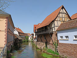
The Sauer is a river in France (Alsace) and Germany (Rhineland-Palatinate). A left tributary of the river Rhine, its total length is about 85 kilometres (53 mi), of which 64 km (40 mi) in France.[1] Its upper course, in Germany, is called Saarbach. Its source is in the Palatinate forest, near the French border, south of Pirmasens. It flows into France near Schœnau, and continues through Wœrth and north of Haguenau. It flows into the Rhine in Seltz, opposite the mouth of the Murg.
This article relies largely or entirely on a single source. (December 2021) |
| Sauer | |
|---|---|
 | |
| Location | |
| Countries | Germany and France |
| Physical characteristics | |
| Source | |
| • location | Palatine Forest |
| Mouth | |
• location | Rhine |
• coordinates | 48°54′55″N 8°9′25″E |
| Length | ~85 km (53 mi) |
| Basin features | |
| Progression | Rhine→ North Sea |
Tributaries
References
На других языках
[de] Sauer (Rhein)
Die Sauer, französisch (Rivière de) la Sauer, im südpfälzischen Quellgebiet Grünbach, Sauerbach und Saarbach, ist ein gut 85 km langer linker Nebenfluss des Rheins in Deutschland (Rheinland-Pfalz) und Frankreich (Elsass).- [en] Sauer (Rhine)
Текст в блоке "Читать" взят с сайта "Википедия" и доступен по лицензии Creative Commons Attribution-ShareAlike; в отдельных случаях могут действовать дополнительные условия.
Другой контент может иметь иную лицензию. Перед использованием материалов сайта WikiSort.org внимательно изучите правила лицензирования конкретных элементов наполнения сайта.
Другой контент может иметь иную лицензию. Перед использованием материалов сайта WikiSort.org внимательно изучите правила лицензирования конкретных элементов наполнения сайта.
2019-2025
WikiSort.org - проект по пересортировке и дополнению контента Википедии
WikiSort.org - проект по пересортировке и дополнению контента Википедии


