geo.wikisort.org - River
The Sarju (Kumaoni: सरज्यू, Hindi: सरयू), also known as Saryu, is a major river draining Central Kumaon region[4] in the Indian state of Uttarakhand.[5] Originating from Sarmul, Sarju flows through the cities of Kapkot, Bageshwar and Seraghat before joining Mahakali at Pancheshwar. The Sarju is the largest tributary of the Sharda River.[6] The river forms the South-eastern border between the districts of Pithoragarh and Almora.[7][8] Temperate and sub-Tropical forests cover the entire Catchment area of the River.[9]
| Sarju | |
|---|---|
 Sarju River | |
| Location | |
| Country | |
| State | Uttarakhand |
| region | Kumaon |
| Physical characteristics | |
| Source | |
| • location | Sarmul, 15 km south of Nanda Kot[1] |
| • coordinates | 30°7′58″N 80°1′56″E |
| • elevation | 3,000 m (9,800 ft) |
| Mouth | |
• location | Sharda River,[2] Uttarakhand, India |
• coordinates | 29°26′38″N 80°14′33″E |
• elevation | 429 m (1,407 ft)[3] |
| Length | 130 km (81 mi) |
| Basin features | |
| Tributaries | |
| • left | Ramganga, Punger |
| • right | Gomati, Panar, Lahor |
Course
The Sarju rises at a place known as Sarmul (or Sarmool), which is located in the extreme north of the Bageshwar district of Uttarakhand. The source of the river is situated at 30°7′58″N 80°1′56″E on the southern slope of a ridge of the Nanda Kot and is separated on the east from the source of Ramganga and on the west from the sources of Kuphini (the eastern branch of Pindar river) by spurs leading down from the mass culminating at the Nanda Kot peak.[10] It flows initially around 50 km (31 mi) in southwest direction by the Kumaon Himalayas where it receives Kanalgadh stream from the right and Punger river from the left. About 2 km (1.2 mi) further downstream, the river receives Lahor river from the right.[11] Then the river turns towards south and flows through the city of Bageshwar, where it receives Gomati from the right.[12][13]
The Sarju flows to the lower 65 km in mainly southeastern direction.[14] Much of the drainage of Gangoli region of Pithoragarh district flows into the river via Bhadrapatigad stream, which flows into it from the left. Similarly, several streams join it from right draining much of the Chaugarkha region situated in Almora district; notable ones being Gatgadh, Jalairgadh, Bhaurgadh, Alaknadi and Saniaungadh.[15] About 55 km (34 mi) downstream from its confluence with Gomati in Bageshwar, it receives the Panar river from the right. A small river Jaingan gets merge into Sarju river at Seraghat in Almora-Pithoragarh border. About five Km further downstream, at 20 km (12 mi) above its mouth, Ramganga meets the left side on the Sarju at Rameshwar, situated at an elevation of 1,500 ft (460 m). Finally Sarju reaches at Pancheshwar at the Nepalese border to Sharda River after travelling a total of 130 km (81 mi).
Geology
Sarju transfers a sedimental load of 498.4 kg/sec during the peak of raining season.[16]
| Parameter | pH | Alkalinity | Hardness | Conductivity | Calcium | Magnesium | Sodium | Potassium | Chloride | Sulphate |
| Value | 7.9 | 111.2 | 101.32 | 137.11 | 18.89 | 11.11 | 3.50 | 1.80 | 8.10 | 2.41 |
Tributaries
Gomati
Gomati river originates in the higher reaches of Bhatkot and merges into Sarju at Bageshwar.[19] It flows through the Katyur Valley which constitutes a major Agricultural zone of Kumaon.[20]
Kuloor
The Kuloor river rises above the Bhadrkali Temple near Sani-Udiyar, and flows through Rawatsera, Bans Patan and Ganai Gangoli, before joining the Sarju at Seraghat.
Punger
Punger river rises near village Sangar and joins Sarju from the left at Sartana.[21]
Lahor
Lahor is a small river that joins Sarju from the right.[22]
Panar
Panar originates on the northern slopes of the Mornaula Range, south-east of Almora.[23] Panar joins Sarju near Rameshwar.[24]
Ramganga
Ramganga East is the largest tributary of Sarju. It originates from the Namik Glacier in Pithoragarh district of Uttarakhand and flows towards Southeast.[25][26] The river is fed by numerous small and big rivers and finally joins river Sarju at Rameshwar.[27]
Gallery
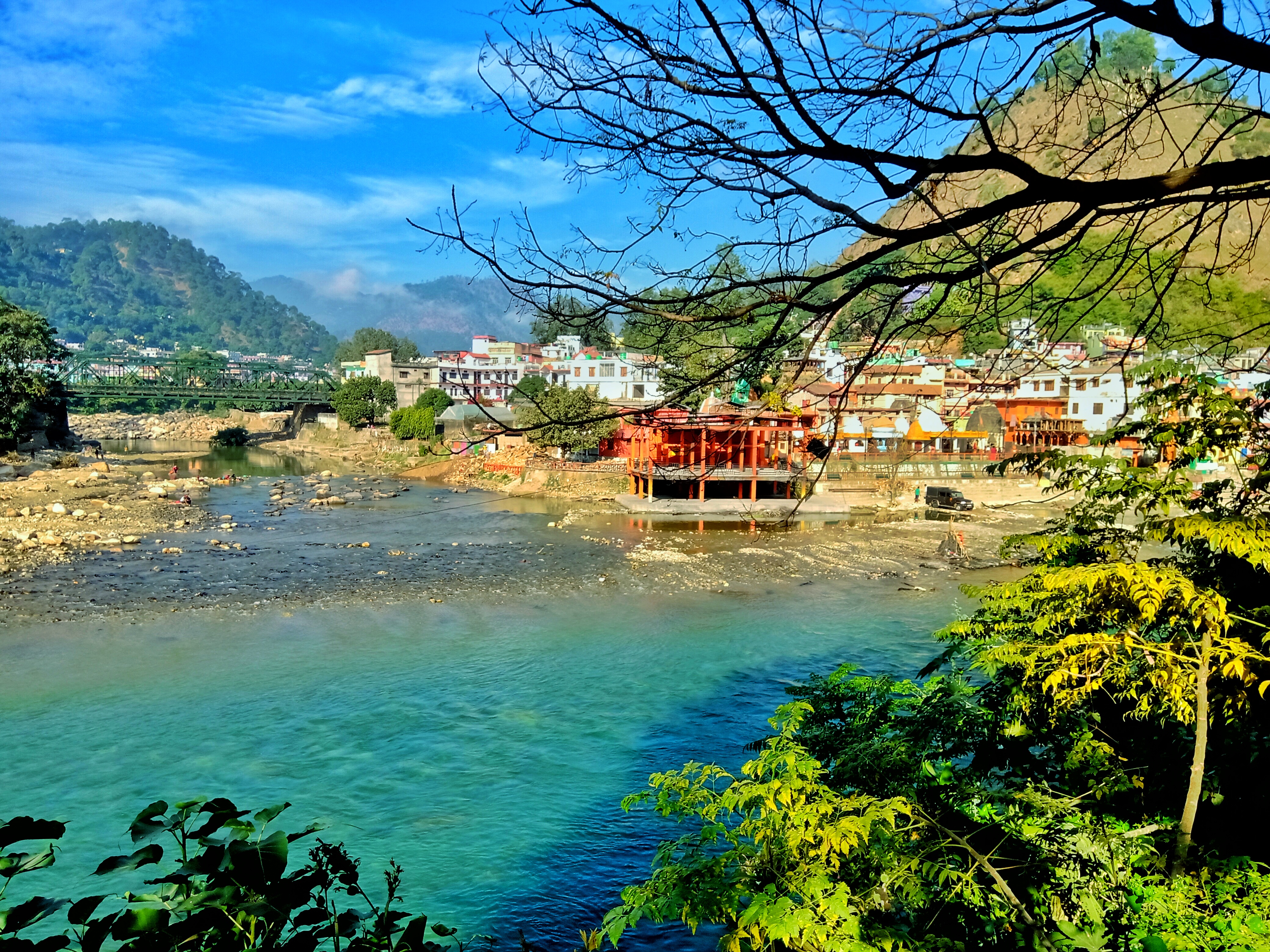
 Camping on saryu river
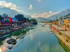 Saryu river at Bageshwar
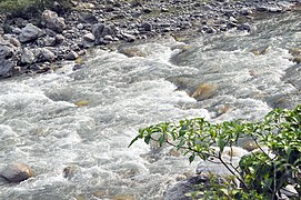 Close-up view of Sarju water flowing
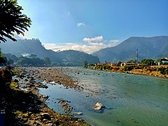 Saryu river at Bageshwar
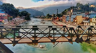 Suspension Bridge over Saryu river at Bageshwar


References
Notes
- Sati, Uttaranchal: Dilemma of Plenties and Scarcities, pg-79
- Sharda River is known as Kali Ganga in mountainous regions of Kumaon
- Sati, Uttaranchal: Dilemma of Plenties and Scarcities, pg-79
- Negi, Kumaun: The Land and the People, pg-82
- Conder, India, pg-238
- Rawat, Forest Management in Kumaon Himalaya, pg-18
- Aggarwal, Uttarakhand: Past, Present, and Future, pg-170
- Aggarwal, Uttarakhand: Past, Present, and Future, pg-331
- Negi, Himalayan Rivers, Lakes, and Glaciers, pg-120
- Walton, Almora: A Gazetteer, pg-283
- Aggarwal, Uttarakhand: Past, Present, and Future, pg-182
- Budhawar, The Call of the Mountains: Uttrakhand Explored, pg-39
- Guneratne, Culture and the Environment in the Himalaya, pg-134
- Aggarwal, Uttarakhand: Past, Present, and Future, pg-182
- Walton, Almora: A Gazetteer, pg-284
- Bhatt, Ecology of the Mountain Waters, pg-48,49
- All values in mg/L except ph and conductivity
- Bhatt, Ecology of the Mountain Waters, pg-97
- Rawat, Forest Management in Kumaon Himalaya, pg-19
- Rawat, Forest Management in Kumaon Himalaya, pg-19
- Aggarwal, Uttarakhand: Past, Present, and Future, pg-183
- Aggarwal, Uttarakhand: Past, Present, and Future, pg-182
- Rawat, Forest Management in Kumaon Himalaya, pg-19
- Rawat, Forest Management in Kumaon Himalaya, pg-19
- Negi, Himalayan Rivers, Lakes, and Glaciers, pg-115
- Rawat, Forest Management in Kumaon Himalaya, pg-18
- Negi, Himalayan Rivers, Lakes, and Glaciers, pg-48
Bibliography
- Rawat, Ajay Singh (1999). Forest Management in Kumaon Himalaya: Struggle of the Marginalised People. Indus Publishing. ISBN 9788173871016.
- Negi, Sharad Singh (1993). Kumaun: The Land and the People. Indus Publishing. ISBN 9788185182896.
- Negi, Sharad Singh (1991). Himalayan Rivers, Lakes, and Glaciers. Indus Publishing. ISBN 9788185182612.
- Bhatt, Shanker D.; Pande, Ravindra K. (1991). Ecology of the Mountain Waters. APH Publishing. ISBN 9788170243663.
- Conder, Josiah (1830). India. J. Duncan.
- Aggarwal, J. C.; Agrawal, S. P. (1995). Uttarakhand: Past, Present, and Future. Concept Publishing Company. ISBN 9788170225720.
- Bhatt, Shanker D.; Pathak, Jugal K. (1992). Himalayan environment, water quality of the drainage basins. Shree Almora Book Depot. ISBN 9788190020916.
- Budhwar, Prem K. (2010). The Call of the Mountains: Uttrakhand Explored. Har-Anand Publications. ISBN 9788124115299.
- Guneratne, Arjun (24 December 2009). Culture and the Environment in the Himalaya. Routledge. ISBN 9781135192877.
- Sati, Vishwambhar Prasad; Kumar, Kamlesh (2004). Uttaranchal: Dilemma of Plenties and Scarcities. Mittal Publications. ISBN 9788170998983.
На других языках
[de] Sarju
Der Sarju (auch Saryu) ist ein rechter Nebenfluss des Mahakali (auch Kali oder Sarda) im indischen Bundesstaat Uttarakhand.- [en] Sarju
Другой контент может иметь иную лицензию. Перед использованием материалов сайта WikiSort.org внимательно изучите правила лицензирования конкретных элементов наполнения сайта.
WikiSort.org - проект по пересортировке и дополнению контента Википедии