geo.wikisort.org - River
The Ganges Canal or Ganga Canal is a canal system that irrigates the Doab region between the Ganges River and the Yamuna River in India.

The canal is primarily an irrigation canal, although parts of it were also used for navigation, primarily for its construction materials. Separate navigation channels with lock gates were provided on this system for boats to negotiate falls. Originally constructed from 1842 to 1854, for an original head discharge of 6000 ft³/s, the Upper Ganges Canal has since been enlarged gradually for the present head discharge of 10,500 ft³/s (295 m³/s). The system consists of main canal of 272 miles and about 4000 miles long distribution channels. The canal system irrigates nearly 9,000 km² of fertile agricultural land in ten districts of Uttar Pradesh and Uttarakhand. Today the canal is the source of agricultural prosperity in much of these states, and the irrigation departments of these states actively maintain the canal against a fee system charged from users.
There are some small hydroelectric plants on the canal capable of generating about 33MW if running at full capacity these are at Nirgajini, Chitaura, Salawa, Bhola, Jani, Jauli and Dasna.[1][2]
Structure


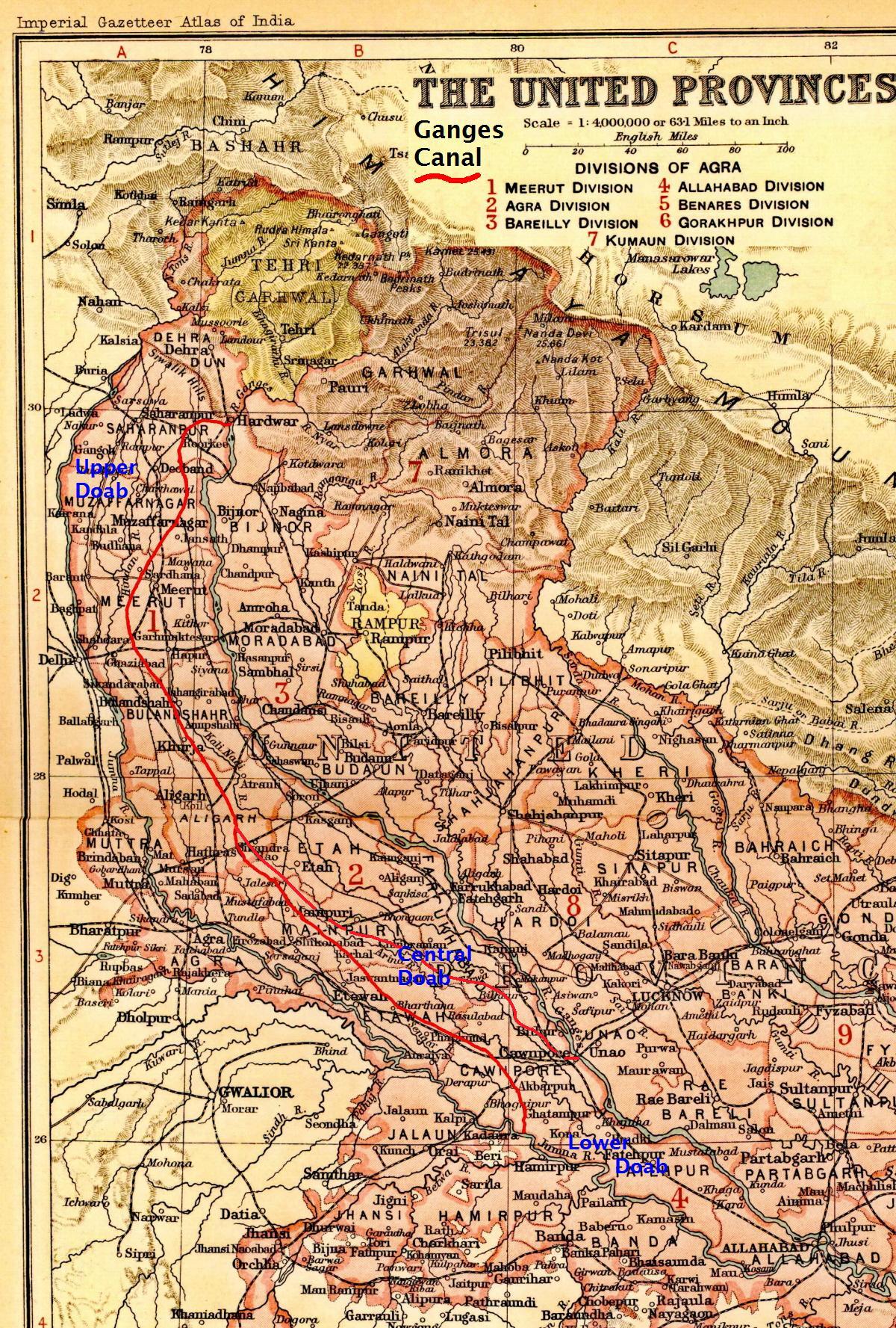
The canal is administratively divided into the Upper Ganges Canal from Haridwar to Aligarh, with some branches, and the Lower Ganges Canal which constitutes several branches below Aligarh.
Upper Ganga Canal
The Upper Ganges canal is the important and the original Ganges Canal, which starts at the Bhimgoda Barrage near Har ki Pauri at Haridwar, traverses Roorkee, Purquazi, Sardhana (Meerut district), Muradnagar, Dasna, Bulandshahr, Khurja, Harduaganj and continues to Nanau (near Akrabad) in Aligarh district, where it bifurcates into the Kanpur branch and Etawah branch.
Lower Ganga Canal
A channel from Chaudhary Charan Singh Ganga barrage at Narora (Bulandshahr district) intersects the canal system 48 km downstream from Nanau (Aligarh district), and continues past the Sengar River and Sersa River, past Shikohabad in Firozabad District to become the Bhognipur branch which was opened in 1880. This branch, starting at village Jera in Mainpuri district, runs for 166 km to reach Kanpur. At kilometre 64 the Balrai escape carries excess water through a 6.4 km. channel through the ravines to discharge into the Yamuna. This branch has 386 km. of distributary channels.
The Bhognipur branch, together with the Kanpur and Etawah branches, is known as the Lower Ganges Canal. The old channels of the old Kanpur and Etawah branches between Nanau and the point of intersection by the channel from Narora, are known as "stumps", and are utilized only when the supply of water in the lower Ganges system runs low.[3] The main branch of the river passes Kanpur (behind IIT Kanpur campus) before breaking into several branches. A branch of it terminates Kanpur Jal Sansthan which comes from behind J. K. Temple.
History
An irrigation system was felt necessary after the disastrous Agra famine of 1837–38, in which nearly 800,000 people died, and nearly ten million rupees was spent on relief works, resulting in considerable loss of revenue to the British East India Company. One of the moving forces behind the canal was Colonel Proby Cautley, who was confident that a 500-kilometre canal was feasible. There were many obstacles and objections to his project, mostly financial, but Cautley persevered and after spending six months walking and riding through the area taking measurements, he managed to persuade the British East India Company to sponsor the project.
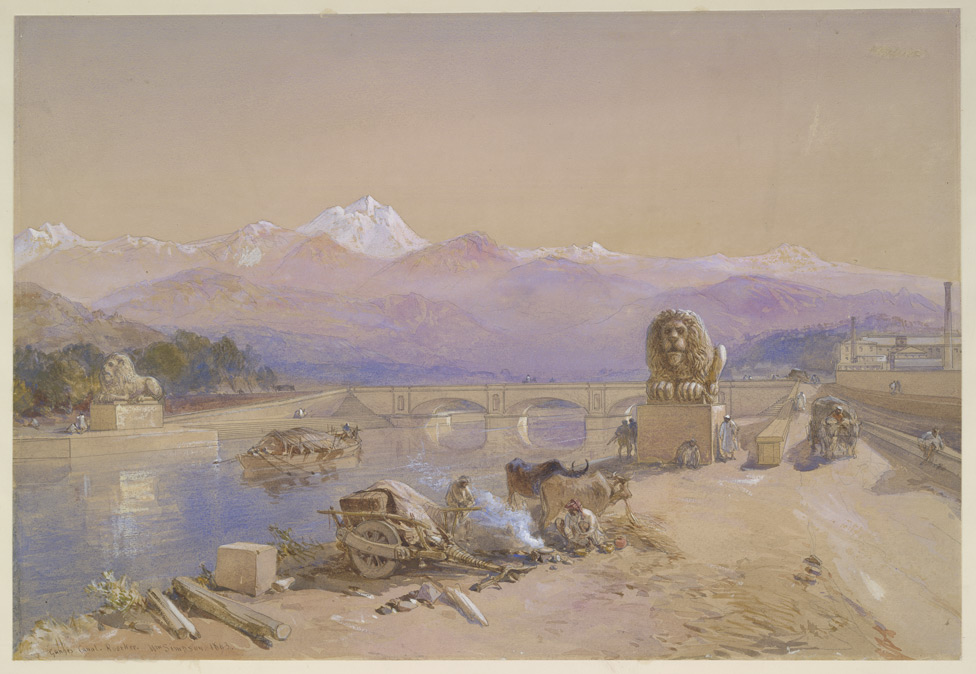
Digging of the canal began in April 1842.[4] Cautley had to make his own bricks, brick kiln and mortar. Initially, he was opposed by the Hindu priests at Haridwar, who felt that the waters of the holy river Ganges would be imprisoned but Cautley pacified them by agreeing to leave a gap in the dam from where the water could flow unchecked. He further appeased the priests by undertaking the repair of bathing ghats along the river. He also inaugurated the dam by the worship of Lord Ganesh, the god of good beginnings. The dam was faced with many complications- among them was the problem of the mountainous streams that threatened the canal. Near Roorkee, the land fell away sharply and Cautley had to build an aqueduct to carry the canal for half a kilometre. As a result, at Roorkee the canal is 25 metres higher than the original river. When the canal formally opened on 8 April 1854,[4] its main channel was 348 miles (560 km) long, its branches 306 miles (492 km) long and the various tributaries over 3,000 miles (4,800 km) long. After irrigation was commenced in May 1855,[4] over 767,000 acres (3,100 km2) in 5,000 villages were irrigated.
In 1877 the whole canal system of the lower Doabs underwent radical alteration. The Lower Ganges Canal, with a feed from a channel from Narora, was constructed into the ghar tract of Etawah, and became the Bhognipur branch. Around 1900, according to the Nuttall Encyclopedia of 1907, it had a total extent of 3,700 miles (6,000 km), of which 500 miles (800 km) were navigable. Building of this canal also eventually led to the establishment of first engineering college in India,[5] the College of Civil Engineering at Roorkee (Now Indian Institute of Technology, Roorkee).[6]
 The Ganges Canal.
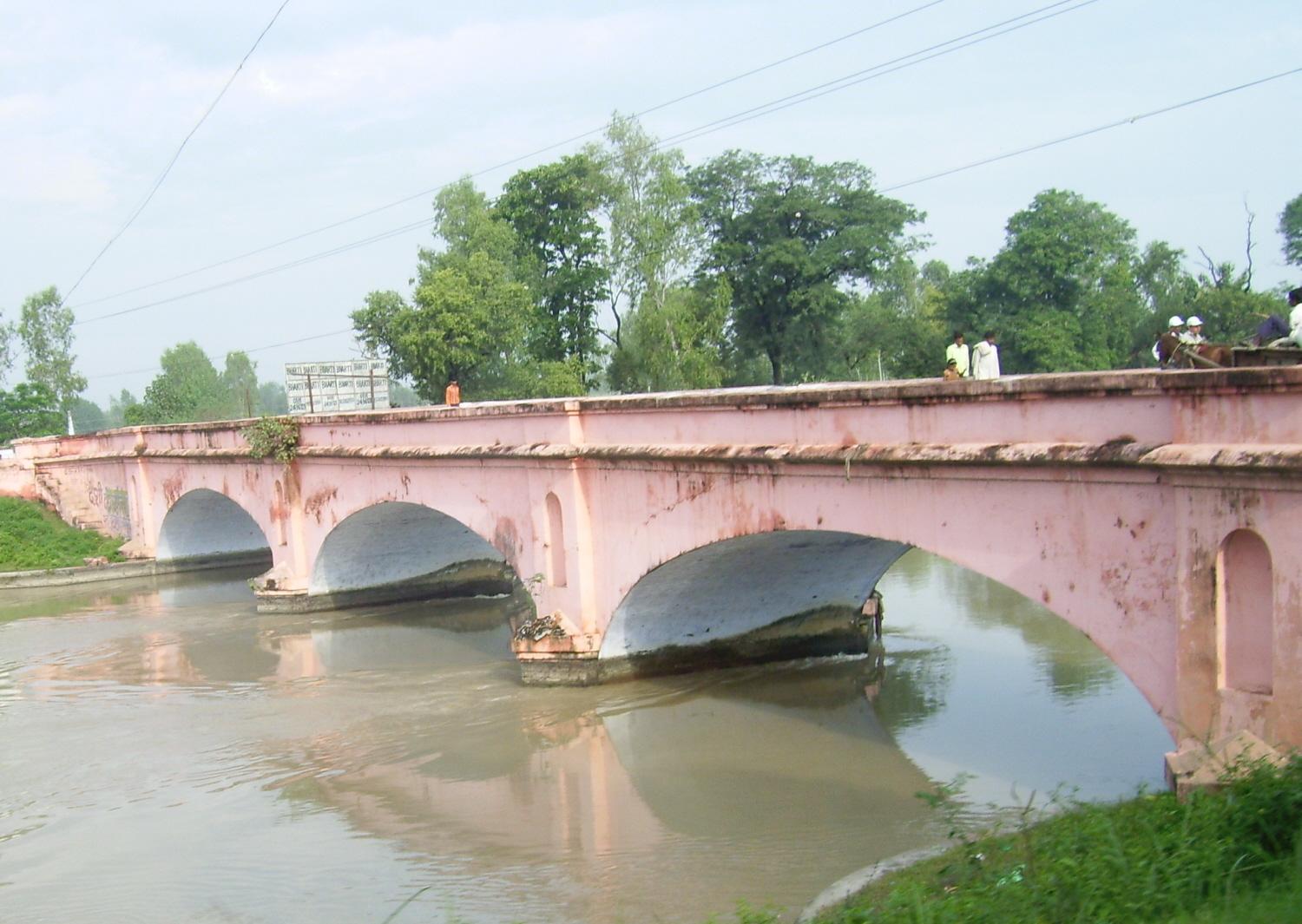
 The same East India Company bridge as in the lead paragraph photographed from the other side.
 A water mill on the canal.
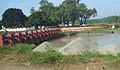 150-year-old locks on the canal.


Further reading
- Cautley, Proby T. (1860). Report of the Ganges Canal Works from their Commencement Until the Opening of the Canal in 1854. London: Smith, Elder.
- Cautley, Proby T. (1864). Ganges Canal: a disquisition on the heads of the Ganges and Jumna canals, North-Western Provinces, in reply to strictures by Major-General Sir Arthur Cotton. London.
References
- "UP Irrigation department, Irrigation charges 2014" (PDF). Archived from the original (PDF) on 16 June 2015.
- "Webcite - UP Irrigation department, Irrigation charges 2014" (PDF). Archived from the original (PDF) on 16 June 2015.
- "District Gazetter: Etawah (UP), Chapter IV: Agriculture and Irrigation". Describes the canal works in central UP under the fifth plan
- Upper Ganges Canal Imperial Gazetteer of India, v. 12, p. 138.
- "History, Indian Institute of Technology Roorkee". IIT Roorkee Website. IIT Roorkee. Retrieved 14 July 2013.
- Account of Roorkee College, Agra: Secundra Orphan Press, 1851, OL 7157290M
This article incorporates text from a publication now in the public domain: Wood, James, ed. (1907). The Nuttall Encyclopædia. London and New York: Frederick Warne. {{cite encyclopedia}}: Missing or empty |title= (help)
External links
Authority control | |
|---|---|
| General | |
| National libraries | |
На других языках
[de] Gangeskanal
Der ca. 560 km[1] lange Gangeskanal ist ein von den Briten in der Mitte des 19. Jahrhunderts geplantes und durchgeführtes Wasserbauprojekt im Norden Indiens. Er dient zur Wasserregulierung und Bewässerung großer Teile der fruchtbaren Doab-Region zwischen den Flüssen Ganges und Yamuna.- [en] Ganges Canal
[ru] Гангский канал
Га́нгский кана́л (англ. Ganga Canal или англ. Ganges Canal) — система каналов в Индии, предназначенная для ирригации региона Доаба между реками Джамна и Ганг. Хотя главным назначением канала является ирригация, некоторые участки использовались для перевозки водным путём материалов для строительства канала. Канал был построен между 1842 и 1854 годами во времена правления Британской Ост-Индской компании. Сначала расход воды составлял 180 м³/с, а затем он был увеличен до 295 м³/с. Длина системы составляет 440 километров главного русла и 6500 километров распределительных каналов. Территория, которая орошается с помощью канала, составляет около 9000 км² плодородных земель штатов Уттар-Прадеш и Уттаракханд. Канал позволил в обоих штатах увеличить урожаи, вследствие чего канал тщательно поддерживают за счёт платы за использование его воды.Другой контент может иметь иную лицензию. Перед использованием материалов сайта WikiSort.org внимательно изучите правила лицензирования конкретных элементов наполнения сайта.
WikiSort.org - проект по пересортировке и дополнению контента Википедии