geo.wikisort.org - River
The Pindar River is a river located in Uttarakhand, India. Pindar originates from Pindari Glacier which is located in Bageshwar district of Kumaon region in Uttarakhand.[1] The source of this river, the Pindar glacier is located at an altitude of 3,820 m (12,530 ft). Pindar glacier has relatively easier access and has been documented well for its retreat over 100 years.[2] Pindar river mouth is located at Karnaprayag where it ends by its confluence with Alaknanda River.
| Pindar | |
|---|---|
 Pindar river during month of September 2011 | |
 Pinder River in far right | |
| Location | |
| Country | India |
| State | Uttarakhand |
| Region | Kumaon division |
| District | Bageshwar, Chamoli |
| Physical characteristics | |
| Source | Pindari Glacier |
| • coordinates | 30°17′N 80°01′E |
| • elevation | 3,820 m (12,530 ft) |
| Mouth | Alaknanda |
• location | Karnaprayag, Uttarakhand |
• coordinates | 30°15′49″N 79°13′00″E |
• elevation | 1,450 m (4,760 ft) |
| Length | 105 km (65 mi) |
| Basin features | |
| Tributaries | |
| • right | Kali Ganga |
Gallery
 Origin from Pindari Glacier
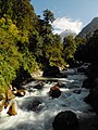 Pindari river from Dwali
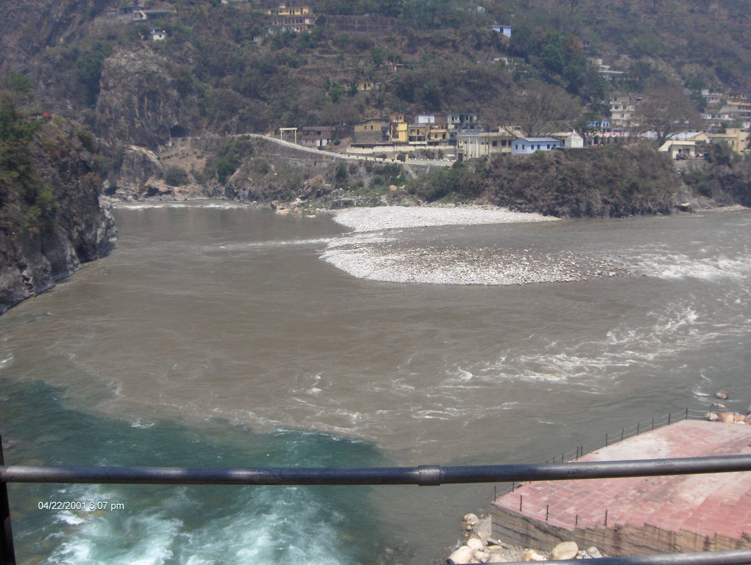
 Confluence of Alaknanda and Pindar from bottom
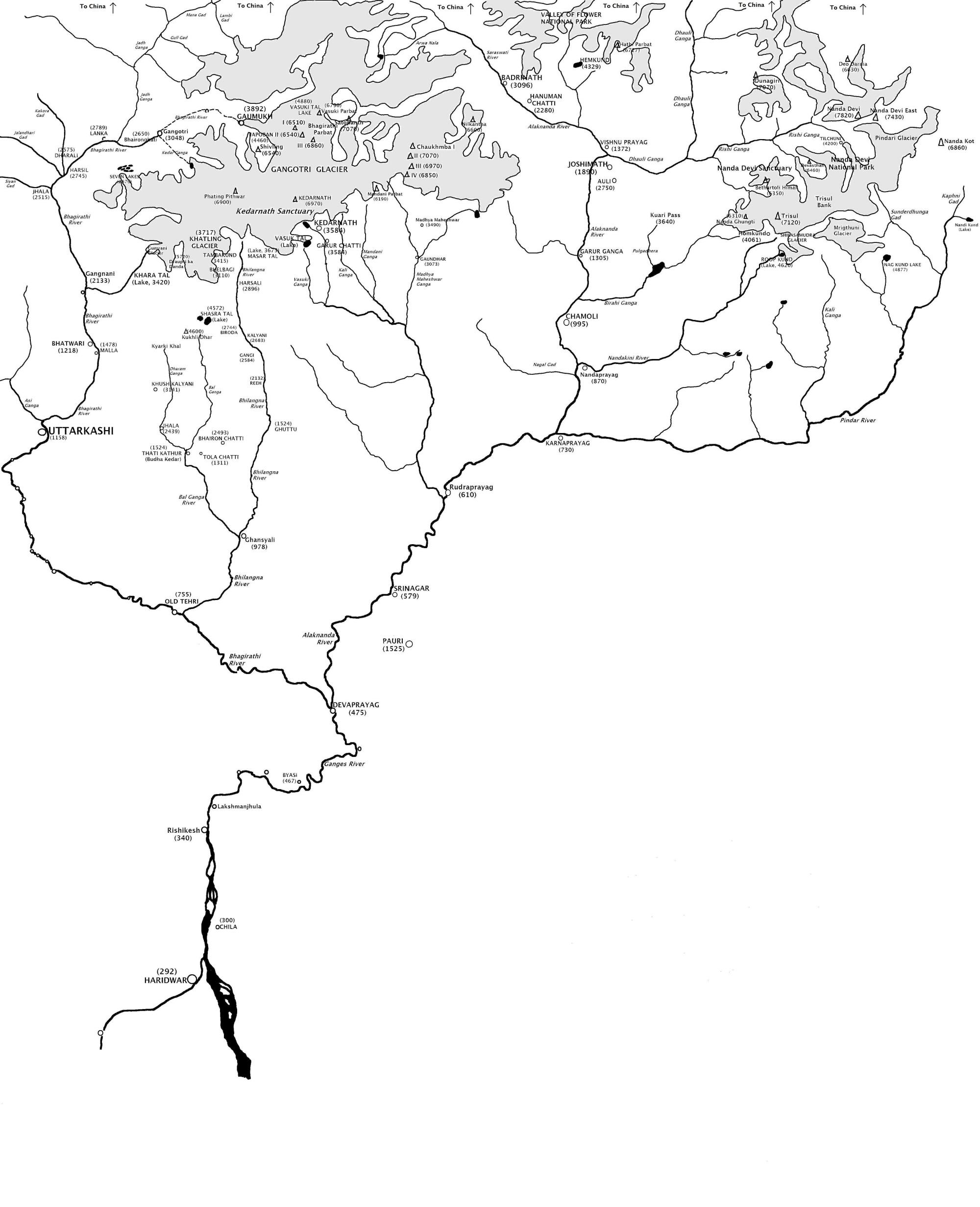
 Pinder River (far right) in the map showing The Himalayan headwaters of the Ganges river in Uttarakhand


References
- "Pindar river in Uttarakhand". Retrieved 5 July 2019.
- "Pindari Glacier". Retrieved 5 July 2019.
External links
Wikimedia Commons has media related to Pindar River.
| Authority control |
|
|---|
This article related to a location in the Indian state of Uttarakhand is a stub. You can help Wikipedia by expanding it. |
На других языках
[de] Pindar (Fluss)
Der Pindar (auch Pindari) ist ein linker Nebenfluss der Alaknanda, dem linken Quellfluss des Ganges, im Himalaya im indischen Bundesstaat Uttarakhand.- [en] Pindar River
Текст в блоке "Читать" взят с сайта "Википедия" и доступен по лицензии Creative Commons Attribution-ShareAlike; в отдельных случаях могут действовать дополнительные условия.
Другой контент может иметь иную лицензию. Перед использованием материалов сайта WikiSort.org внимательно изучите правила лицензирования конкретных элементов наполнения сайта.
Другой контент может иметь иную лицензию. Перед использованием материалов сайта WikiSort.org внимательно изучите правила лицензирования конкретных элементов наполнения сайта.
2019-2026
WikiSort.org - проект по пересортировке и дополнению контента Википедии
WikiSort.org - проект по пересортировке и дополнению контента Википедии