geo.wikisort.org - River
Kisielina is a river in Poland. It flows for 41,37 km (25,7 mi)[2] and feeds off a catchment area of 166,2 km² (64,2 sq mi) before feeding itself into the Vistula,[3] being its right bank tributary.
This article may be expanded with text translated from the corresponding article in Polish. (October 2011) Click [show] for important translation instructions.
|
| Kisielina | |
|---|---|
 | |
| Location | |
| Country | Poland |
| Physical characteristics | |
| Source | |
| • location | near Łysa Góra, Lesser Poland Voivodeship |
| Mouth | |
• location | north of Nowopole, Lesser Poland Voivodeship |
• coordinates | 50°13′46″N 20°43′35″E |
• elevation | 171.1 m (561 ft)[1] |
| Length | 41.37 km (25.71 mi)[2] |
| Basin size | 166.2 km2 (64.2 sq mi) |
| Basin features | |
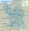
| Progression | Vistula→ Baltic Sea |
Kisielina starts on the northern slopes of the Dąbrowa hill in the vicinity of the village Łysa Góra in the Wiśnicz Foothills. It is joined by its tributaries: Pokrzywka, Upust (Ulga, right) and Zabawski Ditch (right).
The partial regulation of riverbed from Sufczyn to Biadoliny Szlacheckie took place from 2002 to 2005.
See also
References
- General Geodesic Office of Poland. "Kisielina on the Polish Infrastructure Information map portal". Retrieved 2017-09-05.
- National Water Management Board. "Kisielina on the map portal of the National Water Management Board (search result)". Archived from the original on 2017-09-01. Retrieved 2017-09-05.
{{cite web}}: External link in|author= - General Geodesic Office. "Geographical nomenclature of Poland. Volume 1. Hydronyms. Part 1. Flowing water, springs, waterfalls" (PDF) (in Polish). p. 112. Retrieved 2017-09-05.
Tributaries of the Vistula River | ||
|---|---|---|
| Forming rivers |
|  |
| Main tributaries of the left bank | ||
| Main tributaries of the right bank |
| |
| Distributary |
| |
Текст в блоке "Читать" взят с сайта "Википедия" и доступен по лицензии Creative Commons Attribution-ShareAlike; в отдельных случаях могут действовать дополнительные условия.
Другой контент может иметь иную лицензию. Перед использованием материалов сайта WikiSort.org внимательно изучите правила лицензирования конкретных элементов наполнения сайта.
Другой контент может иметь иную лицензию. Перед использованием материалов сайта WikiSort.org внимательно изучите правила лицензирования конкретных элементов наполнения сайта.
2019-2026
WikiSort.org - проект по пересортировке и дополнению контента Википедии
WikiSort.org - проект по пересортировке и дополнению контента Википедии