geo.wikisort.org - River
The Kedron Brook is a brook that flows through the northern suburbs of Brisbane in the south-east region of Queensland, Australia.
| Kedron | |
|---|---|
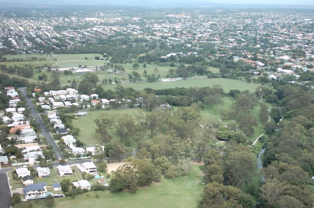 Kedron Brook on the northern edge of Kalinga Park | |
 Location of the river mouth in Queensland | |
| Location | |
| Country | Australia |
| State | Queensland |
| Region | South East Queensland |
| Municipality | Brisbane |
| Physical characteristics | |
| Source | D'Aguilar Range |
| • location | D'Aguilar National Park |
| Source confluence | Kedron Creek and Cedar Creek |
| • location | Ferny Grove |
| • coordinates | 27°24′14″S 152°56′27″E |
| • elevation | 220 m (720 ft) |
| Mouth | confluence with the Schulz Canal |
• location | Nundah |
• coordinates | 27°24′25″S 153°4′28″E |
• elevation | 0 m (0 ft) |
| Length | 29 km (18 mi) |
| Basin size | 110 km2 (42 sq mi) |
| Basin features | |
| National park | D'Aguilar National Park (formerly the Brisbane Forest Park |
| [1][2] | |
Course and features
Formed by spring D'Aguilar Range within the southern portion of the D'Aguilar National Park,[2] Kedron Brook rises below the Ferny Grove retail shopping strip, near the outer suburb of Upper Kedron and flows in an easterly direction. Kedron Brook then meanders through suburbs including Stafford, Grange, Lutwyche, Wooloowin, Kalinga Park, Toombul and Hendra before it empties into the Schulz Canal, which flows into Moreton Bay at Nudgee Beach. The river descends 220 metres (720 ft) over its 29-kilometre (18 mi) course and has a catchment area of 110 square kilometres (42 sq mi).[2]
For much of its length, Kedron Brook is lined with parks and sporting facilities such as bikeways and football fields. Kedron Brook has been channelised where it passes suburbs such as Lutwyche and Wooloowin. Tidal influence reaches as far as Toombul.[3]
The original course of Kedron Brook has been significantly altered in the vicinity of Brisbane Airport, where it has been redirected to a canal named the Schulz Canal.[4] This was done to allow expansion of the airport in recent decades.[5] The canal empties into Moreton Bay adjacent to the small bayside village of Nudgee Beach. At the lower end of the catchment, Boondall Wetlands is an internationally recognised habitat (Ramsar site) for migratory wader birds and other animals in Moreton Bay.[2]
 Kedron Brook stream, looking downstream from Gympie Road, Kedron (2021).
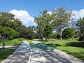 Bicycle and pedestrian paths, Kalinga Park, Kalinga (2021).
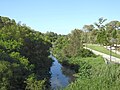
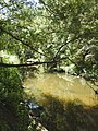 Kedron Brook looking upstream, Kalinga Park, Kalinga (2021).
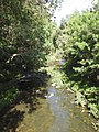 Kedron Brook looking downstream, Kalinga Park, Kalinga (2021).


See also
- List of rivers of Queensland
References
- "Map of Upper Kedron, QLD". Bonzle Digital of Australia. Retrieved 24 September 2015.
- "Kedron Brook catchment" (PDF). Know your creek. City of Brisbane. 2012. Retrieved 24 September 2015.
- "Physical Environment". Kedron Brook Catchment Network. Archived from the original on 23 June 2007.
- "Kedron Brook". Councillor Kim Flesser, Northgate Ward.
- Brisbane Airport Corporation Limited (December 2010). "New Parallel Runway Project Minor Variation to MDP (Approved 8 February 2011)" (PDF). City of Brisbane. Retrieved 24 September 2015.
External links
 Media related to Kedron Brook at Wikimedia Commons
- Kedron Brook Catchment Network
- "Location map for bushcare sites" (Map). Bushcare groups. Wildlife Preservation Society of Queensland Kedron Brook Catchment Branch (Inc.). 2015.
- "Kedron Brook trail". Cycling in Brisbane: Brisbane Bike Adventures. City of Brisbane. 7 April 2014.
Rivers of Queensland | |||||||||||||||
|---|---|---|---|---|---|---|---|---|---|---|---|---|---|---|---|
| |||||||||||||||
| |||||||||||||||
| |||||||||||||||
| |||||||||||||||
| |||||||||||||||
| |||||||||||||||
This Queensland river or creek related article is a stub. You can help Wikipedia by expanding it. |
Другой контент может иметь иную лицензию. Перед использованием материалов сайта WikiSort.org внимательно изучите правила лицензирования конкретных элементов наполнения сайта.
WikiSort.org - проект по пересортировке и дополнению контента Википедии