

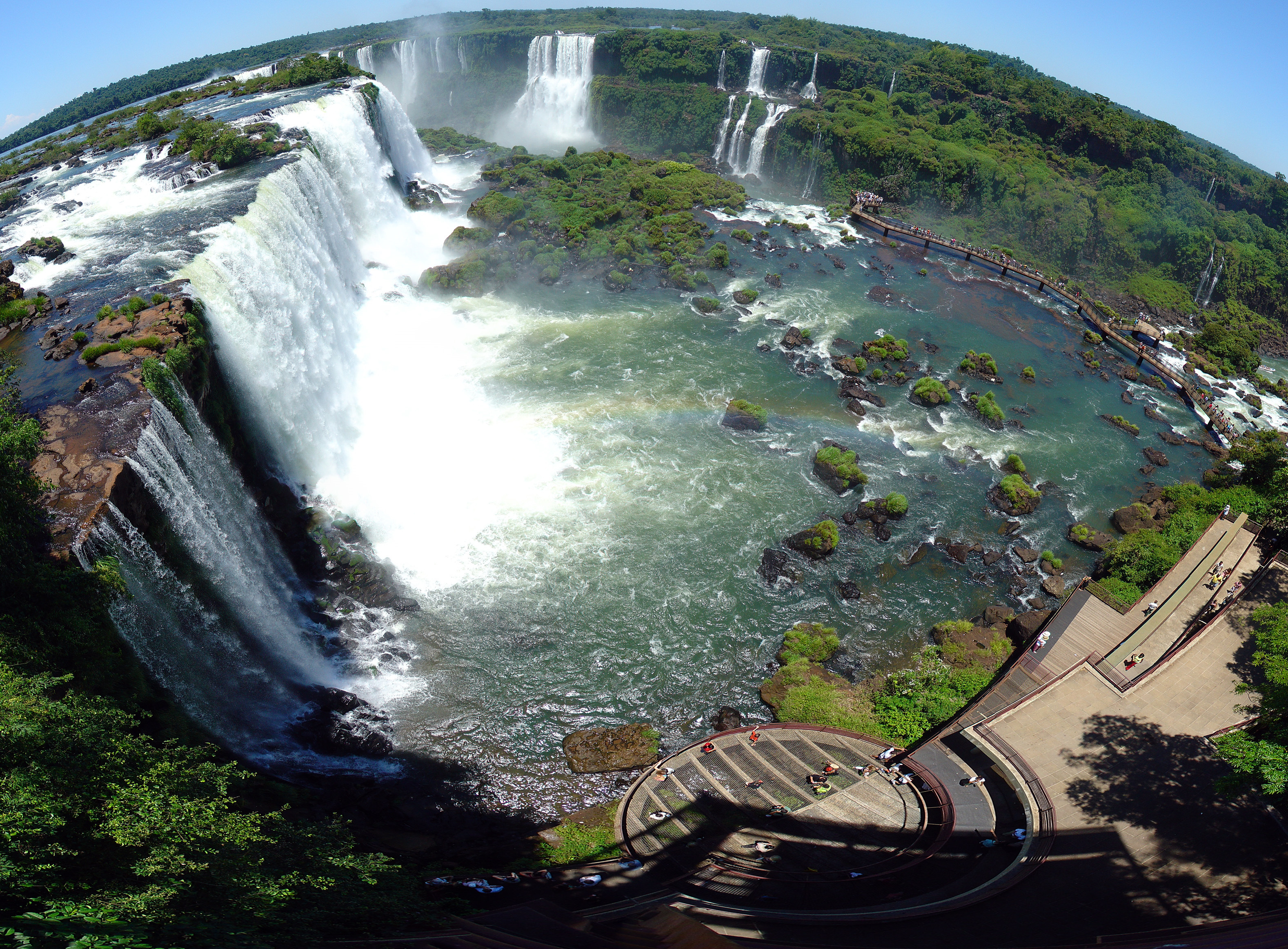
 Panorama of Iguazu Falls seen from Argentina side, Iguazu National Park.
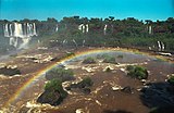 Iguazu Falls in 2000.
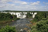 The falls in 2010.
 Panorama of Iguazu Falls seen from Argentina side, Iguazu National Park.


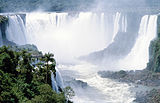

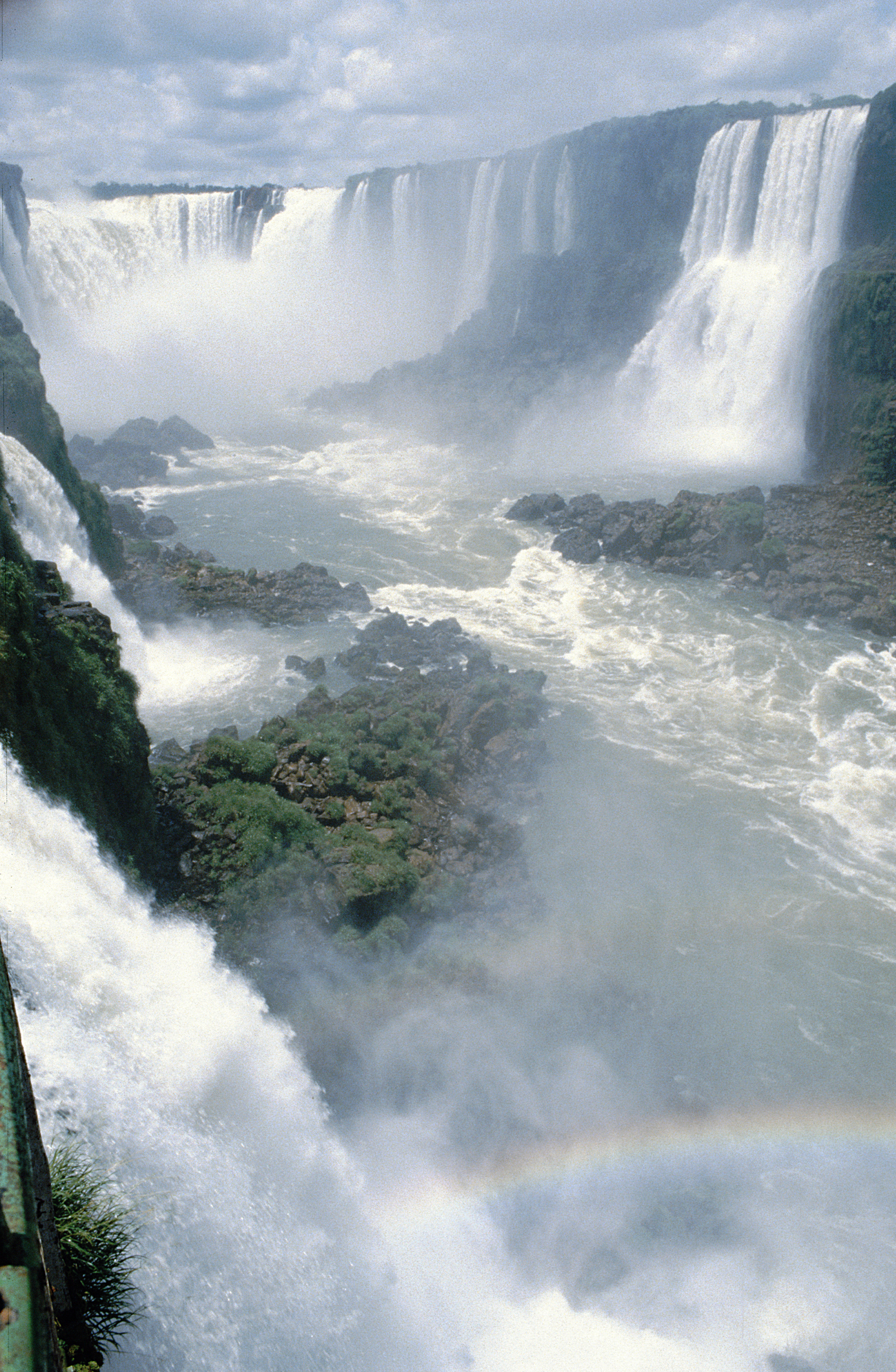
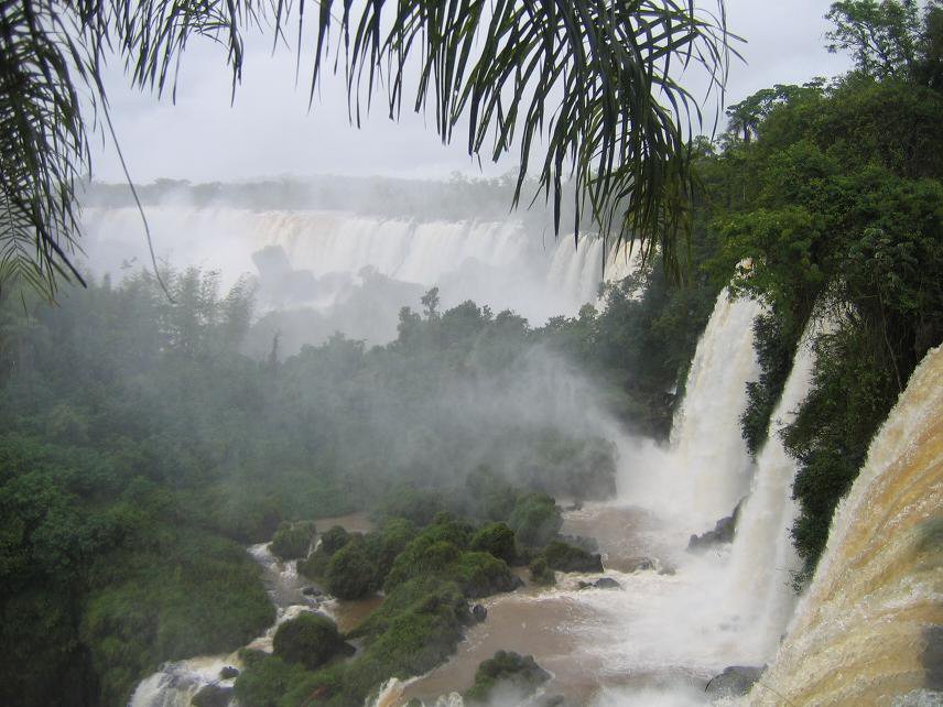
 Iguazu Falls, view of the Devil's Throat from the Brazilian side.
 View of Argentina section from Brazil side.
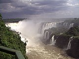 Throat of the Devil's outlook.
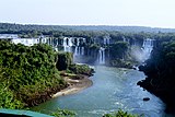
 A view of the central parts of the falls from the Argentina side.
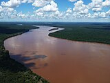 The river directly above Iguazu Falls.
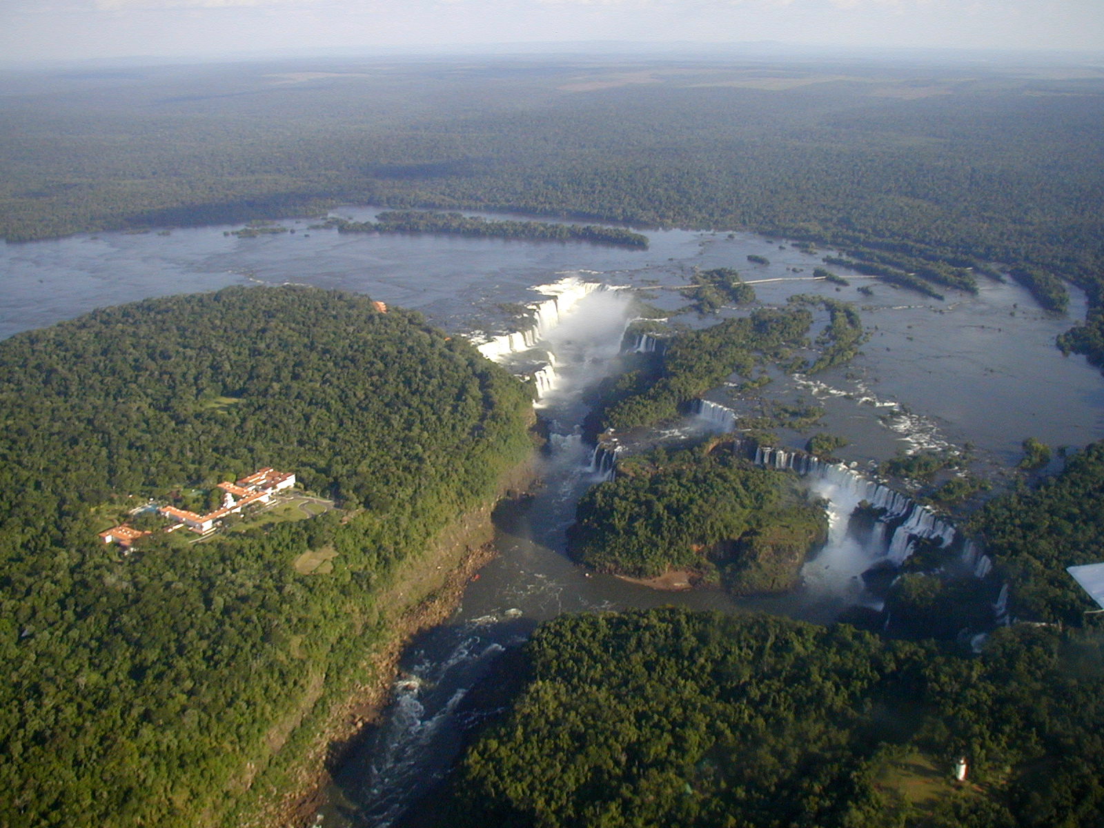
 Iguacu Falls (Argentina). Photo taken from a helicopter.
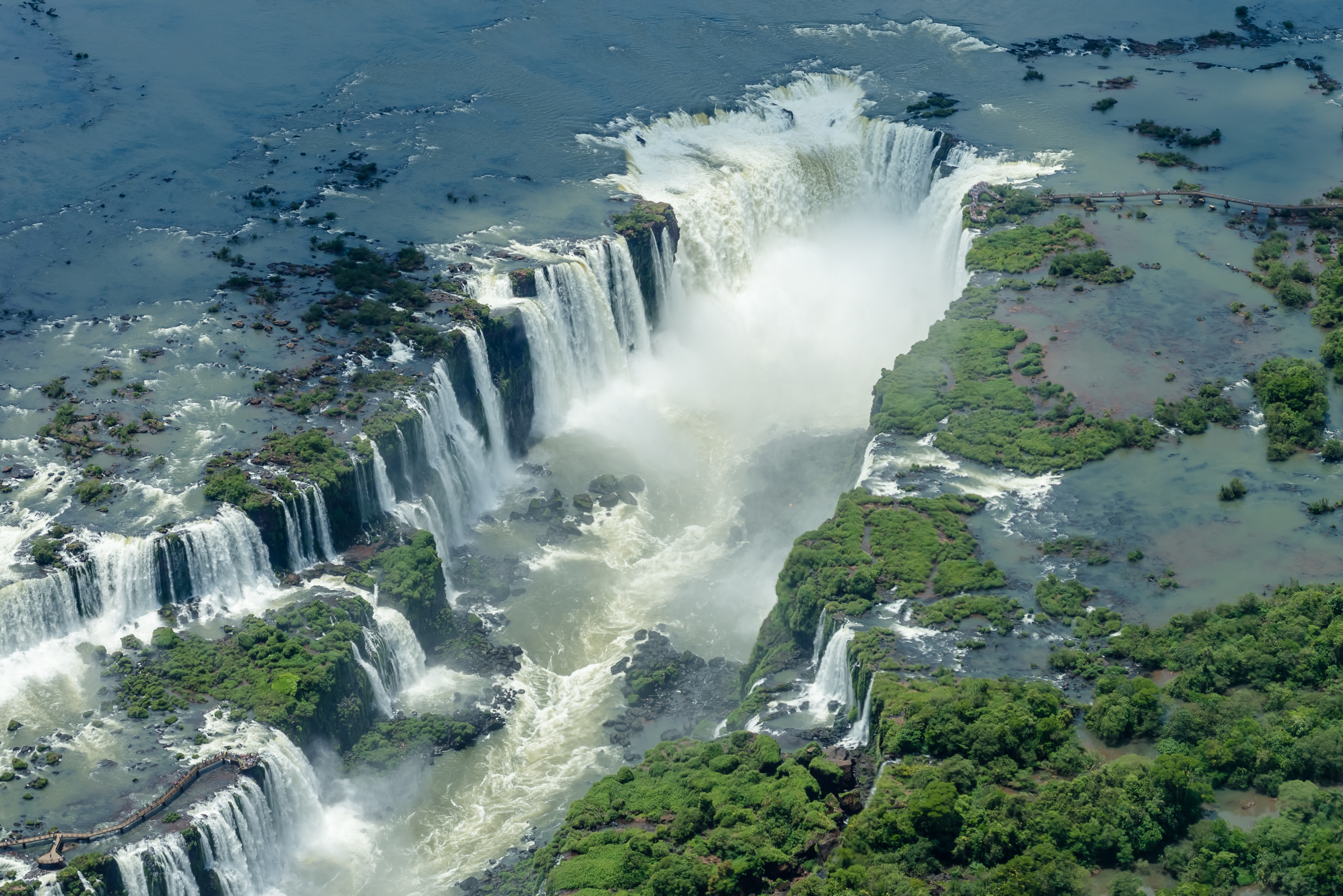
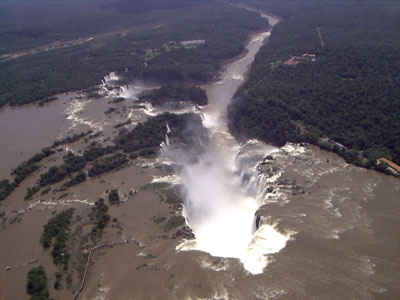
 Aerial view of Devil's Throat at Iguazú Falls, Argentina is on the left while Brazil is on the right.
 Iguazú Falls from the International Space Station, 2016.
 The taperuçu-Velho, also known as Swift-velho and Swift-of-cascade. Total length: 18cm. They live in groups, and shelter on rocks in waterfalls, such as in the Iguaçu Falls in the city of Foz do Iguaçu.
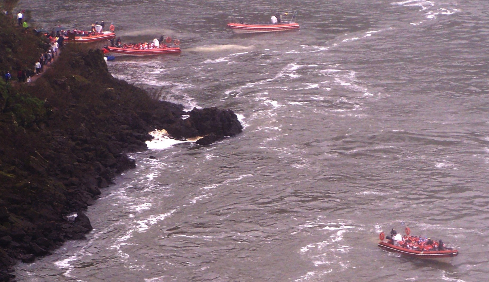
 Boats on Iguazu.
geo.wikisort.org - River
Iguazú Falls or Iguaçu Falls (Guarani: Chororõ Yguasu [ɕoɾo'ɾõ ɨɣʷa'su], Spanish: Cataratas del Iguazú [kataˈɾataz ðel iɣwaˈsu]; Portuguese: Cataratas do Iguaçu [kɐtɐˈɾatɐs du iɡwɐˈsu]) are waterfalls of the Iguazu River on the border of the Argentine province of Misiones and the Brazilian state of Paraná. Together, they make up the largest waterfall system in the world.[2] The falls divide the river into the upper and lower Iguazu. The Iguazu River rises near the heart of the city of Curitiba. For most of its course, the river flows through Brazil; however, most of the falls are on the Argentine side. Below its confluence with the San Antonio River, the Iguazu River forms the border between Argentina and Brazil.
| Iguazú Falls | |
|---|---|
 | |
 | |
 | |
| Location | Argentina: Misiones province Brazil: Paraná state |
| Coordinates | 25°41′12″S 54°26′41″W |
| Number of drops | 275[1] |
| Longest drop | 82 metres (269 ft)[1] |
| Watercourse | Iguazu River |
| Average flow rate | 1,756 m3/s (62,010 cu ft/s)[1] |
 | |
The name Iguazú comes from the Guarani or Tupi words "y" [ɨ], meaning "water", and "ûasú "[waˈsu], meaning "big".[3] Legend has it that a deity planned to marry a beautiful woman named Naipí, who fled with her mortal lover Tarobá in a canoe. In a rage, the deity sliced the river, creating the waterfalls and condemning the lovers to an eternal fall.[3] The first European to record the existence of the falls was the Spanish Conquistador Álvar Núñez Cabeza de Vaca in 1541.
Geology and geography
The staircase character of the falls consists of a two-step waterfall formed by three layers of basalt. The steps are 35 and 40 metres (115 and 131 ft) in height. The columnar basalt rock sequences are part of the 1,000-metre-thick (3,300 ft) Serra Geral formation within the Paleozoic-Mesozoic Paraná Basin. The tops of these sequences are characterized by 8–10 m (26–33 ft) of highly resistant vesicular basalt and the contact between these layers controls the shape of the falls. Headwater erosion rates are estimated at 1.4–2.1 cm/year (0.55–0.83 in/year).[4][1] Numerous islands along the 2.7-kilometre-long (1.7 mi) edge divide the falls into many separate waterfalls and cataracts, varying between 60 and 82 m (197 and 269 ft) high. The number of these smaller waterfalls fluctuates from 150 to 300, depending on the water level. About half of the river's flow falls into a long and narrow chasm called the Devil's Throat (Garganta del Diablo in Spanish or Garganta do Diabo in Portuguese).[1]
The Devil's Throat canyon is 80–90 m (260–300 ft) wide and 70–80 m (230–260 ft) deep. Left of this canyon, another part of the river forms 160–200 individual falls, which merge into a single front during the flood stage. The largest falls are named San Martín, Adam and Eva, Penoni, and Bergano.[4]
About 900 m (2,950 ft) of the 2.7 km (1.7 mi) length does not have water flowing over it. The water of the lower Iguazu collects in a canyon that drains into the Paraná River, a short distance downstream from the Itaipu Dam. The junction of the water flows marks the border between Brazil, Argentina, and Paraguay. Some points in the cities of Foz do Iguaçu, Brazil, Puerto Iguazú, Argentina, and Ciudad del Este, Paraguay, have access to the Iguazu River, where the borders of all three nations may be seen, a popular tourist attraction for visitors to the three cities.
Distribution of the falls between Argentina and Brazil

The Iguazu Falls are arranged in a way that resembles a reversed letter "J". The Argentina–Brazil border runs through the Devil's Throat. On the right bank is the Brazilian territory, which is home to more than 95% of the Iguazu River basin but has just over 20% of the jumps of these falls, and the left side jumps are Argentine, which make up almost 80% of the falls.
Tourism
Aerolíneas Argentinas[5] has direct flights from Buenos Aires to Iguazu International Airport. Azul, GOL, and LATAM Brasil[6] offer services from main Brazilian cities to Foz do Iguaçu.
Access

The falls may be reached from two main towns, with one on either side of the falls: Foz do Iguaçu in Brazil and Puerto Iguazú in Argentina, as well as from Ciudad del Este, Paraguay, on the other side of the Paraná River from Foz do Iguaçu, each of those three cities having commercial airports. The falls are shared by the Iguazú National Park (Argentina) and Iguaçu National Park (Brazil). The two parks were designated UNESCO World Heritage Sites in 1984 and 1986, respectively.[7][8]
The first proposal for a Brazilian national park aimed at providing a pristine environment to "future generations", just as "it had been created by God" and endowed with "all possible preservation, from the beautiful to the sublime, from the picturesque to the awesome" and "an unmatched flora" located in the "magnificent Iguaçu waterfalls". These were the words used by André Rebouças, an engineer, in his book Provinces of Paraná, Railways to Mato Grosso and Bolivia, which started up the campaign aimed at preserving the Iguaçu Falls in 1876. At this time, Yellowstone National Park in the US, the first national park in the world, was four years old.
On the Brazilian side, a walkway along the canyon has an extension to the lower base of Devil's Throat. Helicopter rides offering aerial views of the falls have been available from Brazil, but Argentina has prohibited such helicopter tours because of the adverse environmental impact on the flora and fauna of the falls.[9] From Foz do Iguaçu airport, the park may be reached by taking a taxi or bus to the entrance of the park. Their park has an entrance fee on both sides. Once inside, free and frequent buses are provided to various points within the park. The town of Foz do Iguaçu is about 20 km (12 mi) away, and the airport is between the park and the town.
The Argentine access, across the forest, is by a Rainforest Ecological Train very similar to the one in Disney's Animal Kingdom.[10] The train brings visitors to the entrance of Devil's Throat, as well as the upper and lower trails. The Paseo Garganta del Diablo is a 1 km-long (0.6 mi) trail that brings visitors directly over the falls of Devil's Throat, the highest and deepest of the falls. Other walkways allow access to the elongated stretch of falls across the forest on the Argentine side and to the boats that connect to San Martin Island. Also on the Argentine side, inflatable boat services take visitors very close to the falls.
The Brazilian transportation system aims at allowing an increase in the number of visitors, while reducing the adverse environmental impact, through an increase in the average number of passengers per vehicle inside the park.[citation needed] The new transportation system has a 72-passenger capacity and panoramic-view, double-deck buses.
Comparisons to other notable falls


Upon seeing Iguazu, the United States First Lady Eleanor Roosevelt reportedly exclaimed, "Poor Niagara!"[3] (which, at 50 m or 165 feet, are a third shorter). Often, Iguazu also is compared with Victoria Falls in Southern Africa, which separates Zambia and Zimbabwe. Iguazu is wider but is split into roughly 275 distinct falls and large islands, whereas Victoria has the largest curtain of water in the world, at more than 1,600 m (5,249 ft) wide and over 100 m (328 ft) in height (in low flow, Victoria is split into five by islands but in high flow, it may be uninterrupted). The only wider falls are extremely large rapid-like falls, such as the Boyoma Falls (Stanley Falls).
With the flooding of the Guaíra Falls in 1982, Iguazu currently has the sixth-greatest average annual flow of any waterfall in the world, following number five Niagara, with an average rate of 1,746 m3/s (61,660 cu ft/s). Its maximum recorded flow was 45,700 m3/s (1,614,000 cu ft/s) on 9 June 2014.[11][12] By comparison, the average flow of Niagara Falls is 2,400 m3/s (85,000 cu ft/s), with a maximum recorded flow of 8,300 m3/s (293,000 cu ft/s).[13] The average flow at Victoria Falls is 1,088 m3/s (38,420 cu ft/s), with a maximum recorded flow of 7,100 m3/s (250,000 cu ft/s).[14]
| Size and flow rate of Victoria Falls with Niagara and Iguazu for comparison | ||||||
| Parameters | Victoria Falls | Niagara Falls | Iguazu Falls | |||
|---|---|---|---|---|---|---|
| Height in meters and feet:[15] | 108 m | 360 ft | 51 m | 167 ft | 64–82 m | 210–269 ft |
| Width in meters and feet:[15] | 1,708 m | 5,604 ft | 1,203 m | 3,947 ft | 2,700 m | 8,858 ft |
| Flow rate units (vol/s): | m3/s | cu ft/s | m3/s | cu ft/s | m3/s | cu ft/s |
| Mean annual flow rate:[15] | 1,088 | 38,430 | 2,407 | 85,000 | 1,746 | 61,600 |
| Highest recorded flow:[15] | 12,800 | 452,000 | 6,800 | 240,000 | 45,700 | 1,614,000 |
| Notes: See references for explanation of measurements. For water, cubic metres per second = tonnes per second. Half the water approaching Niagara is diverted for hydroelectric power. Iguazu has two drops; height is given for the biggest drop and total height. 10 falls have greater or equal flow rates, but are not as high as Iguazu and Victoria Falls.[16] | ||||||
Climate
The Iguazu Falls experience a humid subtropical climate (Cfa, according to the Köppen climate classification) with abundant precipitation and high temperatures year-round. During the summer of 2006, a severe drought caused the Iguazu River to become diminished, reducing the amount of water flowing over the falls to 300 cubic metres per second (11,000 cu ft/s) until early December. This was unusual, as dry periods normally last only a few weeks.[17] The period with the greatest volume of water flowing over the falls is usually December to February, coinciding with one of the periods of greatest rainfall.
| Climate data for Iguazu Falls (Foz do Iguacu), Brazil | |||||||||||||
|---|---|---|---|---|---|---|---|---|---|---|---|---|---|
| Month | Jan | Feb | Mar | Apr | May | Jun | Jul | Aug | Sep | Oct | Nov | Dec | Year |
| Record high °C (°F) | 40.0 (104.0) |
40.0 (104.0) |
38.8 (101.8) |
36.8 (98.2) |
36.0 (96.8) |
32.0 (89.6) |
31.3 (88.3) |
35.0 (95.0) |
36.8 (98.2) |
39.0 (102.2) |
38.6 (101.5) |
39.4 (102.9) |
40.0 (104.0) |
| Average high °C (°F) | 33.0 (91.4) |
32.6 (90.7) |
31.1 (88.0) |
28.2 (82.8) |
25.2 (77.4) |
23.1 (73.6) |
23.7 (74.7) |
25.3 (77.5) |
26.9 (80.4) |
28.8 (83.8) |
31.0 (87.8) |
32.6 (90.7) |
28.5 (83.3) |
| Daily mean °C (°F) | 25.5 (77.9) |
25.4 (77.7) |
23.8 (74.8) |
20.8 (69.4) |
17.7 (63.9) |
15.8 (60.4) |
15.7 (60.3) |
17.5 (63.5) |
19.0 (66.2) |
21.4 (70.5) |
23.1 (73.6) |
25.1 (77.2) |
20.9 (69.6) |
| Average low °C (°F) | 19.6 (67.3) |
20.0 (68.0) |
18.4 (65.1) |
15.4 (59.7) |
12.2 (54.0) |
10.4 (50.7) |
9.7 (49.5) |
11.3 (52.3) |
13.5 (56.3) |
15.3 (59.5) |
16.5 (61.7) |
18.6 (65.5) |
15.1 (59.2) |
| Record low °C (°F) | 9.2 (48.6) |
6.8 (44.2) |
5.2 (41.4) |
3.0 (37.4) |
−1.0 (30.2) |
−3.1 (26.4) |
−4.2 (24.4) |
0.0 (32.0) |
1.0 (33.8) |
5.0 (41.0) |
6.3 (43.3) |
3.8 (38.8) |
−4.2 (24.4) |
| Average precipitation mm (inches) | 196.0 (7.72) |
180.1 (7.09) |
174.8 (6.88) |
151.0 (5.94) |
127.6 (5.02) |
138.3 (5.44) |
84.4 (3.32) |
107.4 (4.23) |
146.6 (5.77) |
219.8 (8.65) |
153.7 (6.05) |
189.0 (7.44) |
1,868.7 (73.57) |
| Average precipitation days (≥ 1.0 mm) | 9 | 9 | 8 | 8 | 6 | 8 | 6 | 8 | 8 | 9 | 7 | 9 | 95 |
| Average relative humidity (%) | 77 | 80 | 82 | 85 | 86 | 85 | 83 | 80 | 79 | 78 | 75 | 74 | 80.3 |
| Mean monthly sunshine hours | 230.5 | 196.3 | 209.9 | 193.6 | 180.8 | 151.2 | 168.7 | 157.9 | 146.4 | 195.6 | 231.4 | 232.3 | 2,294.6 |
| Source: INMET[18] | |||||||||||||
Popular culture

Portrayals in film
Iguazu Falls has been featured in several TV shows and movies,[19] including:
- Le cascate dell'Ignazu (1907, Ambrosio. Shot by Roberto Omegna, 135 meters)
- Z Argentiny do Mexika (1954)
- Curucu, Beast of the Amazon (1956)
- Tarzan (1966–69)
- Moonraker (1979)
- The Mission (1986)
- The Country Bears Down Under (1990)
- Baraka (1992)
- Extermineitors IV: Como hermanos gemelos (1992)
- O Trem Caipira (1994)
- Tummy (1995)
- Happy Together (1997)
- Mr. Magoo (1997)
- Miami Vice (2006)
- In the Hands of the Gods (2007)
- Indiana Jones and the Kingdom of the Crystal Skull (2008)
- OSS 117: Rio ne répond plus (2009)
- Salve Geral (2009)
- Survivor: Tocantins (2009)
- Operação X (2011)
- Captain America: Civil War (2016)
- If Cats Disappeared from the World (2016)
- Soarin' Around the World (2016)
- A Fantastic Woman (2017)
- Black Panther (2018)
- New Year Blues (2021)
- Oh My Sunshine Night (2022)
See also
Gallery


References
- "Iguaçu Falls". Encyclopædia Britannica (Encyclopædia Britannica Online Library ed.). 2011. Retrieved 15 April 2011.
- Couzens, Dominic (2008), Top 100 Birding Sites of the World, University of California Press, p. 228, ISBN 978-0-52-025932-4
- Hamre, Bonnie. "Iguazu Falls". About.com Travel.
- Stevaux, Jose; Latrubesse, Edgardo (2010). Migon, Piotr (ed.). Iguazu Falls: A History of Differential Fluvial Incision, in Geomorphological Landscapes of the World. Springer. pp. 101–109. ISBN 9789048130542.
- "Travel to Puerto Iguazu". LATAM. Retrieved 19 January 2017.
- "Travel to Foz Do Iguaçu". LATAM. Retrieved 19 January 2017.
- "Iguazu National Park". unesco.org. UNESCO World Heritage Centre.
- "Iguaçu National Park". unesco.org. UNESCO World Heritage Centre.
- "Helicopter Ride". IguazuFalls.com. Ripio EVT, de Ideas Turisticas SRL. Retrieved 29 April 2021.
- "Meet The Ecological Jungle Train Iguazu Falls". Say Hueque. 15 August 2013. Retrieved 21 December 2021.
- Fabiula Wurmeister (9 June 2014). "Chuvas fazem vazão das Cataratas bater recorde e Itaipu abrir vertedouro". globo.com notícias. Retrieved 11 June 2014.
- "Dia histórico nas Cataratas do Iguaçu". Cataratas do Iguaçu S.A. 10 June 2014. Retrieved 11 June 2014.
- "Niagara Falls". World Waterfall Database. Archived from the original on 1 December 2010. Retrieved 2 December 2010.
- "Victoria Falls". World Waterfall Database. Archived from the original on 1 December 2010. Retrieved 2 December 2010.
- "World Waterfall Database: World's Tallest Waterfalls". Archived from the original on 14 July 2007. Retrieved 11 March 2007.
{{cite web}}: CS1 maint: bot: original URL status unknown (link) - World Commission on Dams website: Archived 1 July 2007 at the Wayback Machine "Case Study – Kariba Dam-Zambezi River Basin" Annex 13 & 14 Victoria Falls Mean Monthly Flows. Website accessed 1 March 2007. This website gives mean monthly flow rates in cubic metres per second (i.e., the total volume of water passing in each calendar month divided by the number of seconds in the month), the standard measure used in hydrology to indicate seasonal variation in flow.
- "The Kerala Articles". keralaarticles.blogspot.com. 6 November 2007.
- "NORMAIS CLIMATOLÓGICAS DO BRASIL 1961–1990" (in Portuguese). Instituto Nacional de Meteorologia. Retrieved 22 September 2014.
- "Most Popular Titles With Location Matching 'Foz do Iguaçu, Paraná, Brazil'". IMDb.com. Retrieved 30 October 2010.
External links
Iguaçu Falls at Wikipedia's sister projects
 Media from Commons
 Travel information from Wikivoyage
- Foz do Iguaçu; Brazilian government site (archived; in Portuguese)
- Copel Monitoramento Hydrológico (Iguazu River flow rate measurements; leftmost green dot gives flow rate at Hotel Cataratas)
- Iguazu Falls at UNESCO World Heritage Centre
- Iguazu Falls facts at BeautifulWorld.com
- "Iguazu Falls". World Waterfall Database.
- Aerial video at vimeo.com
Authority control | |
|---|---|
| General |
|
| National libraries | |
| Other |
|
На других языках
[de] Iguazú-Wasserfälle
Die Iguazú-Wasserfälle (portugiesisch Cataratas do Iguaçu [.mw-parser-output .IPA a{text-decoration:none}kata'ɾatɐs du igwa'su], spanisch Cataratas del Iguazú [kata'ɾatas del iɣwa'su]) sind die Wasserfälle des Flusses Iguaçu/Iguazú an der Grenze zwischen dem brasilianischen Bundesstaat Paraná und der argentinischen Provinz Misiones.- [en] Iguazu Falls
[ru] Игуасу (водопады)
Водопа́ды Игуасу́ (исп. Cataratas del Iguazú, порт. Cataratas do Iguaçu) — комплекс из 275 водопадов[1][2] на реке Игуасу, расположенный на границе Бразилии (штат Парана) и Аргентины (провинция Мисьонес). Водопады находятся на границе аргентинского и бразильского национальных парков «Игуасу». Оба парка были включены в список Всемирного наследия ЮНЕСКО (в 1984 и 1986 годах, соответственно)[3].Текст в блоке "Читать" взят с сайта "Википедия" и доступен по лицензии Creative Commons Attribution-ShareAlike; в отдельных случаях могут действовать дополнительные условия.
Другой контент может иметь иную лицензию. Перед использованием материалов сайта WikiSort.org внимательно изучите правила лицензирования конкретных элементов наполнения сайта.
Другой контент может иметь иную лицензию. Перед использованием материалов сайта WikiSort.org внимательно изучите правила лицензирования конкретных элементов наполнения сайта.
2019-2026
WikiSort.org - проект по пересортировке и дополнению контента Википедии
WikiSort.org - проект по пересортировке и дополнению контента Википедии