geo.wikisort.org - River
The Helmand River (also spelled Helmend, or Helmund, Hirmand; Pashto/Persian: هیرمند / هلمند; Greek: Ἐτύμανδρος (Etýmandros); Latin: Erymandrus) is the longest river in Afghanistan and the primary watershed for the endorheic Sistan Basin.[1] It emerges in the Sanglakh Range of the Hindu Kush mountains in the northeastern part of Maidan Wardak Province, where it is separated from the watershed of the Kabul River by the Unai Pass. The Helmand feeds into the Hamun Lake on the border between Afghanistan and Iran.
| Helmand River | |
|---|---|
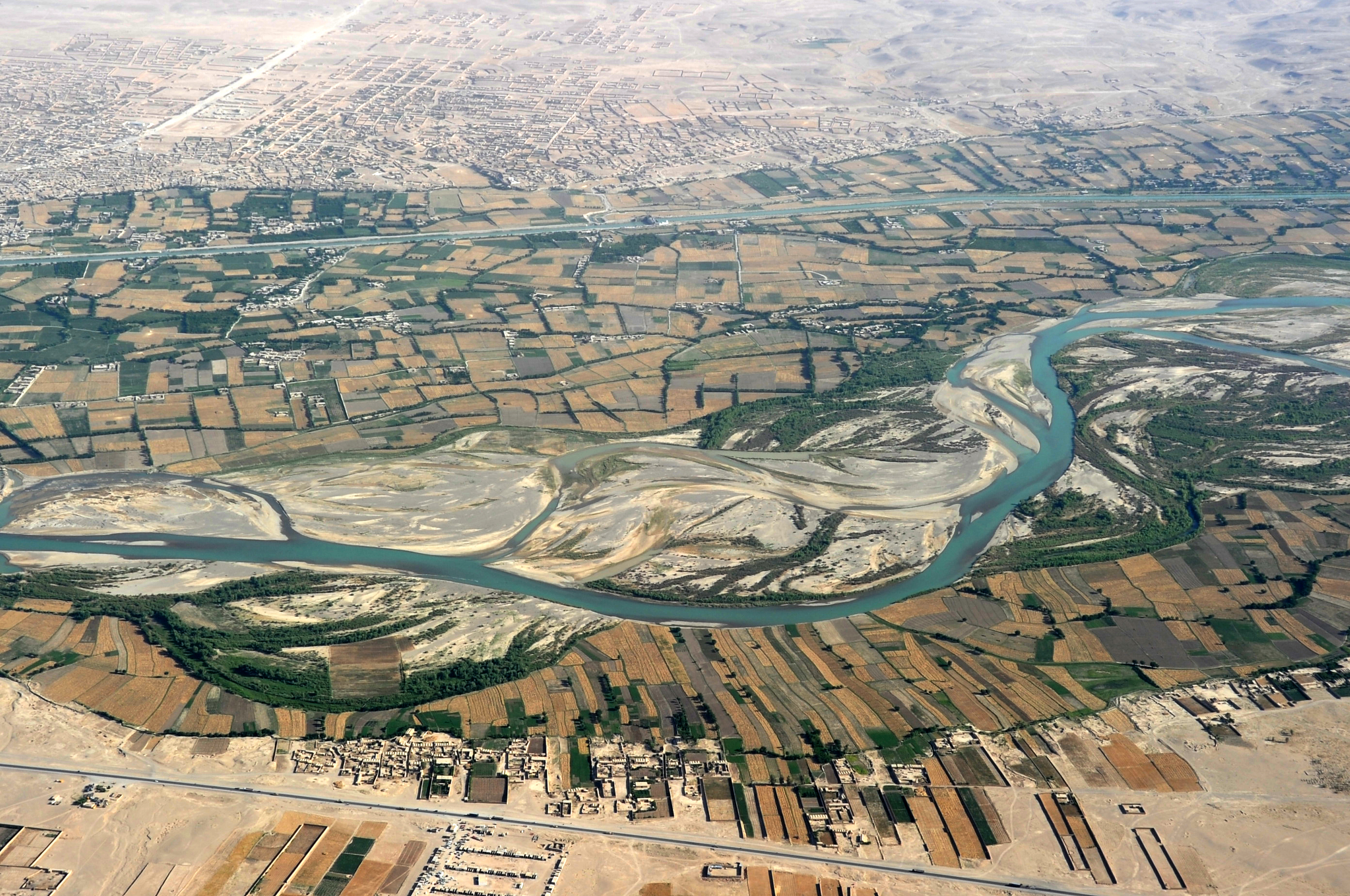 Helmand River and Boghra Canal beyond it | |
 Map of the Helmand River drainage basin | |
| Location | |
| Countries | Afghanistan and Iran |
| Physical characteristics | |
| Source | |
| • location | Hindu Kush mountains |
| Mouth | |
• location | Lake Hamun |
| Length | 1,150 km (710 mi) |
| Basin size | Sistan Basin |
| Basin features | |
| Tributaries | |
| • left | Arghandab River |
| • right | Khash River Chagay River |
Etymology
The name comes from the Avestan Haētumant, literally "dammed, having a dam", which referred to the Helmand River and the irrigated areas around it.[2]
Geography

The Helmand River stretches for 1,150 km (710 mi). It rises in the northeastern part of Maidan Wardak Province in the Hindu Kush mountains, about 40 km[3] west of Kabul (34°34′N 68°33′E), flowing southwestward through Daykundi Province and Uruzgan Province. After passing through the city of Lashkargah in Helmand Province, it enters the desert of Dashti Margo, and then flows to the Sistan marshes and the Hamun-i-Helmand lake region around Zabol at the Afghan-Iranian border (31°9′N 61°33′E). A few smaller rivers such as Tarnak and Arghandab flow into Helmand.[4]
This river, managed by the Helmand and Arghandab Valley Authority, is used extensively for irrigation, although a buildup of mineral salts has decreased its usefulness in watering crops. For much of its length, Helmand is free of salt.[5] Its waters are essential for farmers in Afghanistan, but it feeds into Lake Hamun and is also important to farmers in Iran's southeastern Sistan and Baluchistan province.
A number of hydroelectric dams have created artificial reservoirs on some of the Afghanistan's rivers including the Kajaki Dam on the Helmand River. The chief tributary of the Helmand river, the Arghandab River (confluence at 31°27′N 64°23′E), also has a major dam, north of Kandahar.
History
The Helmand valley region is mentioned by name in the Avesta (Fargard 1:13) as the Aryan land of Haetumant, one of the early centres of the Zoroastrian faith in areas that are now Afghanistan. However, by the late first millennium BC and early first millennium AD, the preponderance of communities of Hindus and Buddhists in the Helmand and Kabul valleys led to Parthians referring to it as White-India.[6][7][8] [9]
See also
- List of rivers of Afghanistan
- Kamal Khan Dam
Notes
- "History of Environmental Change in the Sistan Basin 1976 - 2005" (PDF). Retrieved 2007-07-20.
- Jack Finegan. Myth & Mystery: An Introduction to the Pagan Religions of the Biblical World. Baker Books, 1997. ISBN 0-8010-2160-X, 9780801021602
- "HELMAND RIVER i. GEOGRAPHY – Encyclopaedia Iranica". www.iranicaonline.org. Retrieved 2020-06-14.
- "Helmand River | river, Central Asia". Encyclopedia Britannica. Retrieved 2020-06-15.
- "Helmand River". www.cawater-info.net. Retrieved 2020-06-16.
- "Parthian Stations".
- Vendidad 1, at Avesta.org
- Beyond is Arachosia, 36 schoeni. And the Parthians call this White India; there are the city of Biyt and the city of Pharsana and the city of Chorochoad and the city of Demetrias; then Alexandropolis, the metropolis of Arachosia; it is Greek, and by it flows the river Arachotus. As far as this place the land is under the rule of the Parthians.
- Avesta, translated by James Darmesteter (From Sacred Books of the East, American Edition, 1898
References
- Various authors. "HELMAND RIVER". Encyclopædia Iranica (Online ed.). United States: Columbia University.
- Frye, Richard N. (1963). The Heritage of Persia. World Publishing company, Cleveland, Ohio. Mentor Book edition, 1966.
- Toynbee, Arnold J. (1961). Between Oxus and Jumna. London. Oxford University Press.
- Vogelsang, W. (1985). "Early historical Arachosia in South-east Afghanistan; Meeting-place between East and West." Iranica antiqua, 20 (1985), pp. 55–99.
External links
Daykundi Province | ||
|---|---|---|
Capital: Nili | ||
| Districts | 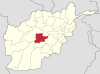 | |
| Landforms | ||
| Other |
| |
Authority control | |
|---|---|
| General |
|
| National libraries | |
| Other | |
На других языках
[de] Hilmend
Der 1125 km lange Hilmend (persisch هلمند Helmand, auch Hirmand genannt; هیرمند Hīrmand) ist der längste Fluss Afghanistans.[5] In der Antike hieß der Fluss bei Arrian Etymandros, bei Polybios Erymanthus und im Avesta Haetumat.[6]- [en] Helmand River
[es] Río Helmand
El río Helmand (también llamado Helmend, Hirmand o Hilmand; en pastún هلمند, en persa هیرمند, Darya-ye Helmand; y en latín, Erymandrus) es un largo río de Asia Central que discurre por Afganistán (el mayor río del país) e Irán.[it] Helmand (fiume)
L'Helmand o Helmand Rōd[2] (in pashto/farsi هلمند رود; latino Erymandrus) è il fiume più lungo dell'Afghanistan (1 150 km[1]) ed è il principale tributario dell'area endoreica del bacino del Sistan[3][4]. Dà il nome alla provincia di Helmand.[ru] Гильменд (река)
Гильме́нд[1] (дари هلمند, пушту هلمند — Хильменд[2]; перс. هيرمند — Хирменд[3]) — река в Афганистане и Иране, протекает по Иранскому нагорью. Длина составляет 1150 км, площадь бассейна — около 500 000 км². Исток реки находится в Гиндукуше.Другой контент может иметь иную лицензию. Перед использованием материалов сайта WikiSort.org внимательно изучите правила лицензирования конкретных элементов наполнения сайта.
WikiSort.org - проект по пересортировке и дополнению контента Википедии