geo.wikisort.org - River
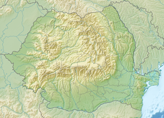
The Cerna (Hungarian: Cserna) is a river in Romania, a left tributary of the river Danube.[1][2] The Cerna has its source on the south-east side of the Godeanu Mountains and flows into the Danube near the town Orșova.[3] The upper reach of the river is sometimes called Cernișoara. With a length of 79 km (49 mi) and its basin of 1,380 km2 (530 sq mi),[2] it carves an erosive tectonic valley with numerous gorges, quite deep sometimes. There is a man-made lake on it (Tierna), just before it crosses the Băile Herculane spa, to perpetuate the old toponimic od Dierna.[clarification needed] The upper course of the Cerna is part of the Domogled-Valea Cernei National Park. The Cerna flows through the villages and towns Cerna-Sat, Țațu, Băile Herculane, Pecinișca, Bârza, Topleț, Coramnic and Orșova.
| Cerna | |
|---|---|
 | |
  | |
| Location | |
| Country | Romania |
| Counties | Gorj, Caraș-Severin, Mehedinți |
| Towns | Băile Herculane, Orșova |
| Physical characteristics | |
| Source | Godeanu Mountains |
| Mouth | Danube |
• location | Orșova |
• coordinates | 44°44′22″N 22°24′44″E |
| Length | 79 km (49 mi) |
| Basin size | 1,380 km2 (530 sq mi) |
| Basin features | |
| Progression | Danube→ Black Sea |
| Tributaries | |
| • right | Belareca |
Tributaries
The following rivers are tributaries of the river Cerna (from source to mouth):[2]
- Left: Arsaca, Jelerău, Valea Mare
- Right: Șturu, Măneasa, Valea Cărbunelui, Valea lui Iovan, Balmez, Naiba, Olanul, Craiova, Iauna, Topenia, Iuta, Prisăcina, Belareca, Jardașița Mare, Sacherștița
References
- "Planul național de management. Sinteza planurilor de management la nivel de bazine/spații hidrografice, anexa 7.1" (PDF, 5.1 MB). Administrația Națională Apele Române. 2010. p. 483.
- Atlasul cadastrului apelor din România. Partea 1 (in Romanian). Bucharest: Ministerul Mediului. 1992. pp. 230–232. OCLC 895459847. River code: VI.2
- Cerna / Cernisoara (jud. Mehedinti), e-calauza.ro
 |
Wikimedia Commons has media related to Cerna River, Caraș-Severin County. |
| Countries |
|  |
|---|---|---|
| Cities |
| |
| Tributaries | ||
| Canals | ||
| See also |
| |

На других языках
[de] Cerna (Fluss)
Die Cerna (ungarisch Cserna) ist ein linker Nebenfluss der Donau in Rumänien, der im Kreis Gorj entspringt.- [en] Cerna (Danube)
Другой контент может иметь иную лицензию. Перед использованием материалов сайта WikiSort.org внимательно изучите правила лицензирования конкретных элементов наполнения сайта.
WikiSort.org - проект по пересортировке и дополнению контента Википедии