geo.wikisort.org - Reservoir
The Harry S Truman Reservoir, also known as Truman Lake, is located in the state of Missouri, United States. It is located between Clinton and Warsaw, on the Osage River and extends south to Osceola. The dam is located in Benton County, but the reservoir also extends into parts of Henry, St. Clair, and Hickory counties.
| Harry S Truman Reservoir | |
|---|---|
| Truman Lake | |
 Harry S Truman Dam | |
 Harry S Truman Reservoir  Harry S Truman Reservoir | |
| Location | Benton / Henry / Hickory / St. Clair counties, Missouri, US |
| Coordinates | 38°15′47″N 93°24′17″W |
| Type | reservoir |
| Primary inflows | Osage River |
| Primary outflows | Osage River |
| Basin countries | United States |
| Surface area | 55,600 acres (225 km2),[1] or 200,000 acres (810 km2) at flood stage[2] |
| Water volume | 5,000,000 acre⋅ft (6.2 km3) [2] |
| Surface elevation | 706 feet (215 m) above sea level.[2] |


History
The U.S. Army Corps of Engineers built and manages the lake and dam. It is used primarily for flood control. It is also used for power generation, recreation, and wildlife management.
Originally named Kaysinger Bluff Dam and Reservoir in 1954, when construction was authorized, construction began in August 1964. It was renamed the Harry S Truman Dam and Reservoir, in honor of the former president from Missouri, by Congress in 1970. Construction was completed in 1979. The Kaysinger name refers to the bluff immediately north next to where the dam was eventually constructed. The bluff or cliff, a popular landmark even before the dam, overlooked the confluence of the South Grand River, Tebo Creek and the Osage River. The visitor center now sits on the bluff.
Completing the Truman Project took many years of planning, land acquisition, constructing new bridges and demolishing old ones. Several roads, towns, and cemeteries had to be relocated. The first construction project completed on the project was relocating Route 13 so it would be above maximum pool level.
The creation of the lake forced the closure of the Frisco Railroad's "Highline". Rising water levels severed the railroad tracks near Osceola and Deepwater and railroad officials declined to spend millions of dollars to reroute the lightly used tracks. The Missouri-Kansas-Texas Railroad, however, did relocate its main line between La Due and Clinton; the project included five miles of new track and a causeway/bridge combination over the lake.
Harry S Truman Regional Visitor Center
The Harry S Truman Regional Visitor Center contains exhibits about the cultural and natural history of Truman Lake, environmental activities, the construction of the dam, the operation of the powerhouse, and the US Army Corps of Engineers. A 67-seat theater shows wildlife, history and water safety videos by request. The observation deck offers views of Truman Lake and part of the Lake of the Ozarks, as well as the dam.
Harry S Truman State Park
Harry S Truman State Park is located in Benton County, Missouri on a peninsula that juts out into the reservoir.
Weaubleau-Osceola structure
The south-west portion of the lake makes up part of the circumference of the Weaubleau-Osceola structure, a 330-335 million year old impact crater.[3]
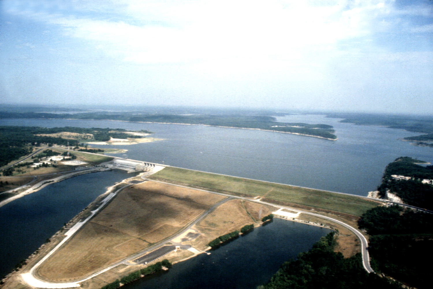
Harry S Truman Dam
| Dam type: | Concrete gravity and earth embankment in two sections |
| Length (total): | 5,964 feet (1,817.8 m) |
| Length (concrete section): | 964 feet (293.8 m) |
| Length (earth section): | 5,000 feet (1,524.0 m) |
| Height above river bed: | 126 feet (38.4 m) |
| Concrete volume: | 327,000 yards³ (250,011 m³) |
| Earth volume: | 8,500,000 yards³ (6,498,755 m³) |
| Spillway length: | 190 feet (57.9 m) in four sections |
| Tainter gates: | 4 |
| Six turbines | Rated at 160 megawatts [2] |
References
- Corps of Engineers "what we do" page Archived 2010-04-01 at the Wayback Machine
- "Learn About the Lake". Army Corps of Engineers, Kansas City District. Retrieved 9 February 2016.
- Miller, J.F., Evans, K.R., Rovey, C.W., II, Ausich, W.L., Bolyard, S.E., Davis, G.H., Ethington, R.L., Sandberg, C.A., Thompson, T.L., and Waters, J.A., "Mixed-age echinoderms, conodonts, and other fossils used to date a meteorite impact, and implications for missing strata in the type Osagean (Mississippian) in Missouri, USA". Echinoderm Paleobiology, 2008, 53p.
 This article incorporates public domain material from the United States Army Corps of Engineers document: "The Harry S. Truman Dam and Reservoir".
External links
Protected areas of Missouri | |||||||||||||||||||
|---|---|---|---|---|---|---|---|---|---|---|---|---|---|---|---|---|---|---|---|
| Federal |
| ||||||||||||||||||
| State |
| ||||||||||||||||||
| |||||||||||||||||||
Harry S. Truman | ||
|---|---|---|
| ||
| Presidency |
|   |
| Life |
| |
| Homes |
| |
| Elections |
| |
| Legacy |
| |
| Public image |
| |
| Family |
| |
| ||
На других языках
[de] Truman Reservoir
Das Harry S. Truman Reservoir (auch Truman Lake) liegt im US-amerikanischen Bundesstaat Missouri.- [en] Truman Reservoir
[fr] Truman Reservoir
Le Harry S. Truman Reservoir (également connu sous le nom de Truman Lake ) est situé dans l'État du Missouri, aux États-Unis. Il est situé entre Clinton et Varsovie, sur la rivière Osage et s'étend au sud jusqu'à Osceola. Le barrage est situé dans le comté de Benton, mais le réservoir s'étend également à certaines parties des comtés de Henry, St. Clair et Hickory.Другой контент может иметь иную лицензию. Перед использованием материалов сайта WikiSort.org внимательно изучите правила лицензирования конкретных элементов наполнения сайта.
WikiSort.org - проект по пересортировке и дополнению контента Википедии