geo.wikisort.org - River
The Eleven Point River is a 138-mile-long (222 km)[2] river in southern Missouri and northern Arkansas, United States. It originates near Willow Springs, Missouri. It more than doubles in flow when Greer Spring Branch runs into it, adding over 200 million US gallons (760,000 m3) of water per day to the river. The name derives from the Mississippi Valley French word pointe, which is a wooded point of land marking a river bend. Voyageurs marked distance by counting these points of land or river bends.[3] The river flows into the Spring River southwest of Pocahontas near the small town of Black Rock.
| Eleven Point River | |
|---|---|
 Eleven Point River, May 2018 | |
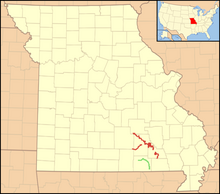 Location of the Eleven Point Wild and Scenic River shown in green; nearby Ozark National Scenic Riverways in red | |
| Location | |
| Country | United States |
| State | Missouri, Arkansas |
| Region | Ozark Plateau, Mississippi Alluvial Plain |
| Cities | Willow Springs, Thomasville |
| Physical characteristics | |
| Source | |
| • location | Willow Springs, Howell County, Ozark Plateau, Missouri |
| Mouth | Spring River |
• location | Black Rock, Arkansas, Randolph County, Mississippi Alluvial Plain, Arkansas |
| Discharge | |
| • location | Ravenden Springs, Arkansas |
| • average | 1,171 cu/ft. per sec.[1] |
| Basin features | |
| Tributaries | |
| • left | Spring Creek, Hurricane Creek |
| • right | Middle Creek, Greer Spring, Frederick Creek, Blue Spring |
National Wild and Scenic River | |
| Type | Scenic |
| Designated | October 2, 1968 |
In 1968 a 44.4-mile (71.5 km) stretch was named the Eleven Point National Wild and Scenic River, one of the original eight rivers chosen to be part of the United States National Wild and Scenic Rivers System.
See also
- List of Missouri rivers
- Irish Wilderness
- List of Arkansas rivers
References
- USGS data
- U.S. Geological Survey. National Hydrography Dataset high-resolution flowline data. The National Map Archived 2012-03-29 at the Wayback Machine, accessed March 9, 2011
- U.S. Geological Survey Geographic Names Information System: Eleven Point River
External links
- Eleven Point River Resource Page
- National Park Service
- Eleven Point River Conservancy
- Friends of the Eleven Point River
This Howell County, Missouri state location article is a stub. You can help Wikipedia by expanding it. |
Другой контент может иметь иную лицензию. Перед использованием материалов сайта WikiSort.org внимательно изучите правила лицензирования конкретных элементов наполнения сайта.
WikiSort.org - проект по пересортировке и дополнению контента Википедии