geo.wikisort.org - Reservoir
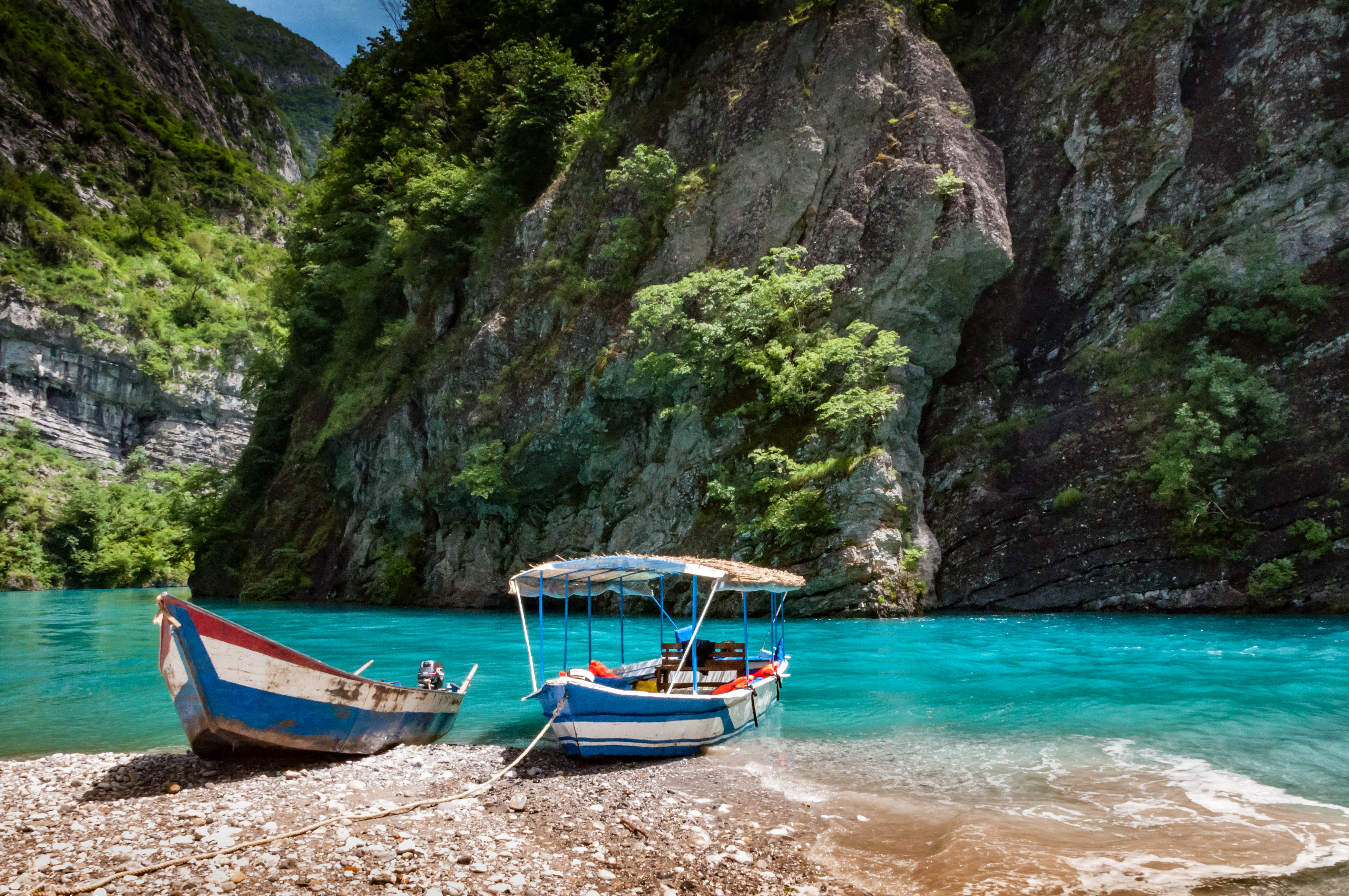
Lake Koman (Albanian: Liqeni i Komanit) is a reservoir on the Drin River in northern Albania. Lake Koman is surrounded by dense forested hills, vertical slopes, deep gorges, and a narrow valley, completely taken up by the river. Besides the Drin, it is fed by the Shala and Valbona Rivers. The lake stretches in an area of 34 km2 (13 sq mi), its width being 400 m (0.25 mi). The narrowest gorge, which is surrounded by vertical canyon walls, is more than 50 m (0.031 mi) wide. The reservoir was constructed between 1979 and 1988 near the village of Koman with a height of 115 m (377 ft).[2]
| Lake Koman | |
|---|---|
 Lake Koman | |
 Lake Koman  Lake Koman | |
| Location | Kukës, Shkodër |
| Coordinates | 42°13′7″N 19°53′56″E |
| Primary inflows | Drin, Shala, Valbona |
| Primary outflows | Drin |
| Basin countries | Albania |
| Max. length | 34 km (21 mi) |
| Surface area | 13 km2 (5.0 sq mi)[1] |
| Max. depth | 34 m (112 ft)[1] |
| Surface elevation | 170 m (560 ft)[1] |
| Settlements | Fierzë, Koman |
 | |
The combination of specific topography and hydrological conditions have contributed to the formation of different habitats.[3] The golden jackal, red fox, european badger, eurasian otter, beech marten, european polecat are the primary predatory mammals.[3] A high number of bird species have been observed in the region, including the common kingfisher, common quail, grey heron, eurasian wryneck, great spotted woodpecker and black-headed gull.[3]
The Lake Koman Ferry operates daily on the lake from Koman to Fierza. The ferry connects the city of Bajram Curri to the region of Tropojë. The journey takes about two and a half hours and is also popular with the foreign tourists.[4] Smaller boats bring people and goods to remote villages, which are often far away from the lake, but can only be reached by water.
![The vertical canyons of the lake are sometimes comparable to the Scandinavian fjords.[5]](http://upload.wikimedia.org/wikipedia/commons/b/bb/Lake_komani_2016_Albania.jpg) |
See also
- Drin River
- Koman Hydroelectric Power Station
- Geography of Albania
- Lakes of Albania
References
- "TREGUES SIPAS QARQEVE INDICATORS BY PREFECTURES" (PDF). Archived from the original (PDF) on 2011-07-24. Retrieved 2011-01-12.
- Korporata Elektroenergjitike Shqiptare. "Specification" (PDF). kesh.al. p. 1.
This dam is 115 m high
- "REHABILITATION OF KOMAN HYDRO POWER PLANT" (PDF). documents.worldbank.org. pp. 22–24.
- "How to Get Here". journeytovalbona.com.
- "Albania - Bradt Travel Guides". Archived from the original on 2014-03-26. Retrieved 2015-05-18.
| |||||||||||||||
На других языках
[de] Koman-Stausee
Der Koman-Stausee (albanisch Liqeni i Komanit) ist ein Stausee am Drin in Nordalbanien. Der in den Jahren 1980 bis 1988 in der Schlucht von Malgun (gryka e Malgunit) beim Dorf Koman erbaute Steinschüttdamm mit Betonaußenschicht ist 115 Meter hoch, besteht aus 600.000 Kubikmetern Material und staut einen See von zwölf Quadratkilometern Fläche.[2] Der Wasserspiegel liegt auf einer Höhe von 170 m ü. A.[3][4]- [en] Lake Koman
[fr] Lac de Koman
Le lac de Koman (en albanais : Liqeni i Komanit) est un réservoir du Drin dans le nord de l'Albanie. Le lac de Koman est entourée par des collines densément boisées, des pentes abruptes, de gorges profondes, et d'une étroite vallée. En plus du Drin, il est alimenté par les rivières Shala et Valbona. Le lac s'étend sur 34 km, avec une largeur de 400 m. La gorge la plus étroites est large de plus de 50 m. Le réservoir a été construit entre 1979 et 1988, près du village de Koman , avec une hauteur de 115 m[1].Другой контент может иметь иную лицензию. Перед использованием материалов сайта WikiSort.org внимательно изучите правила лицензирования конкретных элементов наполнения сайта.
WikiSort.org - проект по пересортировке и дополнению контента Википедии