geo.wikisort.org - Reservoir
Lake Kawaupaka, also known as Lake Kawaupaku, is a small lake near Te Henga (Bethells Beach) in the Auckland Region of New Zealand.[1] The lake is on private land,[2] and is one of the few dune lakes in the region to be surrounded by native forest.[3][4] It is located south-west of Lake Wainamu.
| Lake Kawaupaka | |
|---|---|
 Lake Kawaupaka in 1904 | |
 Lake Kawaupaka | |
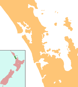
| Location | Auckland Region, North Island |
| Coordinates | 36°53′40″S 174°27′30″E |
| Basin countries | New Zealand |
| Max. length | 0.5 km (0.31 mi) |
| Max. width | 0.25 km (0.16 mi) |
Geology
The lake was originally a river valley. 7,200 years ago at the end of the Last Glacial Maximum, when sea-levels began to rise, Te Henga / Bethells Beach began to form, as sand dunes migrated into the river valley. When sand dunes formed a barrier, Lake Kawaupaka began to form as a freshwater lake.[5]
History
The lake is within the traditional rohe of Te Kawerau ā Maki, and was known as Roto Kawaupaku.[6] The name refers to the Little black cormorant (kawaupaka), who were seen as the guardians of the lake.[7] The lake was part of the greater Te Henga / Bethells Beach and Waitākere River area of settlements, with the localities of Tūrapa located on the north shore and, Pākōwhatu to the east of the lake.[6] Pākōwhatu was a pā that used Ngāti Awa fortification techniques, learnt from the Ngāti Awa people as they travelled south past the Waitākere Ranges area towards Kawhia Harbour and Taranaki.[6]
The lake remained mostly undisturbed during European colonisation. During the 19th century, flax was harvested from the lake, and pioneer John Neale Bethell planted an orchard on the lakeside.[8] The lake was purchase din 1979 by the Queen Elizabeth II National Trust, after which it was administered by the Auckland Regional Council as a nature reserve.[5]
See also
- List of lakes in New Zealand
References
- Gregory's Auckland & Surrounds Street Directory (3rd ed.). 2008. p. map 165. ISBN 978-0-7319-2048-8.
- "Fishing helps clear the murky depths at Lake Wainamu". Auckland Regional Council. 26 March 2007. Retrieved 25 July 2009.
- "Schedule 1: Wetland Management Areas" (PDF). Proposed Auckland Regional Plan: Air, Land and Water Plan. July 2005. p. 5. Archived from the original (PDF) on 14 October 2008. Retrieved 25 July 2009.
- TKITA-2013-0062 CULTURAL VALUES ASSESSMENT FOR BETHELLS / TE HENGA / WAITAKERE VALLEY LOCAL AREA PLAN Prepared by Edward Ashby Heritage and Environment Unit Te Kawerau Iwi Tribal Authority
- Cameron, Ewen; Hayward, Bruce; Murdoch, Graeme (2008). A Field Guide to Auckland: Exploring the Region's Natural and Historical Heritage (Revised ed.). Random House New Zealand. p. 162. ISBN 978-1-86962-1513.
- Murdoch, Graeme (1990). "Nga Tohu o Waitakere: the Maori Place Names of the Waitakere River Valley and its Environs; their Background History and an Explanation of their Meaning". In Northcote-Bade, James (ed.). West Auckland Remembers, Volume 1. West Auckland Historical Society. pp. 13, 17, 22. ISBN 0-473-00983-8.
- "Lake Kawaupaka". New Zealand Gazetteer. Land Information New Zealand. Retrieved 10 May 2022.
- Waitākere Ranges Local Board (October 2015). "Local Area Plan: Te Henga (Bethells Beach) and the Waitākere River Valley. Waitākere Ranges Heritage Area" (PDF). Auckland Council. ISBN 978-0-908320-17-2. Retrieved 15 May 2022.
Другой контент может иметь иную лицензию. Перед использованием материалов сайта WikiSort.org внимательно изучите правила лицензирования конкретных элементов наполнения сайта.
WikiSort.org - проект по пересортировке и дополнению контента Википедии