geo.wikisort.org - Mountains
Shepherd Mountain is a summit in Iron County in the U.S. state of Missouri.[1] Shepherd Mountain lies just west of Ironton and Stouts Creek in the Arcadia Valley.[2]
| Shepherd Mountain | |
|---|---|
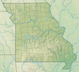 Shepherd Mountain Iron County, Missouri, U.S. | |
| Highest point | |
| Elevation | 1,598 ft (487 m) |
| Coordinates | 37°36′25″N 90°36′25″W[1] |
| Geography | |
| Location | Iron County, Missouri, U.S. |
| Parent range | Saint Francois Mountains |
| Topo map | USGS Ironton |
Shepherd Mountain has the name of Forrest Shepherd, a geologist.[3] The mountain was the scene of action during the Battle of Fort Davidson.[4]
References
- U.S. Geological Survey Geographic Names Information System: Shepherd Mountain
- Ironton, Missouri, 7.5 Minute Topographic Quadrangle, USGS, 1968
- "Iron County Place Names, 1928–1945 (archived)". The State Historical Society of Missouri. Archived from the original on 24 June 2016. Retrieved 12 October 2016.
{{cite web}}: CS1 maint: bot: original URL status unknown (link) - "The Battle of Pilot Knob State Historic Site". River Valley Region Association. Retrieved 12 October 2016.
This Iron County, Missouri state location article is a stub. You can help Wikipedia by expanding it. |
Текст в блоке "Читать" взят с сайта "Википедия" и доступен по лицензии Creative Commons Attribution-ShareAlike; в отдельных случаях могут действовать дополнительные условия.
Другой контент может иметь иную лицензию. Перед использованием материалов сайта WikiSort.org внимательно изучите правила лицензирования конкретных элементов наполнения сайта.
Другой контент может иметь иную лицензию. Перед использованием материалов сайта WikiSort.org внимательно изучите правила лицензирования конкретных элементов наполнения сайта.
2019-2026
WikiSort.org - проект по пересортировке и дополнению контента Википедии
WikiSort.org - проект по пересортировке и дополнению контента Википедии