geo.wikisort.org - Mountains
Ketcherside Mountain is a summit in Iron County in the U.S. state of Missouri.[2] The peak lies about 4+1⁄2 miles (7 km) southeast of Taum Sauk Mountain and about 6+1⁄2 miles (10 km) south-southwest of Ironton. Hogan and Hogan Mountain lie to the west-southwest.[3]
| Ketcherside Mountain | |
|---|---|
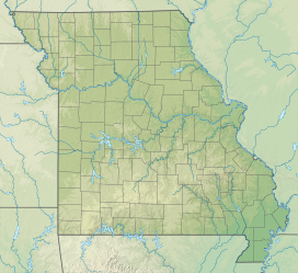 Ketcherside Mountain Iron County, Missouri, U.S. | |
| Highest point | |
| Elevation | 1,698 ft (518 m)[1] |
| Coordinates | 37°31′25″N 90°40′08″W[2] |
| Geography | |
| Location | Iron County, Missouri, U.S. |
| Parent range | Saint Francois Mountains |
| Topo map | USGS Ironton |
Ketcherside Mountain has the name of the local Ketcherside (or Catcherside) family.[4]
References
- Ironton, Missouri, 7.5 Minute Topographic Quadrangle, USGS, 1968
- "Ketcherside Mountain". Geographic Names Information System. United States Geological Survey. Retrieved 2017-06-23.
- Missouri Atlas & Gazetteer, DeLorme, 1998, First edition, p. 56 ISBN 0-89933-224-2
- "Iron County Place Names, 1928–1945 (archived)". The State Historical Society of Missouri. Archived from the original on 24 June 2016. Retrieved 12 October 2016.
{{cite web}}: CS1 maint: bot: original URL status unknown (link)
This Iron County, Missouri state location article is a stub. You can help Wikipedia by expanding it. |
Текст в блоке "Читать" взят с сайта "Википедия" и доступен по лицензии Creative Commons Attribution-ShareAlike; в отдельных случаях могут действовать дополнительные условия.
Другой контент может иметь иную лицензию. Перед использованием материалов сайта WikiSort.org внимательно изучите правила лицензирования конкретных элементов наполнения сайта.
Другой контент может иметь иную лицензию. Перед использованием материалов сайта WikiSort.org внимательно изучите правила лицензирования конкретных элементов наполнения сайта.
2019-2026
WikiSort.org - проект по пересортировке и дополнению контента Википедии
WikiSort.org - проект по пересортировке и дополнению контента Википедии