geo.wikisort.org - Mountains
The Oberhalbstein Alps (German: Oberhalbsteiner Alpen) or Platta Group (Italian: Alpi del Platta) are a mountain range in the Alps of eastern Switzerland and northern Italy. They are considered to be part of the Central Eastern Alps. The Oberhalbstein Alps are separated from the Lepontine Alps in the west by the Splügen Pass; from the Plessur Alps in the north by the river Albula; from the Albula Alps in the east by the Septimer Pass and the river Gelgia; from the Bernina Range in the south by the Val Bregaglia.
| Oberhalbstein Alps | |
|---|---|
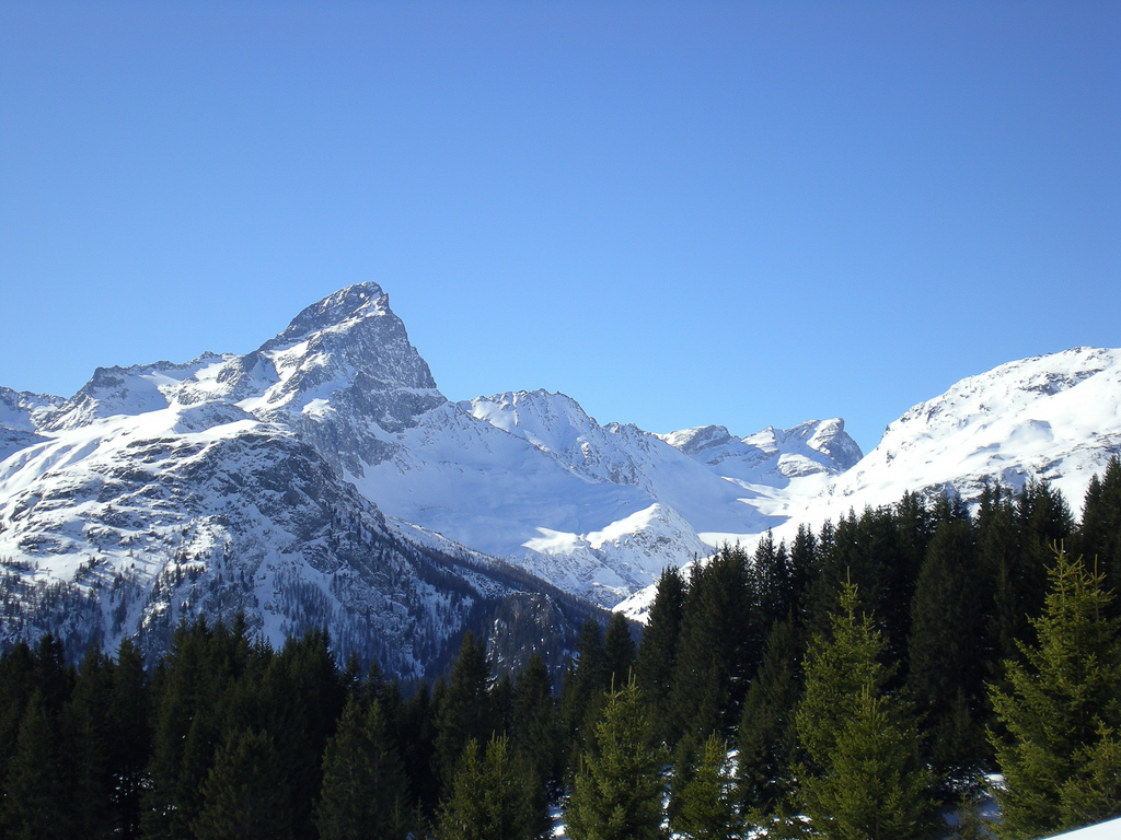
 Piz Platta | |
| Highest point | |
| Peak | Piz Platta |
| Elevation | 3,386 m (11,109 ft) |
| Coordinates | 46°29′13.1″N 9°33′42.2″E |
| Geography | |
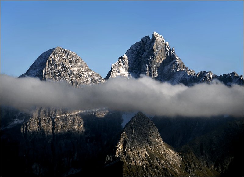
 Oberhalbstein Alps
The borders of the range according to Alpine Club classification of the Eastern Alps | |
| Countries | Switzerland and Italy |
| States | Graubünden and Lombardy |
| Range coordinates | 46°27.3′N 9°30.45′E |
| Parent range | Central Eastern Alps |
The Oberhalbstein Alps are drained by the rivers Hinterrhein, Gelgia, Liro and Mera.
Peaks

The main peaks of the Oberhalbstein Alps are:
| Peak | Elevation | |
|---|---|---|
| m | ft | |
| Piz Platta | 3392 | 11,129 |
| Piz Forbesch | 3258 | 10,689 |
| Piz Timun | 3201 | 10,502 |
| Pizzo Stella | 3163 | 10,375 |
| Piz Duan | 3133 | 10,279 |
| Pizz Gallagiun | 3107 | 10,200 |
| Gletscherhorn | 3106 | 10,191 |
| Cima da Lägh | 3082 | 10,112 |
| Piz Grisch | 3062 | 10,050 |
| Usser Wissberg | 3053 | 10,016 |
| Piz Bles | 3045 | 9,990 |
| Surettahorn | 3027 | 9,971 |
| Tscheischhorn | 3019 | 9,905 |
| Piz Curvér | 2975 | 9,761 |
| Piz Alv | 2854 | 9,365 |
| Piz Miez | 2835 | 9,301 |
| Sur Carungas | 2829 | 9,281 |
| Piz Mez | 2718 | 8,917 |
| Piz Arlos | 2696 | 8,847 |
Passes
The main mountain passes of the Oberhalbstein Alps are:
| Mountain pass | location | type | elevation | |
|---|---|---|---|---|
| m | ft | |||
| Passo della Duana | Avers to the Val Bregaglia | snow | 2800 | 9187 |
| Passo da la Prasignola | Avers to Soglio | cattle path | 2720 | 8924 |
| Forcella di Lago or Madris Pass | Avers to Chiavenna | footpath | 2680 | 8793 |
| Forcellina | Avers to the Septimer Pass | footpath | 2673 | 8770 |
| Passo di Lei | Avers to Chiavenna | footpath | 2659 | 8724 |
| Stallerberg | Avers to Bivio | footpath | 2584 | 8478 |
| Pass da Sett (Septimer Pass) | Bivio to Val Bregaglia | bridle path | 2311 | 7582 |
| Pass da Niemet | Innerferrera to Madesimo | footpath | 2280 | 7481 |
See also
References
- Swisstopo maps
Mountain ranges of the Western Limestone Alps according to the AVE | ||
|---|---|---|
|  | |
На других языках
[de] Oberhalbsteiner Alpen
Die Oberhalbsteiner Alpen sind eine Gebirgsgruppe bei Avers. Synonym verwendet die AVE für dieses Gebiet die Bezeichnung Plattagruppe. Nach SOIUSA werden sie als Platta-Alpen oder in Anlehnung an den SAC-Führer «Avers» auch mit Averser Berge bezeichnet. Das Gebiet wird im Norden ab Splügenpass bis Thusis vom Hinterrhein und bis Tiefencastel von der Albula und im Osten bis zum Septimer von der Julia begrenzt. Die West- und Südgrenze bilden bis zum Zusammenfluss in Chiavenna der Liro und die Maira. Die höchste Erhebung in der Region ist der Piz Platta (3392 m ü. M.). Er ist namengebend für die Alpenclub Sektion "Piz Platta SAC" des Gebiets.[1]- [en] Oberhalbstein Alps
[fr] Chaîne de l'Oberhalbstein
La chaîne de l'Oberhalbstein est un massif des Alpes orientales centrales. Il s'élève entre la Suisse (canton des Grisons) et l'Italie (Lombardie). Il tient son nom de la vallée qui borde le massif à l'est.[it] Alpi del Platta
Le Alpi del Platta (dette anche Monti dell'Avero; Oberhalbsteiner Alpen in tedesco) sono un gruppo montuoso[1] delle Alpi Retiche occidentali, a cavallo tra Italia (Lombardia) e Svizzera (Canton Grigioni). Il punto culminante è il Piz Platta che raggiunge i 3.392 m s.l.m.Текст в блоке "Читать" взят с сайта "Википедия" и доступен по лицензии Creative Commons Attribution-ShareAlike; в отдельных случаях могут действовать дополнительные условия.
Другой контент может иметь иную лицензию. Перед использованием материалов сайта WikiSort.org внимательно изучите правила лицензирования конкретных элементов наполнения сайта.
Другой контент может иметь иную лицензию. Перед использованием материалов сайта WikiSort.org внимательно изучите правила лицензирования конкретных элементов наполнения сайта.
2019-2026
WikiSort.org - проект по пересортировке и дополнению контента Википедии
WikiSort.org - проект по пересортировке и дополнению контента Википедии