geo.wikisort.org - Mountains
The Lepontine Alps (German: Lepontinische Alpen, French: Alpes lépontines, Italian: Alpi Lepontine) are a mountain range in the north-western part of the Alps. They are located in Switzerland (Valais, Ticino, Uri and Graubünden) and Italy (Piedmont and Lombardy).
| Lepontine Alps | |
|---|---|
 Monte Leone | |
| Highest point | |
| Peak | Monte Leone |
| Elevation | 3,553 m (11,657 ft) |
| Coordinates | 46°24′N 8°08′E |
| Naming | |
| Native name | |
| Geography | |
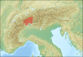 Lepontine Alps (red)
| |
| Countries | Switzerland and Italy |
| Cantons, Regions | Valais, Ticino, Graubünden, Uri, Piedmont and Lombardy |
| Range coordinates | 46°25′N 8°40′E |
| Parent range | Western Alps |
| Borders on | Pennine Alps, Bernese Alps, Uri Alps, Glarus Alps, Western Rhaetian Alps and Lugano Prealps |
| Topo map | Swiss Federal Office of Topography swisstopo |
| Geology | |
| Orogeny | Alpine orogeny |
The Simplon rail tunnel (from Brig to Domodossola) the Gotthard rail (from Erstfeld to Bodio) and Gotthard road tunnels (from Andermatt to Airolo) and the San Bernardino road tunnel are important transport arteries.
The eastern portion of the Lepontine Alps, from the St Gotthard Pass to the Splügen Pass, is sometimes named the Adula Alps, while the western part is historically referred to as the Ticino Alps.
Etymology
The designation Lepontine Alps, derived from the Latin name of the Val Leventina, has long been somewhat vaguely applied to the Alpine ranges that enclose it, before being used for the whole range.[1]
Geography
Following the line marking the division of the waters that flow into the Po from those that feed the Rhone or the Rhine, the main ridge of the Lepontine Alps describes a somewhat irregular curve, convex to the north, from the Simplon Pass to the Splugen Pass. With the single exception of the Monte Leone, overlooking the pass of the Simplon, the summits of this portion of the chain are much inferior in height to those of the neighbouring chains; but two peaks of the Adula group, culminating at the Rheinwaldhorn, exceed 11,000 feet (3,400 m) in height.[1]
The extensive region lying south of the main ridge is occupied by mountain ranges whose summits sometimes rival in height those of the dividing ridge, and which are cut through by deep valleys, three of which converge in the basins of Lake Maggiore and Lake Como, the deepest of all the lakes on the south side of the Alps. The most important of these valleys is the Val Leventina, or the Upper valley of the Ticino. This has been known from a remote antiquity because it leads to the Pass of St Gotthard, one of the easiest lines of communication between northern and southern Europe.
The Lepontine Alps are drained by the rivers Rhône in the west, Reuss in the north, Rhine (Vorderrhein and Hinterrhein) in the east and Ticino and Toce in the south.
List of peaks


The chief peaks of the Lepontine Alps are:
| Name | Elevation | |
|---|---|---|
| m | ft | |
| Monte Leone | 3,553 | 11,684 |
| Rheinwaldhorn | 3,402 | 11,149 |
| Güferhorn | 3,393 | 11,132 |
| Blinnenhorn | 3,384 | 11,103 |
| Basodino | 3,276 | 10,749 |
| Pizzo Tambò | 3,276 | 10,749 |
| Helsenhorn | 3,274 | 10,742 |
| Wasenhorn | 3,255 | 10,680 |
| Ofenhorn | 3,242 | 10,637 |
| Scherbadung (Monte Cervandone) | 3,213 | 10,542 |
| Piz Medel | 3,203 | 10,509 |
| Scopi | 3,200 | 10,499 |
| Pizzo Rotondo | 3,197 | 10,489 |
| Hohsandhorn | 3,182 | 10,440 |
| Piz Terri | 3,151 | 10,331 |
| Pizzo di Cassimoi | 3,129 | 10,266 |
| Kastelhorn | 3,128 | 10,262 |
| Piz Aul | 3,124 | 10,250 |
| Pizzo Pesciora | 3,120 | 10,247 |
| Witenwasserenstock | 3,084 | 10,119 |
| Campo Tencia | 3,075 | 10,089 |
| Leckihorn | 3,069 | 10,069 |
| Bruschghorn | 3,054 | 10,020 |
| Lorenzhorn | 3,048 | 10,000 |
| Alperschällihorn | 3,045 | 9,991 |
| Chilchalphorn | 3,040 | 9,974 |
| Saashörner | 3,039 | 9,970 |
| Piz Corbet | 3,025 | 9,925 |
| Piz Blas | 3,023 | 9,918 |
| Monte Giove | 3,010 | 9,876 |
| Cime di Val Loga | 3,004 | 9,856 |
| Pizzo Centrale | 3,003 | 9,853 |
| Pizzas d'Anarosa | 3,002 | 9,850 |
| Piz Beverin | 2,998 | 9,843 |
| Weisshorn (Splugen) | 2,992 | 9,817 |
| Teurihorn | 2,973 | 9,754 |
| Piz de Mucia | 2,967 | 9,734 |
| Piz Pombi | 2,967 | 9,734 |
| Pizzo Lucendro | 2,959 | 9,708 |
| Piz Denter | 2,956 | 9,698 |
| Piz Tomul | 2,949 | 9,676 |
| Piz Cavel | 2,944 | 9,659 |
| Piz Caschleglia | 2,936 | 9,633 |
| Barenhorn | 2,932 | 9,620 |
| Six Madun (Badus) | 2,932 | 9,619 |
| Poncione di Manió | 2,925 | 9,596 |
| Pizzo Fiorèra | 2,921 | 9,583 |
| Pizzo Forno | 2,907 | 9,537 |
| Piz Muraun | 2,899 | 9,512 |
| Zervreilahorn | 2,898 | 9,508 |
| Valserhorn | 2,886 | 9,469 |
| Piz Serenastga | 2,874 | 9,429 |
| Cima della Bianca | 2,893 | 9,491 |
| Punta della Rossa | 2,888 | 9,475 |
| Poncione di Valleggia | 2,873 | 9,426 |
| Punta Valgrande | 2,857 | 9,373 |
| Monte Cistella | 2,851 | 9,353 |
| Piz Canal | 2,846 | 9,337 |
| I Rodond | 2,830 | 9,280 |
| Piz Maler | 2,790 | 9,150 |
| Fil de Dragiva | 2,786 | 9,140 |
| Piz Lukmanier | 2,778 | 9,115 |
| Piz Riein | 2,762 | 9,062 |
| Fibbia | 2,738 | 8,983 |
| Monte Prosa | 2,738 | 8,983 |
| Pizzo di Campedell | 2,724 | 8,937 |
| Pizzo del Torto | 2,723 | 8,934 |
| Pizzo di Röd | 2,699 | 8,855 |
| Pizzo Solögna | 2,698 | 8,852 |
| Rasiva | 2,684 | 8,806 |
| Cima di Piancabella | 2,671 | 8,763 |
| Pizzo d'Orsalia | 2,664 | 8,740 |
| Pizzo Malora | 2,640 | 8,660 |
| Cima de Nomnom | 2,633 | 8,638 |
| Poncione dei Laghetti | 2,616 | 8,583 |
| Piz d'Arbeola | 2,600 | 8,500 |
| Breithorn | 2,599 | 8,527 |
| Pizzo Paglia | 2,594 | 8,510 |
| Piz Pazzola | 2,581 | 8,468 |
| Piz Radun | 2,581 | 8,468 |
| Piz de Cressim | 2,575 | 8,448 |
| Pizzo di Madéi | 2,551 | 8,369 |
| Piz Titschal | 2,550 | 8,370 |
| Pizzo Columbe | 2,549 | 8,363 |
| Pizzo Cavregasco | 2,535 | 8,317 |
| Poncione Pro do Rodùc | 2,522 | 8,274 |
| Pizzo di Cadrèigh | 2,516 | 8,225 |
| Piz de Setag | 2,476 | 8,123 |
| Pizzo d'Orsalietta | 2,476 | 8,123 |
| Piz Vizan | 2,471 | 8,107 |
| Pizzo di Porcaresc | 2,467 | 8,094 |
| Pizzo Campanile | 2,458 | 8,064 |
| Poncione della Marcia | 2,454 | 8,051 |
| Madone di Càmedo | 2,446 | 8,025 |
| Poncione di Piotta | 2,439 | 8,002 |
| Pizzo di Brünesc | 2,429 | 7,969 |
| Cima dell'Uomo | 2,390 | 7,840 |
| Cima dello Stagn | 2,382 | 7,815 |
| Pizzo Bombögn | 2,331 | 7,648 |
| Poncione d'Alnasca | 2,301 | 7,549 |
| Schlüechtli | 2,283 | 7,490 |
| Pala da Tgiern | 2,279 | 7,477 |
| Madom da Sgióf | 2,265 | 7,431 |
| Pizzo Alzasca | 2,262 | 7,421 |
| Pizzo Muncréch | 2,252 | 7,388 |
| Corno di Gesero | 2,227 | 7,306 |
| Camoghè | 2,226 | 7,303 |
| Monte Zeda | 2,156 | 7,073 |
| Glaser Grat | 2,124 | 6,969 |
| Piz Mundaun | 2,065 | 6,775 |
| Pizzo Peloso | 2,064 | 6,772 |
| Madone (Locarno) | 2,051 | 6,729 |
| Crest dil Cut | 2,016 | 6,614 |
| Monte Berlinghera | 1,930 | 6,330 |
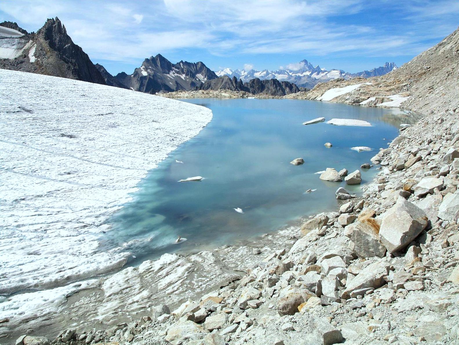
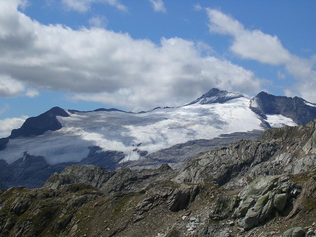
Glaciers
Main glaciers :
- Gries Glacier
- Paradies Glacier
- Basòdino Glacier
List of passes
The chief passes of the Lepontine Alps are:
| Mountain pass | location | type | elevation | |
|---|---|---|---|---|
| m | ft | |||
| Zapport Pass | Hinterrhein to Malvaglia and Biasca | snow | 3,079 | 10,103 |
| Guferlücke | Canaltal to Lentatal (near Vals, Switzerland) | snow | 2,980 | 9,777 |
| Lentalücke | Hinterrhein to Vals | snow | 2,954 | 9,692 |
| Hohsand Pass | Binn to La Frua (Toce waterfalls) | snow | 2,927 | 9,603 |
| Lecki Pass | Realp to Oberwald VS | snow | 2,912 | 9,554 |
| Passo Rotondo | Airolo to Oberwald | snow | 2,880 | 9,449 |
| Kaltwasser Pass | Simplon Hospice to Alpe Veglia | snow | 2,844 | 9,331 |
| Scaradra Pass | Vals to Olivone | footpath | 2,770 | 9,088 |
| Satteltelücke | Vals to Vrin | footpath | 2,768 | 9,082 |
| Ritter Pass | Binn to Alpe Veglia | snow | 2,692 | 8,832 |
| Cavanna Pass | Realp to Bedretto | snow | 2,611 | 8,566 |
| Scatta Minoja | Devero to Formazza | bridle path | 2,597 | 8,521 |
| Bocca di Cadlimo | Airolo to the Lukmanier Pass | footpath | 2,542 | 8,340 |
| Valserberg | Hinterrhein to Vals | bridle path | 2,507 | 8,225 |
| Safierberg | Splügen to Safien | bridle path | 2,490 | 8,170 |
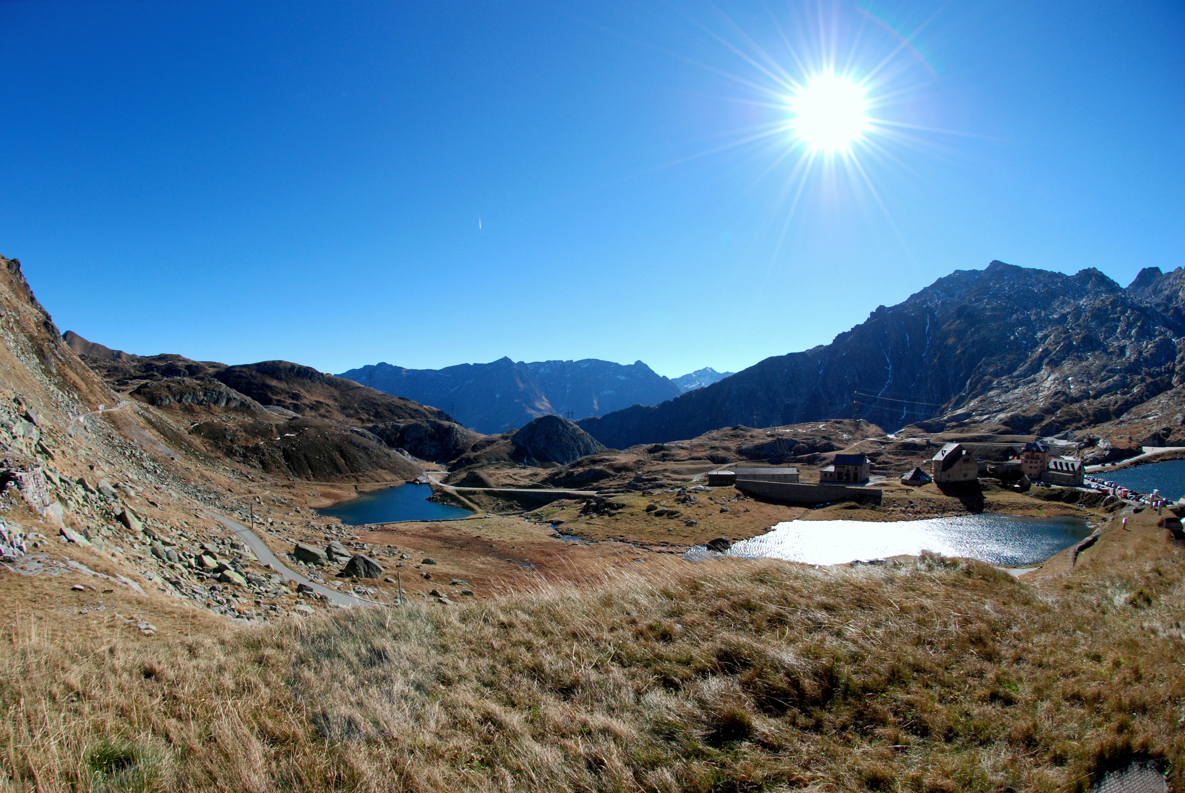
| Nufenen Pass | Ulrichen to Airolo | road | 2,478 | 8,130 |
| Geisspfad Pass | Binn to Devero | footpath | 2,475 | 8,120 |
| Gries Pass | Ulrichen to La Frua | bridle path | 2,468 | 8,098 |
| Passo di Naret | Fusio to Airolo | bridle path | 2,443 | 8,015 |
| Passo Valtendra | Alpe Veglia to Devero and Baceno | bridle path | 2,431 | 7,976 |
| Diesrut Pass | Vrin to Somvix | bridle path | 2,424 | 7,953 |
| Albrun Pass | Binn to Devero and Baceno | bridle path | 2,410 | 7,907 |
| Greina Pass | Olivone to Somvix | bridle path | 2,360 | 7,743 |
| San Giacomo Pass | Airolo to La Frua | bridle path | 2,308 | 7,573 |
| Passo di Buffalora | Mesocco to the Val Calanca | footpath | 2,265 | 7,431 |
| Passo dell'Uomo | Quinto, Switzerland to the Lukmanier Pass | bridle path | 2,212 | 7,258 |
| Splügen Pass | Thusis to Chiavenna | road | 2,117 | 6,946 |
| St Gotthard Pass | Andermatt to Airolo | road | 2,114 | 6,936 |
| San Bernardino Pass | Thusis to Bellinzona | road | 2,063 | 6,769 |
| Lukmanier Pass | Disentis to Olivone | road | 1,917 | 6,289 |
See also
References
- Ball, John (1866). The Alpine guide, Central Alps. London. p. 245.
- This article incorporates text from a publication now in the public domain: Chisholm, Hugh, ed. (1911). "Alps". Encyclopædia Britannica (11th ed.). Cambridge University Press.
Authority control | |
|---|---|
| General |
|
| National libraries | |
На других языках
[de] Lepontinische Alpen
Die Lepontinischen Alpen sind eine Gebirgsgruppe in den Westalpen. Sie umfassen die Gebirgszüge zwischen dem Simplonpass im Westen, dem Splügenpass im Osten und den oberitalienischen Seen im Süden. Der Name leitet sich von den Lepontiern ab, einem im Altertum an der oberen Rhone und am Tessin lebenden Volk, dessen Hauptort Oscellä, das heutige Domodossola, war.- [en] Lepontine Alps
[es] Alpes Lepontinos
Los Alpes Lepontinos (en italiano, Alpi Lepontine) son una sección del gran sector Alpes del noroeste, según la clasificación SOIUSA. Su pico más alto es Monte Leone, con 3.552 m s. n. m.. El nombre proviene de los leponcios, antigua población que habitaba en estos montes.[fr] Alpes lépontines
Les Alpes lépontines sont un massif montagneux situé dans la partie centrale des Alpes entre la Suisse et l'Italie. Elles sont à cheval sur les cantons du Valais, d'Uri, des Grisons, du Tessin et sur les régions italiennes du Piémont et de Lombardie.[it] Alpi Lepontine
Le Alpi Lepontine sono una sezione delle Alpi che interessa la Svizzera e l'Italia. Secondo la Partizione delle Alpi fanno parte delle Alpi Centrali, mentre secondo la SOIUSA esse si trovano nelle Alpi Nord-occidentali.[ru] Лепонтинские Альпы
Лепонтинские Альпы — горы, часть Западных Альп на территории Швейцарии (кантоны Вале, Тичино и Граубюнден) и Италии (Пьемонт).Другой контент может иметь иную лицензию. Перед использованием материалов сайта WikiSort.org внимательно изучите правила лицензирования конкретных элементов наполнения сайта.
WikiSort.org - проект по пересортировке и дополнению контента Википедии