geo.wikisort.org - Mountains
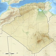
Mount Tahat (Arabic: جبل تاهات) is the highest mountain peak in Algeria. It sits at an elevation of 2,908 metres (9,541 ft).[4][5] Other sources indicate an elevation of 3,003 metres (9,852 ft).[6] Tahat is also the highest peak in the Hoggar Mountains. Its nearest city is Tamanrasset which is located 56 kilometres (35 mi) to the south.
| Mount Tahat | |
|---|---|
 | |
| Highest point | |
| Elevation | 3,003 m (9,852 ft)[1] |
| Prominence | 2,328 m (7,638 ft)[2][3] |
| Listing | Country high point List of mountains in Algeria Ultra |
| Coordinates | 23°17′20″N 5°32′01″E[3] |
| Naming | |
| Native name | جبل تاهات (Arabic) |
| Geography | |
| Location | Algeria |
| Parent range | Hoggar Mountains |
| Climbing | |
| First ascent | 1931 |
Mount Tahat is of volcanic origin. It is located in an arid, rocky high plateau area of the central Sahara Desert. The Tuareg inhabit this region. To the north lie the Tassili n'Ajjer mountains, which contain cave paintings dating from a period between 8000 and 2000 BC. The rock art is pastoral, showing cattle breeding and hunting of animals that are today exclusively found in the southern Sahara's climate.

See also
References
- "Mount Tahat - Seven Natural Wonders" Archived 2019-02-11 at the Wayback Machine Sevennaturalwonders.org. Retrieved 2018-06-20.
- "Africa Ultra-Prominences" Peaklist.org. Retrieved 2012-01-14.
- "Tahat, Algeria". Peakbagger.com. Retrieved 2014-05-15.
- "Africa Ultra-Prominences". peaklist.org. Retrieved 2019-03-07.
- "Tahat - Peakbagger.com". www.peakbagger.com. Retrieved 2019-03-07.
- "French Colonies - Algeria". www.discoverfrance.net. Retrieved 2019-03-07.
External links
На других языках
[de] Tahat
Der Tahat (arabisch جبل تاهات Dschabal Tahat, DMG Ǧabal Tāhāt) ist der höchste Berg Algeriens. Seine Höhe wird traditionell mit 3.003 m angegeben.[1] Andere Quellen kommen zu deutlich niedrigeren Werten zwischen 2.908 m[2] und 2.859 m.[3] Er ist außerdem die höchste Erhebung im Atakor-Vulkanfeld und im gesamten Ahaggargebirge.- [en] Mount Tahat
[es] Tahat
El monte Tahat (en árabe, جبل تاهات) es una montaña de origen volcánico y el pico más alto del macizo de Ahaggar y de Argelia (3.003 msnm). Se encuentra a 56 km N de Tamanrasset, la población más cercana, y a 1.511 km SSE de Argel.[fr] Tahat
Le mont Tahat est d'origine volcanique. Il est situé dans la zone aride du Sahara central. S'élevant dans un environnement de rocailles et de plateaux, il culmine à 2 918 d'altitude. C'est le plus haut sommet du massif du Hoggar et aussi de l'Algérie.[it] Monte Tahat
Il monte Tahat (2.918 m s.l.m.)[1] è la montagna più alta dell'Algeria. Si trova nel massiccio dell'Atakor, nel cuore dell'Ahaggar. È una montagna di origine vulcanica e si trova nella zona arida del Sahara.[ru] Тахат
Таха́т (араб. جبل تاهات) — гора в центральной части пустыни Сахара, высшая точка Алжира (2918 м[1] или по другим данным — 3003 м[2]). Расположена на юге Алжира и является частью нагорья Ахаггар. Ближайший город — расположенный в 60 км к югу Таманрассет. Как и все нагорье, гора имеет вулканическое происхождение и относится к вулканическому полю Атакор.Другой контент может иметь иную лицензию. Перед использованием материалов сайта WikiSort.org внимательно изучите правила лицензирования конкретных элементов наполнения сайта.
WikiSort.org - проект по пересортировке и дополнению контента Википедии
