geo.wikisort.org - Mountains
Mount Lincoln is a 5,089-foot-high (1,551 m) mountain within the Franconia Range of the White Mountains of New Hampshire. Lincoln is located between Little Haystack and Mount Lafayette. All three overlook Franconia Notch. The west side of Lincoln drains into the main stem of the Pemigewasset River. The east side drains into Lincoln Brook, thence into the Franconia Branch of the Pemigewasset.
| Mount Lincoln | |
|---|---|
 Mount Lincoln viewed from Little Haystack Mountain on the Franconia Ridge. | |
| Highest point | |
| Elevation | 5,089 ft (1,551 m)[1] |
| Prominence | 169 ft (52 m)[1] |
| Parent peak | Mount Lafayette |
| Listing | White Mountain 4000-Footers |
| Coordinates | 44°08′56″N 71°38′40″W[2] |
| Geography | |
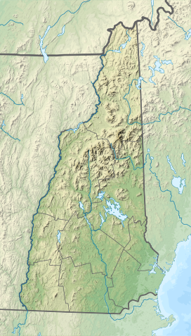  | |
| Country | United States |
| State | New Hampshire |
| District | Grafton County |
| Subdivision | Franconia |
| Parent range | Franconia Range |
| Topo map | USGS Franconia |
| Climbing | |
| Easiest route | Hike |
The Appalachian Trail, a 2,170-mile (3,490 km) National Scenic Trail from Georgia to Maine, traverses Franconia Ridge, including Lincoln.
See also
- Four-thousand footers
- White Mountains Region
- List of mountains in New Hampshire
References
- "Mount Lincoln, New Hampshire". Peakbagger.com. Retrieved 2013-01-29.
- "Mount Lincoln". Geographic Names Information System. United States Geological Survey. Retrieved 2013-01-29.
External links
- "Hiking Mount Lincoln". Appalachian Mountain Club.
- "Mt. Lincoln". HikeTheWhites.com:
This New Hampshire state location article is a stub. You can help Wikipedia by expanding it. |
Текст в блоке "Читать" взят с сайта "Википедия" и доступен по лицензии Creative Commons Attribution-ShareAlike; в отдельных случаях могут действовать дополнительные условия.
Другой контент может иметь иную лицензию. Перед использованием материалов сайта WikiSort.org внимательно изучите правила лицензирования конкретных элементов наполнения сайта.
Другой контент может иметь иную лицензию. Перед использованием материалов сайта WikiSort.org внимательно изучите правила лицензирования конкретных элементов наполнения сайта.
2019-2025
WikiSort.org - проект по пересортировке и дополнению контента Википедии
WikiSort.org - проект по пересортировке и дополнению контента Википедии