geo.wikisort.org - Mountains
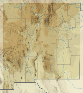
The Jicarilla Mountains are a mountain range in Lincoln County, New Mexico[1] in the southwestern United States. The Jicarilla Mountains were named after the Jicarilla Apache Nation. The Sacramento Mountains lie to the southwest.[2]
| Jicarilla Mountains | |
|---|---|
 Location in New Mexico | |
| Highest point | |
| Peak | Ancho Peak |
| Elevation | 2,385 m (7,825 ft) |
| Coordinates | 33°51′09″N 105°39′50″W |
| Geography | |
| Location | Lincoln County, New Mexico |
| Range coordinates | 33°52′N 105°40′W |
In 1850 the first gold seekers began to arrive to the Jicarilla Mountains, but it would take time before the first mines were established. Jicarilla and White Oaks are two towns that were abandoned when the mines were no longer profitable in the early 1900s.
The range was also called the Sacramento Mountains.[1]
References
- U.S. Geological Survey Geographic Names Information System: Jicarilla Mountains
- Carizozo, NM, 1:100,000 Scale Topographic Map, USGS, 1981
- Julyan, Robert (2006). The Mountains of New Mexico. Albuquerque: University of New Mexico Press. ISBN 978-0-8263-3515-9
На других языках
- [en] Jicarilla Mountains
[it] Monti Jicarilla
I monti Jicarilla sono una catena montuosa situata nella contea di Lincoln[1] nel Nuovo Messico, nel sud-ovest degli Stati Uniti. I monti Jicarilla prendono il nome dalla Nazione Jicarilla Apache. I monti Sacramento si trovano a sud-ovest.[2]Текст в блоке "Читать" взят с сайта "Википедия" и доступен по лицензии Creative Commons Attribution-ShareAlike; в отдельных случаях могут действовать дополнительные условия.
Другой контент может иметь иную лицензию. Перед использованием материалов сайта WikiSort.org внимательно изучите правила лицензирования конкретных элементов наполнения сайта.
Другой контент может иметь иную лицензию. Перед использованием материалов сайта WikiSort.org внимательно изучите правила лицензирования конкретных элементов наполнения сайта.
2019-2025
WikiSort.org - проект по пересортировке и дополнению контента Википедии
WikiSort.org - проект по пересортировке и дополнению контента Википедии