geo.wikisort.org - Mountains
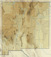
Eagle Peak is a mountain in Catron County, New Mexico, near the town of Reserve.[3] The summit is the highest point in the Tularosa Mountains.[4]
| Eagle Peak | |
|---|---|
 Eagle Peak Catron County, New Mexico, U.S. | |
| Highest point | |
| Elevation | 9,801 ft (2,987 m) NAVD 88[1] |
| Prominence | 2,266 ft (691 m)[2] |
| Coordinates | 33°40′37″N 108°34′37″W[1] |
| Geography | |
| Location | Catron County, New Mexico, U.S. |
| Parent range | Tularosa Mountains |
| Topo map | USGS Eagle Peak |
References
- "Eagle Peak ET". NGS Data Sheet. National Geodetic Survey, National Oceanic and Atmospheric Administration, United States Department of Commerce. Retrieved 2011-05-14.
- "Eagle Peak, New Mexico". Peakbagger.com. Retrieved 2011-05-14.
- Survey, U. S. Coast and Geodetic; Culley, Frank Lambuth (1940). Triangulation in New Mexico: 1927 Datum. U.S. Government Printing Office.
- Office, United States Bureau of Land Management New Mexico State (1986). New Mexico Statewide Wilderness Study: Appendices, wilderness analysis reports (Las Cruces District). U.S. Department of the Interior, Bureau of Land Management, New Mexico State Office.
External links
- "Tularosa Mountains". SummitPost.org. Retrieved 2011-05-14.
Текст в блоке "Читать" взят с сайта "Википедия" и доступен по лицензии Creative Commons Attribution-ShareAlike; в отдельных случаях могут действовать дополнительные условия.
Другой контент может иметь иную лицензию. Перед использованием материалов сайта WikiSort.org внимательно изучите правила лицензирования конкретных элементов наполнения сайта.
Другой контент может иметь иную лицензию. Перед использованием материалов сайта WikiSort.org внимательно изучите правила лицензирования конкретных элементов наполнения сайта.
2019-2025
WikiSort.org - проект по пересортировке и дополнению контента Википедии
WikiSort.org - проект по пересортировке и дополнению контента Википедии