geo.wikisort.org - Mountains
Canjilón Mountain is a 10,922 feet (3,329 m). mountain approximately six miles northeast of the village of Canjilón,[3] in the Carson National Forest.
| Canjilón Mountain | |
|---|---|
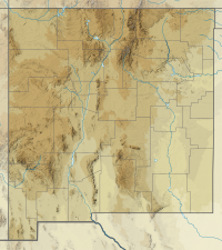
 Canjilón Mountain Location of Canjilón Mountain in New Mexico | |
| Highest point | |
| Elevation | 10,922 ft (3,329 m) NAVD 88[1] |
| Prominence | 1,034 ft (315 m)[2] |
| Coordinates | 36°34′05″N 106°21′06″W[1] |
| Geography | |
| Location | Rio Arriba County, New Mexico, U.S. |
| Parent range | Tusas Mountains |
| Topo map | USGS Canjilon Mountain |
The word cajilon is the term for "deer antler" in Northern New Mexican Spanish.[4] The mountain was so named because of its resemblance to an antler.[4] The mountain gave its name to the nearby creek (Canjilon Creek), to the nearby lakes (Canjilon lakes), and to the village of Canjilon.[4]
Canjilón Mountain was the site of a 3.7 magnitude earthquake on June 4, 2008.[5]
References
- "Jilon". NGS data sheet. U.S. National Geodetic Survey. Retrieved 2014-02-12.
- "Canjilon Mountain, New Mexico". Peakbagger.com. Retrieved 2014-02-12.
- "Canjilón Lakes". Digital Abiquiu. Archived from the original on February 1, 2012. Retrieved February 12, 2014.
- Julyan, Robert (1998). The place names of New Mexico. Albuquerque, NM: University of New Mexico Press. ISBN 978-0826316899.
- "Information on New Mexico Seismic Activity from the New Mexico Tech Seismological Observatory: Earthquake between Chama and Abiqui, NM". Department of Earth and Environmental Science, New Mexico Institute of Mining and Technology. Archived from the original on 27 September 2008.
Текст в блоке "Читать" взят с сайта "Википедия" и доступен по лицензии Creative Commons Attribution-ShareAlike; в отдельных случаях могут действовать дополнительные условия.
Другой контент может иметь иную лицензию. Перед использованием материалов сайта WikiSort.org внимательно изучите правила лицензирования конкретных элементов наполнения сайта.
Другой контент может иметь иную лицензию. Перед использованием материалов сайта WikiSort.org внимательно изучите правила лицензирования конкретных элементов наполнения сайта.
2019-2025
WikiSort.org - проект по пересортировке и дополнению контента Википедии
WikiSort.org - проект по пересортировке и дополнению контента Википедии