geo.wikisort.org - Mountains
The Hochgolling (2,862 m) is a mountain of the Eastern Alps, located on the border of Steiermark and Salzburg, Austria, near the ski resort of Schladming. It is the highest peak of the Lower Tauern range.
| Hochgolling | |
|---|---|
 Hochgolling from the west in 1994 | |
| Highest point | |
| Elevation | 2,862 m (9,390 ft)[1] |
| Prominence | 1,124 m (3,688 ft)[1][2] |
| Isolation | 24 km (15 mi) |
| Coordinates | 47°16′00″N 13°45′42″E |
| Geography | |
 Hochgolling Location in the Alps | |
| Location | Steiermark and Salzburg, Austria |
| Parent range | Lower Tauern |
| Climbing | |
| First ascent | August the 8th 1791, by an unknown alpinist of Tamsweg[3] |
A hiking rather than a climbing peak, the mountain is relatively low by alpine standards, but still towers over all of its neighbours. Its northern face is a 1,200 m high wall, while its other slopes are more gentle. A long ridge slopes south from the summit, dividing the Göriach Valley from the Lessach Valley.
Due to Hochgolling's topographic isolation the views from its summit are panoramic, stretching from the glaciated peaks of the vast High Tauern in the west to the lower Gurktal Alps to the east, and including the Julian Alps, Kamnik Alps and Karawanks to the south.[4]
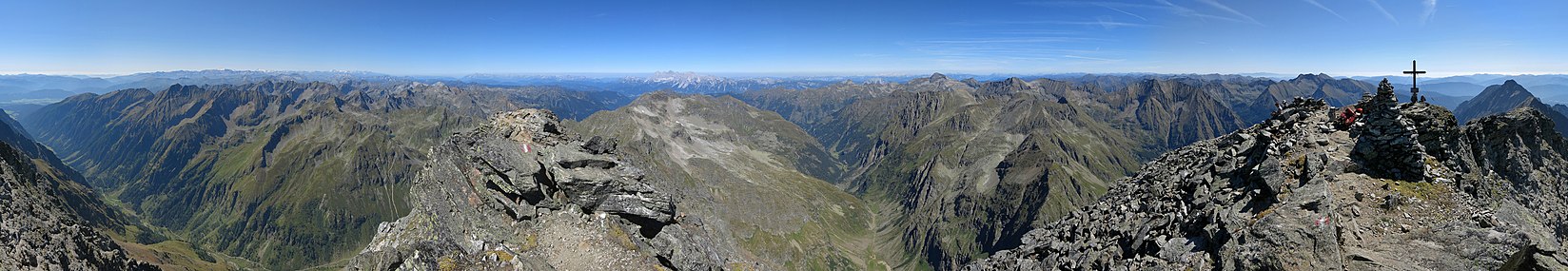 Panoramic view from the summit

References
- Hochgolling, Austria, on www.peakbagger.com (access: May 2012)
- Key col:Radstädter Tauern - 1,738 m
- Peter Holl: Alpenvereinsführer Niedere Tauern, Bergverlag Rudolf Rother, München 1983. ISBN 3-7633-1231-5
- "Hochgolling - summitpost". summitpost.org. Retrieved 19 February 2016.
External links
| Wikimedia Commons has media related to Hochgolling. |
- Hochgolling on www.summitpost.org
| Authority control |
|
|---|
This Styria location article is a stub. You can help Wikipedia by expanding it. |
На других языках
[de] Hochgolling
Der Hochgolling ist ein Berg des Alpenhauptkamms an der Grenze zwischen dem Salzburger Lungau und der Steiermark. Mit einer Höhe von 2862 m ü. A.[1] ist er der höchste Berg der Schladminger Tauern sowie der gesamten Niederen Tauern. Schaustück des allseits steil abfallenden und durch dunkles Gestein geprägten Berges ist seine rund 1000 Meter hohe Nordwand.- [en] Hochgolling
[fr] Hochgolling
Le Hochgolling est un sommet des Alpes, à 2 862 m d'altitude, point culminant des Niedere Tauern, et en particulier du chaînon du Schladminger Tauern, en Autriche (limite entre le land de Salzbourg et le land de Styrie).[it] Hochgolling
L'Hochgolling (2.862 m s.l.m.) è la montagna più alta delle Alpi dei Tauri orientali. Si trova in Austria sul confine tra il Salisburghese e la Stiria.[ru] Хохголлинг
Хохголлинг[2] (нем. Hochgolling) — самая высокая гора Низкого Тауэрна, Австрия. Высота вершины составляет 2862 м. Первое восхождение на вершину 8 августа 1791 года совершил неизвестный альпинист из местечка Тамсвег[3] .Другой контент может иметь иную лицензию. Перед использованием материалов сайта WikiSort.org внимательно изучите правила лицензирования конкретных элементов наполнения сайта.
WikiSort.org - проект по пересортировке и дополнению контента Википедии