geo.wikisort.org - Mountains
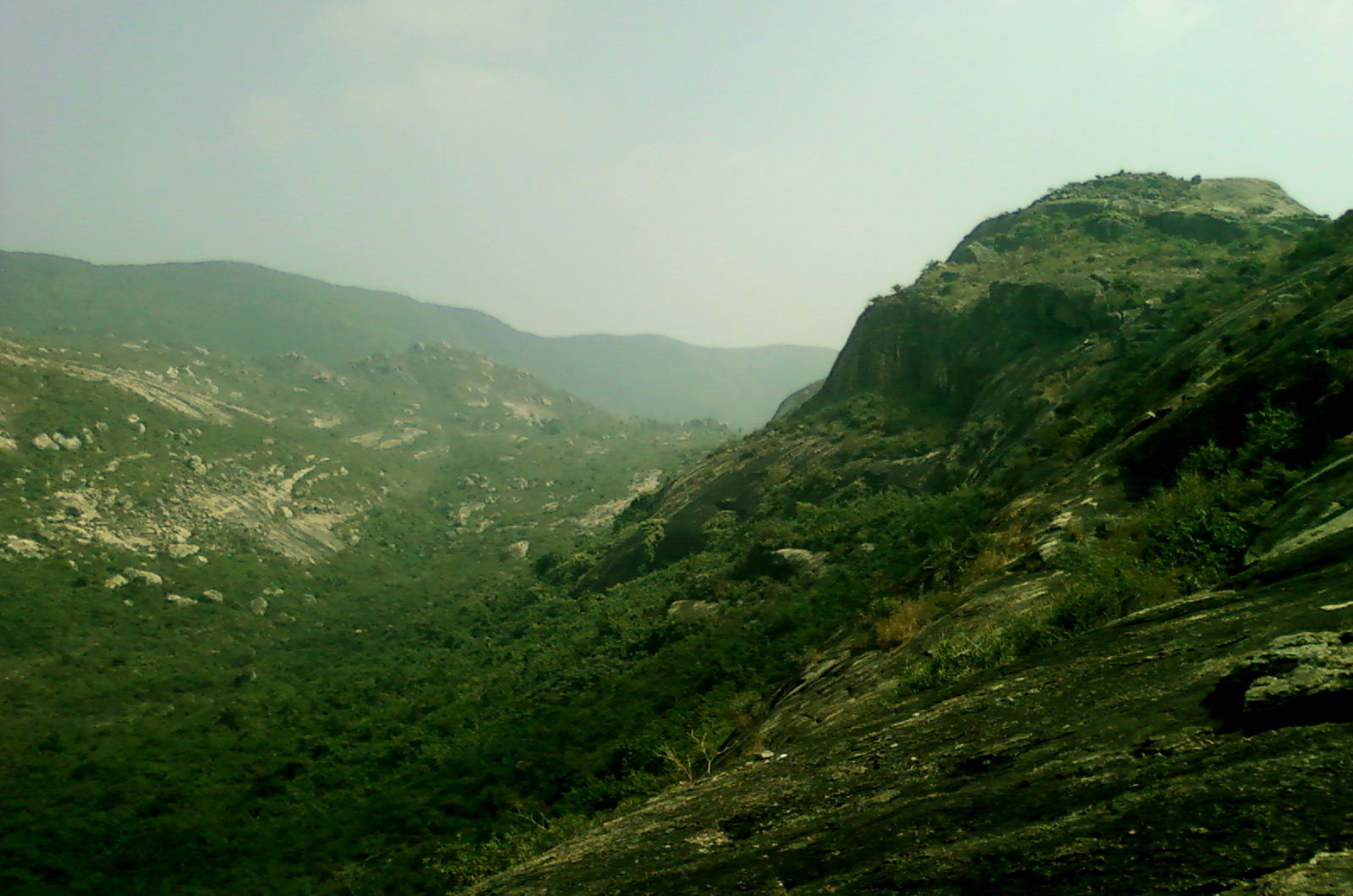
The Erramala (Telugu: ఎఱ్ఱమల) are a range of low hills in southern India,[1] in Kurnool district of Andhra Pradesh state. The Erramala hills lie on the Deccan plateau, running east–west and dividing the basin of the Penna River to the south from the basin of the Krishna River to the north. The hill range may be extended along the Penna River basin in Kadapa district.
| Erramala Hills | |
|---|---|
| The Erramalas | |
 The Erramalas during monsoon | |
| Highest point | |
| Coordinates | 15°12′48″N 77°57′12″E |
| Geography | |
 Erramala Hills | |
| Country | India |
| State | Andhra Pradesh |
| Geology | |
| Age of rock | Cambrian |
Some important visitor attractions along the Erramala Hills are as follows:
- Belum Caves
- Yadiki Caves
- Yaganti
- Gandikota
- Kalva Bugga
- Kolimigundla
- Tadipatri
- Orvakal Rocks
- Kethavaram Rock art site
- Banaganapalli
- Owk
To the east lies the higher Nallamalla Hills.
Gallery
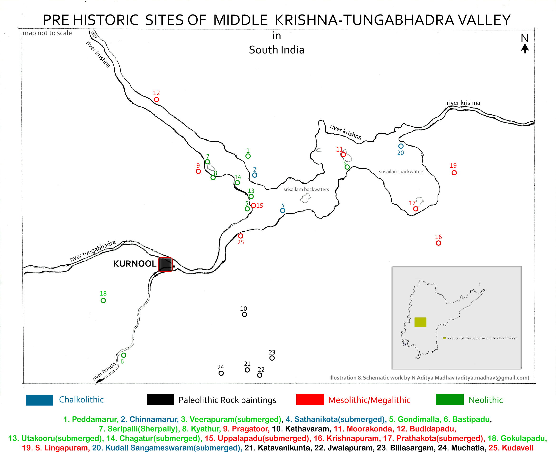
 Pre Historic Mid Krishna-Tungabhadra Valley sites are located along the Erramala and Nallamala ranges

References
- Erramala Range at the Encyclopædia Britannica
| Rivers |
|      |
|---|---|---|
| Regions |
| |
| Hills |
| |
| Peaks | ||
| Waterfalls |
| |
| Parks & Reserves |
| |
| States |
| |
На других языках
[de] Erramala
Die Erramala-Hügel (Telugu ఎఱ్ఱమల) sind eine niedrige Hügelkette[1] in Süd-Indien, im Distrikt Kurnool des Bundesstaates Andhra Pradesh. Sie gehören zu den Ostghats und erstrecken sich über das Dekkan-Plateau von Osten nach Westen. Dabei trennen sie das Einzugsgebiet des Pennar-Flusses im Süden von dem des Krishna im Norden. Die Hügelkette setzt sich auch entlang des Pennar weiter fort bis nach Kadapa. Die Hügel waren seit der Kolonialzeit ein beliebter Ort für die Sommerfrische der Beamten und auch von Missionaren wie Lesslie Newbigin.[2] In den letzten Jahrzehnten wurden im Gebiet von Jwalapuram bedeutende archäologische Funde gemacht.- [en] Erramala
Текст в блоке "Читать" взят с сайта "Википедия" и доступен по лицензии Creative Commons Attribution-ShareAlike; в отдельных случаях могут действовать дополнительные условия.
Другой контент может иметь иную лицензию. Перед использованием материалов сайта WikiSort.org внимательно изучите правила лицензирования конкретных элементов наполнения сайта.
Другой контент может иметь иную лицензию. Перед использованием материалов сайта WikiSort.org внимательно изучите правила лицензирования конкретных элементов наполнения сайта.
2019-2026
WikiSort.org - проект по пересортировке и дополнению контента Википедии
WikiSort.org - проект по пересортировке и дополнению контента Википедии