geo.wikisort.org - Mountains
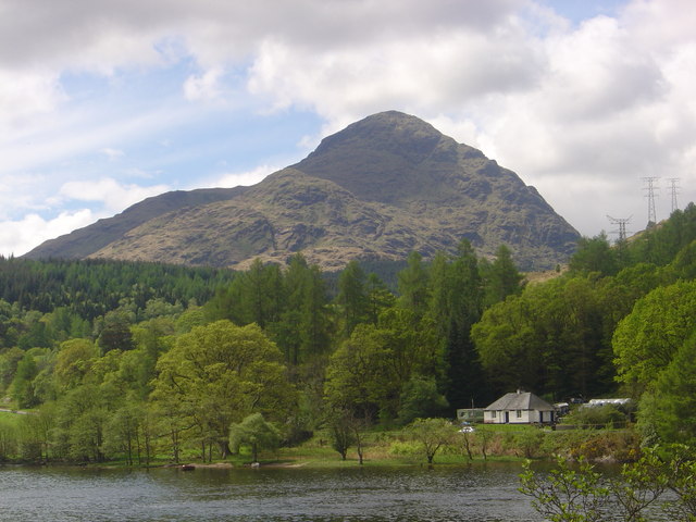
A' Chrois is a mountain located in the Arrochar Alps north west of Arrochar in Argyll, an extremely scenic area which is technically in the highlands although it is within easy reach of the heavily populated areas of Glasgow. A' Chrois stands north of Arrochar at the head of Loch Long and reaches a height of 848 meters (2,782 ft). The mountain forms a ridge starting with Ben Arthur The Cobbler in the south by Ardgartan through Beinn Narnain to A' Chrois in the north by Glen Loin, visible to Loch Lomond. A'Chrois also provides the eastern gateway to the Arrochar Alps and can be climbed via by Beinn Narnain or Succoth. It is classed as a Corbett Top of Beinn Narnain.
| A' Chrois | |
|---|---|
 | |
| Highest point | |
| Elevation | 848 m (2,782 ft) |
| Prominence | 106 m (348 ft) |
| Listing | |
| Coordinates | 56°13′53″N 4°45′40″W |
| Geography | |
 A' Chrois Argyll and Bute, Scotland  A' Chrois A' Chrois (Scotland) | |
| Location | Argyll and Bute, Scotland |
| Parent range | Arrochar Alps |
| OS grid | NN288077 |
References
This Argyll and Bute location article is a stub. You can help Wikipedia by expanding it. |
Другой контент может иметь иную лицензию. Перед использованием материалов сайта WikiSort.org внимательно изучите правила лицензирования конкретных элементов наполнения сайта.
WikiSort.org - проект по пересортировке и дополнению контента Википедии