geo.wikisort.org - Island
Watubela is an archipelago in the Maluku Islands, east of Ceram and north of Kai Islands, southeast of the Gorong archipelago, and southwest of the Bomberai Peninsula of Papua, Indonesia. It includes the islands of Watubela itself, Kesui (also called Kasiui) and Teor (also called Tio'or).[1] The islands now form two separate districts (kecamatan) within the East Seram Regency of Maluku. Kesui Watubela District (also called Wakate District) includes Watubela and Kesui Islands, with a number of smaller islands; Teor District consists of the island of the same name.
 Watubela archipelago in the east of Maluku Islands | |
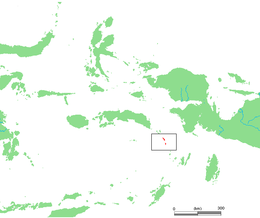 Watubela archipelago (red) in eastern Indonesia | |
| Geography | |
|---|---|
| Location | Southeast Asia |
| Archipelago | Maluku Islands |
| Major islands | Watubela, Kesui, Teor, Bam, Uta |
| Administration | |
Indonesia | |
| Province | Maluku |
| Additional information | |
| Time zone |
|
The English naturalist Alfred Russel Wallace described the islands, which he called the Matabello Islands, in chapter 25 of his 1869 book The Malay Archipelago.[2]
References
- servinghistory.com
- Wallace, Alfred Russel (1869). "25: Ceram, Goram, and the Matabello Islands". The Malay Archipelago: The land of the orang-utan, and the bird of paradise. A narrative of travel, with sketches of man and nature (1 ed.). Macmillan.
External links
This article about a location in Maluku Province is a stub. You can help Wikipedia by expanding it. |
На других языках
[de] Watubela-Inseln
Die indonesischen Watubela-Inseln (indon. Kepulauan Watubela, auch Matabello-Inseln,[1] lokal Wakate[2]) bestehen aus den Hauptinseln Watubela, Kasiui (Kesui, Kasui) und Teor (Tioor) und vier weiteren kleinen, unbewohnten Inseln. Sie gehören zu den Südlichen Molukken.- [en] Watubela archipelago
Другой контент может иметь иную лицензию. Перед использованием материалов сайта WikiSort.org внимательно изучите правила лицензирования конкретных элементов наполнения сайта.
WikiSort.org - проект по пересортировке и дополнению контента Википедии