geo.wikisort.org - Island
Saunders Island is a crescent-shaped island 8.8 km (5.5 mi) long, lying between Candlemas Island and Montagu Island in the South Sandwich Islands, a British Overseas Territory in the southern Atlantic Ocean. It is a volcanic island composed of an active stratovolcano, 990-metre (3,248 ft) Mount Michael.
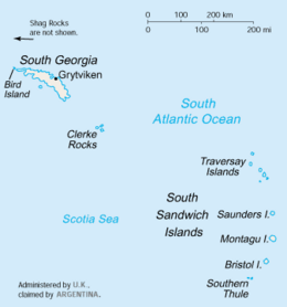 Saunders Island location | |
 Location of Saunders Island | |
| Geography | |
|---|---|
| Coordinates | 57°47′S 026°27′W |
| Archipelago | South Sandwich Islands |
| Length | 8.8 km (5.47 mi) |
| Highest elevation | 990 m (3250 ft) |
| Highest point | Mount Michael |
| Administration | |
United Kingdom | |
| Demographics | |
| Population | Uninhabited |
History
Saunders Island was discovered in 1775 by Captain James Cook, who named it for Sir Charles Saunders, First Lord of the Admiralty.[1] It was charted in greater detail by Bellingshausen in 1819,[2] and in 1930 by Discovery Investigations (DI) personnel aboard Discovery II. The island was surveyed in 1964 by HMS Protector.[3] Polar explorer Ernest Shackleton sometimes misspells the island's name as "Sanders Island" in his book South.
Features

The centre of the island is Mount Michael, a volcano known to have erupted explosively in 1819, and has erupted repeatedly since 2000, most recently in 2005. The 700 m (2,297 ft) diameter summit crater contains a persistent lava lake, one of only eight in the world.[4][5][6]
On the east coast of the island is Sombre Point, the island's northeast point. The name applied by United Kingdom Antarctic Place-Names Committee (UK-APC) in 1971 refers to the dark and dull aspect of the basaltic rock and ash in this vicinity.[7] Cordelia Bay is a small bight which along the entire east side of the island. It was charted in 1930 by DI personnel and named for Cordelia Carey, daughter of Discovery II captain Commander W.M. Carey.[8]
West of Sombre Point are the Yellowstone Crags, a group of crags which are eroded into striking pinnacles. The name applied by UK-APC in 1971 refers to the yellow colour of the tuff rocks and their craggy topography.[9] Ollivant Point and Carey Point have both been referred to as the island's westernmost point.[3][10] Both were named by UK-APC, for Martin Ollivant, Captain of HMS Protector at the time of her survey of the island, and Commander Carey, respectively.[3][10]
See also
- List of Antarctic and sub-Antarctic islands
References
- Beaglehole, J. C. (2015). The Journals of Captain James Cook on his Voyages of Discovery : Volume II: The Voyage of the Resolution and Adventure 1772-1775. London: Taylor and Francis. ISBN 9781351543255. OCLC 994714606.
- Amos, Jonathan (3 July 2019). "Remote British territory hosts persistent lava lake". Retrieved 5 July 2019.
- "Ollivant Point". Geographic Names Information System. United States Geological Survey. Retrieved 20 July 2021.
-
Robin George Andrews (12 July 2019). "A Burning Lava Lake Concealed by a Volcano's Glacial Ice". The New York Times. Retrieved 17 July 2019.
{{cite news}}: CS1 maint: url-status (link) - "Remote Mount Michael volcano hosts persistent lava lake". BBC News. BBC News. Retrieved 3 July 2019.
- Metcalfe, Tom; July 5, Live Science Contributor |; ET, 2019 08:16am. "Rare Lake of Bubbling Lava Discovered on Remote Antarctic Island". Live Science. Retrieved 5 July 2019.
{{cite web}}:|first2=has generic name (help) - "Sombre Point". Geographic Names Information System. United States Geological Survey. Retrieved 20 July 2021.
- "Cordelia Bay". Geographic Names Information System. United States Geological Survey. Retrieved 20 July 2021.
- "Yellowstone Crags". Geographic Names Information System. United States Geological Survey. Retrieved 20 July 2021.
- "Carey Point". Geographic Names Information System. United States Geological Survey. Retrieved 17 April 2013.
- "Saunders". Global Volcanism Program. Smithsonian Institution.
- LeMasurier, W. E.; Thomson, J. W., eds. (1990). Volcanoes of the Antarctic Plate and Southern Oceans. American Geophysical Union. p. 512 pp. ISBN 0-87590-172-7.
- Volcano World: Mount Michael
Capital: King Edward Point | |||||||
| General |
| ||||||
| Settlements / Whaling stations |
| ||||||
| South Georgia islands |
| ||||||
| South Sandwich Islands |
| ||||||
| Seamounts | |||||||
| Landmarks |
| ||||||
This South Georgia and the South Sandwich Islands location article is a stub. You can help Wikipedia by expanding it. |
На других языках
[de] Saunders Island (Südsandwichinseln)
Saunders Island ist die drittgrößte der im Südatlantik gelegenen Südlichen Sandwichinseln.- [en] Saunders Island, South Sandwich Islands
[fr] Île Saunders
L'île Saunders est une île inhabitée en forme de croissant de 8,8 km de long, située dans l'archipel des Îles Sandwich du Sud, entre l'île Candlemas et l'île Montagu, faisant partie du territoire britannique d'outre-mer regroupant la Géorgie du Sud-et-les îles Sandwich du Sud. C'est une île volcanique avec un cratère actif, le Mont Michael, qui en constitue le point culminant à 990 m d'altitude.[it] Isola di Saunders (Sandwich Australi)
L'isola di Saunders è un'isola situata nell'Oceano Atlantico meridionale; fa parte dell'arcipelago delle isole Sandwich Australi, politicamente parte del territorio della Georgia del Sud e Isole Sandwich Australi, uno dei Territori d'oltremare britannici.[ru] Сондерс (Южные Сандвичевы острова)
Сондерс (англ. Saunders Island) — вулканический остров в архипелаге Южные Сандвичевы острова. Был открыт в 1775 году Джеймс Куком. Примечателен тем, что в кратере вулкана находится стабильное лавовое озеро диаметром 700 метров — всего в мире существует 8 таких озёр. Входит в Южную Георгию и Южные Сандвичевы Острова (Великобритания), оспаривается Аргентиной.Другой контент может иметь иную лицензию. Перед использованием материалов сайта WikiSort.org внимательно изучите правила лицензирования конкретных элементов наполнения сайта.
WikiSort.org - проект по пересортировке и дополнению контента Википедии