geo.wikisort.org - Island
Preobrazheniya Island (Russian: Остров Преображения), meaning 'Transfiguration Island',[1] is an island in the Laptev Sea, Russia.
Russian: Остров Преображения | |
|---|---|
 View of the island. | |
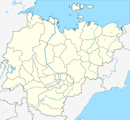 Preobrazheniya Sakha Republic (Yakutia) | |
| Geography | |
| Location | Laptev Sea |
| Coordinates | 74°40′N 112°56′E |
| Area | 12 km2 (4.6 sq mi) |
| Length | 7 km (4.3 mi) |
| Width | 2.5 km (1.55 mi) |
| Highest elevation | 77 m (253 ft) |
| Administration | |
Russia | |
Geography
The island is elongated and small. It is situated off the Northern mouth of the Khatanga Gulf (Russian: Хатангский залив), 15 km north of Bolshoy Begichev Island.
Preobrazheniya Island is 7 km in length and its maximum width is 2,5 km. This island is granitic and has high rocky cliffs on its eastern side. The west side of the island is sloping to a gravel beach.
History
This island was useful as a landmark for ships plying the Northern Sea Route in the past. It is also known as "Ostrov Vstrechnyy". There is an abandoned Polar research station on Preobrazheniya.
Administration
For administrative purposes Preobrazheniya Island belongs to the Sakha (Yakutia) Republic of the Russian Federation.
References
- The Arctic Ocean Hydrographic Expedition 1910–1915
- On Preobrazheniya Station
- William Barr (Arctic historian), The Drift of Lenin's Convoy in the Laptev Sea, 1937–1938. (full text)
- William Barr, The First Soviet Convoy to the Mouth of the Lena.
- Picture of the island from a recent visit by a British yachtsman: http://www.sailnews.com/148.0.html?&tx_ttnews[cat]=56&tx_ttnews[tt_news]=4484&tx_ttnews[backPid]=147&cHash=a3f483c055
|
This Sakha Republic location article is a stub. You can help Wikipedia by expanding it. |
На других языках
[de] Preobraschenije-Insel
Die Preobraschenije-Insel (russisch остров Преображения, „Insel der Verklärung“) ist eine russische Insel im Chatangagolf der Laptewsee. Politisch gehört sie zum Anabarski ulus der Republik Sacha.- [en] Preobrazheniya Island
[it] Preobraženija
Preobraženija (russo: Остров Преображенья) è un'isola russa situata nel mar Glaciale Artico. È stata scoperta nel 1736 da Vasilij Prončiščev durante le esplorazioni della Seconda spedizione in Kamčatka.[ru] Остров Преображения
Остров Преображения — небольшой остров в Хатангском заливе моря Лаптевых, в 15 км севернее острова Большой Бегичев. Административно относится к Республике Саха (Якутия).Другой контент может иметь иную лицензию. Перед использованием материалов сайта WikiSort.org внимательно изучите правила лицензирования конкретных элементов наполнения сайта.
WikiSort.org - проект по пересортировке и дополнению контента Википедии