geo.wikisort.org - Island
Polillo (Tagalog pronunciation: [poˈliʎo̞]) is an island in the northeastern region of the Philippine archipelago. It is the largest island and the namesake of the Polillo Islands. It is separated from Luzon Island by the Polillo Strait and forms the northern side of Lamon Bay.
 Aerial view of Polillo Island | |
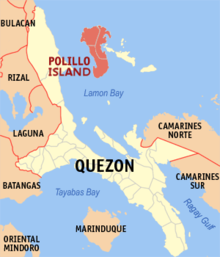
 Polillo Island Location within the Philippines  Polillo Island Polillo Island (Philippines) | |
| Geography | |
|---|---|
| Location | Lamon Bay |
| Coordinates | 14°50′34″N 121°55′45″E |
| Archipelago | Polillo Islands |
| Adjacent bodies of water |
|
| Area | 628.9 km2 (242.8 sq mi)[1] |
| Highest elevation | 1,063 ft (324 m) |
| Highest point | Mount Malolo |
| Administration | |
Philippines | |
| Region | Calabarzon |
| Province | Quezon |
| Municipalities |
|
| Largest municipality | Polillo (pop. 28,125) |
| Demographics | |
| Population | 64,802 (2010)[2] |
| Pop. density | 103.0/km2 (266.8/sq mi) |
The island itself is subdivided across three municipalities. The municipality of Polillo covers the southern portion of the island, while the northeastern part is administered by the municipality of Burdeos. The northwest is within the jurisdiction of the municipality of Panukulan. The island is also home to the Butaan lizard, a vulnerable relative of the Komodo dragon.[3]
As of the 2010 Philippine Census, the island is home to 64,802 individuals.[2]
In the mid-16th century, Spaniards came to the island and there they built a chapel. They took charge of the management of the island and many changes and development they brought there upon their times.[citation needed]
See also
| Wikivoyage has a travel guide for Polillo Island. |
- Burdeos, Quezon
- Panukulan, Quezon
- Polillo, Quezon
References
- "Islands by Land Area". Island Directory Tables. United Nations Environment Programme. Retrieved 4 March 2013.
- "Total Population by Province, City, Municipality and Barangay: as of May 1, 2010" (PDF). 2010 Census of Population and Housing. National Statistics Office. Archived from the original (PDF) on 29 October 2013. Retrieved 27 November 2013.
- Sy, E.; Afuang, L.; Duya, M.R. & Diesmos, M. (2009). "Varanus olivaceus". IUCN Red List of Threatened Species. 2009: e.T22888A9396856. doi:10.2305/IUCN.UK.2009-2.RLTS.T22888A9396856.en. Retrieved 23 December 2017.
External links
 Geographic data related to Polillo Island at OpenStreetMap
- Philippine Standard Geographic Code
- Philippine Census Information
- Wildlife and Conservation in the Polillo Islands
The 40 largest islands of the Philippines | ||
|---|---|---|
| ||
| ||
This article about a location in Calabarzon region is a stub. You can help Wikipedia by expanding it. |
На других языках
[de] Polillo Island
Polillo Island[1] ist die größte Insel im philippinischen Polillo-Archipel. Sie liegt im Norden der Bucht von Lamon in der Philippinensee, wenige Kilometer vor der Südostküste der Insel Luzon.- [en] Polillo Island
[fr] Polillo
Polillo est une île des Philippines de la province de Quezon. Il y avait 64 802 habitants au recensement de 2010 pour une superficie de 629 km2. Elle est située en mer des Philippines, entre Luçon et les iles de Patnanungan et Jomalig. Elle est subdivisée en trois municipalités.[ru] Полилло (остров)
Полилло (англ. Polillo Island) — остров на северо-востоке Филиппин в составе архипелага Лусон в бухте Ламон[en] (Филиппинское море). Административно относится к провинции Кесон. 19-й по площади остров страны и 438-й по этому показателю в мире.Другой контент может иметь иную лицензию. Перед использованием материалов сайта WikiSort.org внимательно изучите правила лицензирования конкретных элементов наполнения сайта.
WikiSort.org - проект по пересортировке и дополнению контента Википедии