geo.wikisort.org - Coast
The South East Cape is a cape located at the southernmost point of the main island of Tasmania, the southernmost state of Australia.[1] The cape is situated in the southern and south-eastern corner of the Southwest National Park, part of the Tasmanian Wilderness World Heritage Area, approximately 94 kilometres (58 mi) southwest of Hobart in Tasmania and about 65 kilometres (40 mi) east and a little south of the South West Cape.
South East Cape | |
|---|---|
Cape | |
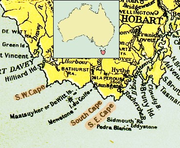 1916 map of the south coast of Tasmania, showing South East Cape | |
 South East Cape Location of South East Cape in Tasmania | |
| Coordinates: 43°38′37″S 146°49′39″E | |
| Location | South Coast |
UNESCO World Heritage Site | |
| Official name | Tasmanian Wilderness |
| Location | Oceania |
| Criteria | iii, iv, vi, vii, viii, ix, x |
| Reference | 181 |
| Inscription | 1982 (6th Session) |
Location and features
South East Cape is the southernmost point of the mainland of Tasmania but not of the state of Tasmania. The Maatsuyker Islands and the Pedra Branca island group, just offshore, are also part of the state of Tasmania and lie further south than South East Cape. The state of Tasmania also includes Macquarie Island, which is about 1,600 km SE of South East Cape.
South East Cape is one of the five southernmost capes that can be rounded by Southern Ocean sailors.
The cape is also a reference point for sectors of the southern coastline of Tasmania.[2] Much sea traffic passes near it, and many ships and boats have been wrecked or grounded there.[3]
See also
- South West Cape
- South Coast Track
- Extreme points of Australia
References
- "SOUTH-EAST CAPE — TASMANIA'S END". The Mercury. Hobart, Tasmania. 18 May 1945. p. 7. Retrieved 29 June 2015 – via National Library of Australia.
- Nash, Michael; Tasmania. Dept. of Lands, Parks and Wildlife (1988), A maritime archaeological survey of South East Tasmania: Cape Raoul to South East Cape, Department of Lands, Parks and Wildlife, ISBN 978-0-7246-2113-2
- Tasmania. Navigation and Survey Authority (1995), Foundering of FV "Tasmanian Enterprise", South East Cape, on 13 April 1995, Navigation and Survey Authority of Tasmania, retrieved 29 June 2015
External links
- Continental Extremities of Australia
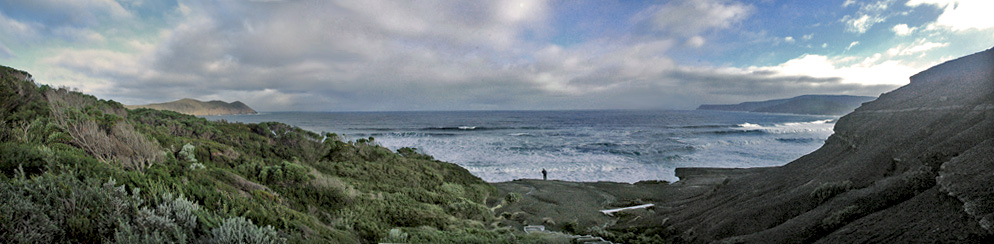
- Picture of South East Cape
- Map of the area with South East Cape on the right edge, South Cape, South West Cape, the Maatsuyker Islands with De Witt Island, The Sisters and Maatsuyker Island
- Another map of the area between South East Cape and South West Cape and the Maatsuyker Islands
Southern region of Tasmania, Australia | |||||
|---|---|---|---|---|---|
| City Other settlements |
| ||||
| Governance |
| ||||
| Mountains | |||||
| Protected areas, parks and reserves |
| ||||
| Rivers | |||||
| Harbours, bays, inlets and estuaries |
| ||||
| Coastal features |
| ||||
| Transport |
| ||||
| Landmarks |
| ||||
| Islands | |||||
| Books and newspapers |
| ||||
| Flora, fauna, and fishlife |
| ||||
| Bioregions | |||||
| Indigenous heritage |
| ||||
| Other |
| ||||
| |||||
На других языках
- [en] South East Cape
[ru] Саут-Ист-Кейп
Саут-Ист-Кейп (англ. South East Cape - юго-восточный мыс) — мыс, самая южная точка острова Тасмания.Другой контент может иметь иную лицензию. Перед использованием материалов сайта WikiSort.org внимательно изучите правила лицензирования конкретных элементов наполнения сайта.
WikiSort.org - проект по пересортировке и дополнению контента Википедии