geo.wikisort.org - Coast
Howth Head (/ˈhoʊθ/ HOHTH; Ceann Bhinn Éadair in Irish) is a peninsula northeast of the city of Dublin in Ireland, within the governance of Fingal County Council. Entry to the headland is at Sutton while the village of Howth and the harbour are on the north-eastern face. Most of Howth Head is occupied by the Hill of Howth, though there are other regions, such as the tombolo at Sutton, extensive beaches on the northern shores, and small ones in other parts. The Baily Lighthouse is on the southeastern part of Howth Head. Nearby are the districts of Baldoyle and Portmarnock, and adjacent is the nature reserve of North Bull Island.
This article includes a list of general references, but it lacks sufficient corresponding inline citations. (October 2019) |
Ceann Bhinn Éadair | |
|---|---|
 Aerial view of Howth Head looking south. | |
 Howth Head 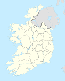 Howth Head | |
| Geography | |
| Location | Ireland |
| Adjacent to | |
| Area | 11 km2 (4.2 sq mi) |
| Highest elevation | 171 m (561 ft) |
| Highest point | Ben of Howth |
| Administration | |
| County | Dublin |
| Demographics | |
| Population | 8,294 (2016) |
| Pop. density | 754/km2 (1953/sq mi) |

History
The earliest mention of the peninsula may be on a map attributed to Claudius Ptolemy, where it was called Edri Deserta or in Greek Εδρου ἐρῆμος (Edrou Heremos, Edar's isolated place). Here it was portrayed as an island, but it is not clear if this was due to actual separation from the headland or inaccurate information available to the cartographer. Other writers think that Edrou was actually Lambay Island, from Greek ἑδρα (hedra) "sitting place [for ships]".[1]
The peninsula has been occupied since at least the 3rd millennium BC, with two middens found, and a dolmen dating back to around 2200 BC. It features in several Irish legends. A fishing settlement developed at Howth, and the area developed under the Norman St. Lawrence family, who owned most of Howth Head from the late 1100s until 2019. In the 19th century, an electric tramline made the whole hill more accessible.
Location and topography
Originally an island,[2] Howth Head is connected to the mainland via a narrow strip of land, or tombolo, and forms the northerly bound of the great crescent of Dublin Bay, roughly corresponding to Dalkey Hill and Killiney Hill in the south.
Most of the headland is hilly, with peaks such as the 171 m Black Linn, by the Ben of Howth, on a side road beyond the Green Hill Quarries at the Loughereen Hills, Shielmartin Hill (163 m) overlooking Carrickbrack Road and Carrickbrack and Dun Hill. There are also craggy areas such as Muck Rock (Carrickmore), and Kilrock.
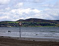
Howth has an extensive and varied coastline, and there are steep sea cliffs around parts, especially on the north coast. Key points on the coast, clockwise from Sutton, include Cush Point, Claremont Strand, the small headland at Howth village, Balscadden Bay, Kilrock, the Great and Little Baily, Lion's Head, Doldrum Bay, the Needles, Drumleck Point, Red Rock and Sutton Strand.
Due to the shape of the landform, and its rocky nature, with thin soil covering, Howth features multiple streams and several fast-running streams, due to hard rock under a thin soil layer. These include the Bloody StreamCoulcour Brook, the Boggeen Stream, the Offington Stream, the Whitewater Brook, the Balsaggart Stream, and the Carrickbrack and Santa Sabina Streams.[3]
Fauna and flora
The cliffs support a large colony of seabirds, notably razorbills, common guillemots, fulmars, kittiwakes and cormorants. The scrubland above supports several heathland species including skylarks, meadow pipits, common whitethroats, linnets, stonechats and whinchats. The most commonly seen birds of prey are kestrels, peregrine falcons and common buzzards.[citation needed]
Gorse grows in many places on the headland. Fires are frequent during dry summers. Thirty-one non-native plants were recorded in 2018 from Howth Head.[4]
Transport
There are two railway stations on or near the head. Sutton station is on the northern edge of the tombolo between Sutton and Baldoyle, and Howth station is on the head in the village of Howth. Both are served by Dublin Area Rapid Transit trains and have regular services to and from Dublin city centre. Historically the Hill of Howth Tramway ran between the stations around the head between 1901 and 1959. Additionally Dublin Bus routes serve the headland. A full road network accesses most parts, although some are only reachable by some of the many footpaths.
Gallery
 Howth Head viewed from on the North Bull Island in Dublin Bay
 Cliffs at Howth Head with Baily Lighthouse in the distance
 Baily Lighthouse at the southeast end of Howth Head
 Optic from Baily lighthouse, installed in 1902 and removed in 1972 when the lighthouse was modernised
 Walk on Howth Head


Leisure
Howth is a popular destination for day-trippers from the capital, accessible by car, bus and one of the northern termini of the Dublin Area Rapid Transit train system (DART). Hikers can choose from a wide range of routes, including the Cliff Walk, the Cliff Path Closed Loop, or making for the ancient cairn on one of Howth's several summits. On clear days, the Wicklow Mountains can be seen, with Dublin city below. Slieve Donard, an 852-metre peak in Northern Ireland may also be visible - a distance of 90 km (56 mi). Quite frequently, Snowdon (1,085 m) in Snowdonia National Park in Wales can also be seen - a distance of 138 km (86 mi).
Popular culture
Howth Head is the location where Leopold Bloom proposes to Molly in James Joyce's Ulysses. In the short story 'Eveline', another work by James Joyce from the collection Dubliners, it is mentioned that Eveline and her family once had a picnic on the Hill of Howth. Howth Head is also central to Joyce's final work, Finnegans Wake, in which one of the principal characters, HCE, is, among other things, representative of the mountain.[citation needed]
Howth Head is mentioned in the lyrics of the title track of Kate Bush's 1989 album, The Sensual World: '...took six big wheels and rolled our bodies / off of Howth Head and into the flesh, mmh, yes...'. The song is inspired by Molly Bloom's soliloquy in Joyce's Ulysses.[citation needed]
The peninsula also features in the backdrop of multiple paintings by Irish artist William Orpen (1878-1931) and by American artist James Whistler.[5]

Howth Head is the setting of two scenes from the Tony Award-winning musical "Once."[citation needed]
References
- "Ireland" (PDF). romaneranames.uk. Archived from the original (PDF) on 2 April 2019.
- "Dublin Uncovered: Howth".
- Dublin: 2013, Doyle, J.W., "Ten Dozen Waters: The Rivers of County Dublin" - 8th edition
- Dhuill, Emer Ni and Smyth, N. 2021 Invasive non-native and alien garden escape species on the southern cliffs of Howth Head, Co. Dublin (H21) Irish Naturalists' Journal 37(2)
- "James McNeill Whistler (1834-1903) Howth Head, near Dublin". christies.com. Retrieved 4 June 2020.
External links
- Howth Coast Guard Cliff and Coast Rescue Unit
- Howth Lifeboat Station
- Howth Head - pictures on the Travvi
Peninsulas of Ireland | ||
|---|---|---|
Geography of Ireland / Coastal landforms of Ireland | ||
| Leinster |  | |
| Ulster | ||
| Connacht | ||
| Munster | ||
На других языках
[de] Howth Head
Howth Head (irisch Ceann Bhinn Éadair) ist eine Halbinsel im Norden von Dublin in der Republik Irland, nahe den Städten Sutton und Portmarnock. Größter Ort der Halbinsel ist Howth.- [en] Howth Head
Другой контент может иметь иную лицензию. Перед использованием материалов сайта WikiSort.org внимательно изучите правила лицензирования конкретных элементов наполнения сайта.
WikiSort.org - проект по пересортировке и дополнению контента Википедии