geo.wikisort.org - Coast
The Caird Coast is the portion of the coast of Coats Land lying between the terminus of Stancomb-Wills Glacier, in 20º00´W, and the vicinity of the Hayes Glacier, in 27º54´W. Shackleton named it for Sir James Key Caird, patron of the expedition.[1]
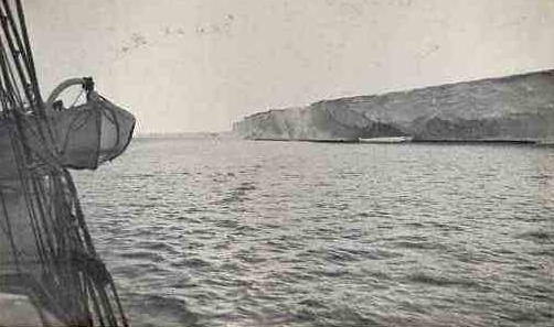
In December 1914 and January 1915, as part of the ill-fated British Imperial Trans-Antarctic Expedition, Ernest Shackleton continued the exploration southward, joining Bruce's discovery to land which Wilhelm Filchner had discovered from the Deutschland in 1912.
References
Antarctica | ||||||||
|---|---|---|---|---|---|---|---|---|
| Geography |
|  | ||||||
| History |
| |||||||
| Politics |
| |||||||
| Society |
| |||||||
| Famous explorers |
| |||||||
| ||||||||
Imperial Trans-Antarctic Expedition | |||||
|---|---|---|---|---|---|
| Events |
| ||||
| Locations |
| ||||
| Personnel |
| ||||
| |||||
This Coats Land location article is a stub. You can help Wikipedia by expanding it. |
На других языках
- [en] Caird Coast
[it] Costa di Caird
La costa di Caird (centrata alle coordinate .mw-parser-output .geo-default,.mw-parser-output .geo-dms,.mw-parser-output .geo-dec{display:inline}.mw-parser-output .geo-nondefault,.mw-parser-output .geo-multi-punct{display:none}.mw-parser-output .latitude,.mw-parser-output .longitude{white-space:nowrap}.mw-parser-output .geo{}body.skin-vector .mw-parser-output #coordinates{font-size:85%;line-height:1.5em;position:absolute;right:0;top:0;white-space:nowrap}76°00′S 24°00′W) è una parte della costa della Terra di Coats, in Antartide. In particolare, la costa di Caird si estende tra il fronte del ghiacciaio Stancomb-Wills (75°18′S 19°00′W), a est, e il ghiacciaio Hayes (76°16′S 27°54′W), a ovest, e confina quindi a est con la costa della Principessa Marta (e quindi con la Terra della Regina Maud) e a ovest con la costa di Luitpold, conosciuta anche come costa di Confín.Текст в блоке "Читать" взят с сайта "Википедия" и доступен по лицензии Creative Commons Attribution-ShareAlike; в отдельных случаях могут действовать дополнительные условия.
Другой контент может иметь иную лицензию. Перед использованием материалов сайта WikiSort.org внимательно изучите правила лицензирования конкретных элементов наполнения сайта.
Другой контент может иметь иную лицензию. Перед использованием материалов сайта WikiSort.org внимательно изучите правила лицензирования конкретных элементов наполнения сайта.
2019-2026
WikiSort.org - проект по пересортировке и дополнению контента Википедии
WikiSort.org - проект по пересортировке и дополнению контента Википедии