geo.wikisort.org - Sea
Table Bay (Afrikaans: Tafelbaai) is a natural bay on the Atlantic Ocean overlooked by Cape Town (founded 1652 by Van Riebeeck) and is at the northern end of the Cape Peninsula, which stretches south to the Cape of Good Hope. It was named because it is dominated by the flat-topped Table Mountain.

This article needs additional citations for verification. (January 2017) |
| Table Bay | |
|---|---|
 An aerial view of Table Bay from Bloubergstrand, to the north of Cape Town. Table Mountain is visible in the distance on the far side of the bay. | |
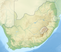 Table Bay Location in South Africa | |
| Coordinates | 33°53′S 18°27′E |
| Native name | Tafelbaai (Afrikaans) |
| Ocean/sea sources | Southern Atlantic Ocean |
| Basin countries | South Africa |
| Islands | Robben Island |
| Settlements | Cape Town |
History
Bartolomeu Dias was the first European to explore this region in 1486. The bay, although famous for centuries as a haven for ships, is actually a rather poor natural harbour and is exposed to storm waves from the northwest. Many sailing ships seeking refuge in the bay during the 17th and 18th centuries were driven ashore by winter storms.
The Dutch colonists nevertheless persisted with their efforts on the shores of Table Bay, because good natural harbours along this coastline are almost non-existent. The best of them, Saldanha Bay, lacked fresh water. Simon's Bay was well protected from westerly winter storms and swells, but more exposed to summer southeasterliy storms and difficult to access overland from Cape Town. Hout Bay was small and exposed to the prevailing southwesterly swell. Eventually a harbour was built in Table Bay by a process of land reclamation and was protected from storm waves by breakwaters. The older part of this development is called the Victoria Dock; the newer part, the Duncan Dock. Robben Island, where Nelson Mandela was imprisoned for decades, is in this bay.
The bay's beaches were oiled following an accident involving the Dutch tanker Sliedrecht in November 1953. The vessel moved 96 kilometres (60 mi) offshore to pump out 1,000 tonnes of oil that had been fouled with seawater after the initial impact.[1]
Image gallery
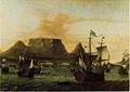 Dutch ships off Table Bay in the 17th century
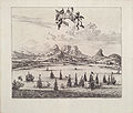 Looking over sailing ships in Table Bay in 1727 with Table Mountain in the background
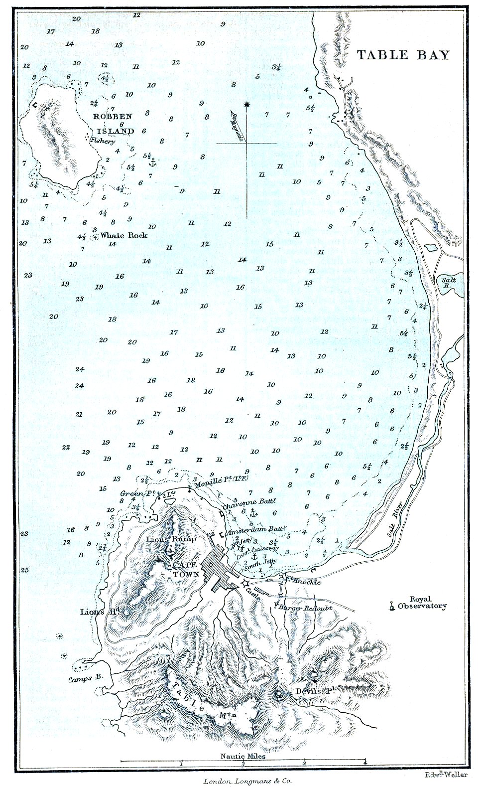
 Map of Table Bay (1882)
 Map of the Docks and Infrastructure (1884)
 Cape Town from space, looking south over False Bay with Hangklip Point (top left), Cape Point (top right) and Table Bay south and east of the clearly visible, circular Robben Island, February 1995.
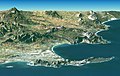 Synthetic perspective with 2× exaggerated elevation, from satellite elevation and image data. Looking east over Cape Peninsula and False Bay (behind) with Robben Island (front left), Table Mountain (centre front) and Cape Point (front right).
 Sketch of Cape Town from the East India Company Ship Defense, en route from the Downs to Bombay, anchored in Table Bay on January 24, 1739.


See also
- False Bay
- Eduard Bohlen
References
- "Ship Oil Kills Fish, Penguins". Newcastle Sun (NSW : 1918 - 1954). 1953-11-03. p. 8. Retrieved 2020-04-22.
Cape Town | |||||||||||||||||||||||||||||||
|---|---|---|---|---|---|---|---|---|---|---|---|---|---|---|---|---|---|---|---|---|---|---|---|---|---|---|---|---|---|---|---|
| |||||||||||||||||||||||||||||||
| |||||||||||||||||||||||||||||||
| |||||||||||||||||||||||||||||||
| |||||||||||||||||||||||||||||||
| |||||||||||||||||||||||||||||||
| |||||||||||||||||||||||||||||||
| |||||||||||||||||||||||||||||||
| |||||||||||||||||||||||||||||||
| |||||||||||||||||||||||||||||||
| |||||||||||||||||||||||||||||||
| |||||||||||||||||||||||||||||||
African seas | |
|---|---|
| Oceans and seas |
|
| Gulfs and bays |
|
| Straits |
|
| Historical seas |
|
| Authority control |
|
|---|
На других языках
- [en] Table Bay
[ru] Столовая (бухта)
Столо́вая[1][2] (африк. Tafelbaai, Тафелбай[3]; англ. Table Bay) — бухта Атлантического океана, у юго-западных берегов Африки. Длина 15 км, ширина у входа 7,4 км, глубина 11—40 м. Скорость течений до 6 км/ч. Приливы полусуточные, величина их 1,7 м[4]. Впадает р. Солт[4]. На западном берегу — порт Кейптаун. Бухта получила своё название из-за горы Столовая, расположенной на её южном берегу.Другой контент может иметь иную лицензию. Перед использованием материалов сайта WikiSort.org внимательно изучите правила лицензирования конкретных элементов наполнения сайта.
WikiSort.org - проект по пересортировке и дополнению контента Википедии