geo.wikisort.org - Sea
Dungonab Bay[3] or Dongonab Bay[4] (Arabic: خليج دونجوناب Ḫalīj Dūnjūnāb) is a body of water on the coastline of Sudan on the Red Sea.
| Dungonab Bay | |
|---|---|
| Dungunāb Bay | |
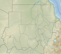 Dungonab Bay Location in Sudan | |
| Coordinates | 21°0′N 37°11′E |
| Native name |
|
| Ocean/sea sources | Red Sea |
| Basin countries | Sudan |
| Max. length | 33 km (21 mi) |
| Max. width | 12 km (7.5 mi) |
| Islands | Numerous[1] |
UNESCO World Heritage Site | |
| Part of | "Dungonab Bay – Mukkawar Island Marine National Park" part of Sanganeb Marine National Park and Dungonab Bay – Mukkawar Island Marine National Park |
| Criteria | Natural: (vii), (ix), (x) |
| Reference | 262rev-002 |
| Inscription | 2016 (40th Session) |
Ramsar Wetland | |
| Official name | Dongonab Bay-Marsa Waiai |
| Designated | 2 February 2009 |
| Reference no. | 1859[2] |
Geography
The Dungonab Bay is south-facing and is located 130 km to the north of Port Sudan. Its mid part, the Rawayah Lagoon, is surrounded by coral reefs. Together with Mukkawar Island and Sanganeb (an isolated coral reef), the area was declared the Dungonab Bay – Mukkawar Island Marine National Park and became a World Heritage Site in 2016.[5] It has been designated as a protected Ramsar site since 2009.[2]
See also
- African Parks Network
- List of World Heritage Sites in Africa
- List of World Heritage Sites in the Arab States
References
- GoogleEarth
- "Dongonab Bay-Marsa Waiai". Ramsar Sites Information Service. Retrieved 25 April 2018.
- "Dungunāb". Mapcarta. Retrieved 14 October 2016.
- Dongonab Bay, Sudan - Geographical Names
- UNESCO - Sanganeb Marine National Park and Dungonab Bay – Mukkawar Island Marine National Park
External links
- Sanganeb Marine National Park and Dungonab Bay - Mukkawar Island Marine National Park UNESCO collection on Google Arts and Culture
African seas | |
|---|---|
| Oceans and seas |
|
| Gulfs and bays |
|
| Straits |
|
| Historical seas |
|
This Sudan location article is a stub. You can help Wikipedia by expanding it. |
Текст в блоке "Читать" взят с сайта "Википедия" и доступен по лицензии Creative Commons Attribution-ShareAlike; в отдельных случаях могут действовать дополнительные условия.
Другой контент может иметь иную лицензию. Перед использованием материалов сайта WikiSort.org внимательно изучите правила лицензирования конкретных элементов наполнения сайта.
Другой контент может иметь иную лицензию. Перед использованием материалов сайта WikiSort.org внимательно изучите правила лицензирования конкретных элементов наполнения сайта.
2019-2026
WikiSort.org - проект по пересортировке и дополнению контента Википедии
WikiSort.org - проект по пересортировке и дополнению контента Википедии