geo.wikisort.org - Sea
St. Marys Bay (Miꞌkmaq: Wagweiik[1]) south western Nova Scotia, Canada, is surrounded by the modern municipal districts of Clare Municipal District and Digby.
Saint Mary's Bay (Wagweiik) is situated within the Federal Fishing District 34, the most lucrative lobster fishing zone in Canada with the Bay accounting for 1,691 metric tonnes of commercially landed lobster in the 2016–2017 season and a record high value of $25.3 million. The bay is also well known for haddock, herring, mackerel, clams and scallops.
Pre European contact
The native Mi'kmaw have occupied and used Oostitukum (Digby Neck) and the mainland shore and the waters between since before the arrival of Europeans, and the bay is known by the Mi'kmaw as Wagweiik. The mouth of Salmon River is thought to be a traditional summer settlement of the Mi'kmaw and several artifacts have been found there, as well as at Meteghan, Major's Point and other sites.[2] Place names like Hectanooga, Mitihikan (Meteghan), and Chicaben (Church Point) are found in the area. They also had a principal settlement by River Allen near Cape Sainte-Marie used for fishing and as a canoe route.[2] The Mi'kmaw also used a fishing weir system for catching mackerel and herring that they taught to the new settlers, which they continued to use until well into the 1900s, and fish drying techniques that continue today. They also caught eels, seals, clams, urchins and other sea life, as well as berries, medicinal plants and other coastal resources. As new settlers arrived in the 1760s-1780s, the Mi'kmaw were instrumental in helping the new Acadians survive and become skilled in surviving the harsh winters along the coast. By the 1800s most Mi'kmaw had left the area to live on the Reserve in Bear River, while still returning for fishing, hunting, trade and ceremony throughout the year.
Geography
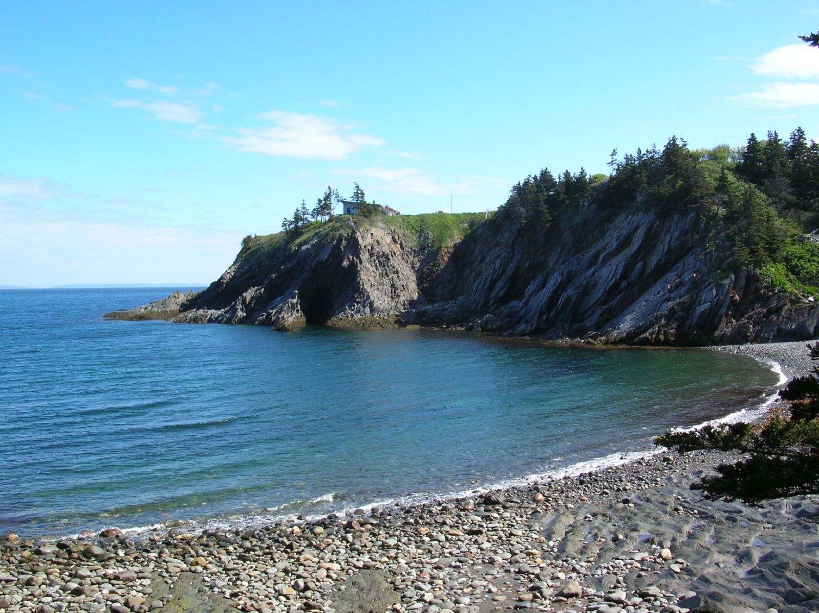
A sub-basin of the Gulf of Maine, the bay's southeastern shore is formed by mainland Nova Scotia, while its northwestern shore is formed by the Digby Neck, Long Island and Brier Island.
The bay bifurcates the two municipal districts in Digby County, with the bilingual Clare Municipal District located on the mainland portion (southeastern shore) and the Digby Neck being part of the Digby Municipal District, which also occupies the eastern half of the county.
These bodies of water have shaped life on Digby Neck in several ways. Their tides are among the highest in the world, spanning 50 feet (16 metres) in places. The rich and varied flora and fauna of the bays are a result of this tidal action. Regularly exposed swaths of wet ocean floor create a special environment for the species that inhabit these regions. Tidal action also causes a stirring up of the water, allowing whales to feed easily on agitated plankton. This is one reason why the Bay of Fundy is world-renowned for its whale watching trips.[citation needed]
Shipbuilding, once an economic force in the area, was facilitated by the tides. Dry docks allowed ships to be built and floated without moving them, a significant advantage given the size and weight of a large boat. Weir fishing also benefits from the tides. At high tide the weir is submerged, fish swim in to the weir and, at low tide, the fishermen row in and scoop up the fish that are trapped at low tide.
Major communities situated on St. Marys Bay include Sandy Cove, Weymouth, Belliveaus Cove, Comeauville, Saulnierville, and Meteghan.
Public parks are located at Meteghan (Smugglers Cove Provincial Park), Cape St. Marys, (Mavilette Beach). and Plympton (Savary Picnic Park).
Indigenous fishery
The Peace and Friendship Treaty of 1752[3] signed in Shubencadie/Sipekne’katik district on November 22, 1752 in Halifax by Jean Baptiste Cope and representatives for His Majesty The King (Government of Canada) affirmed that the Sipekne’katik the right to have free liberty of Hunting and Fishing among numerous other rights.
In the fall of 2020, the Sipekne’katik First Nation began exercising its self-managed moderate livelihood fishery in St. Mary's Bay, resulting in Acadian fishermen targeting and intimidating buyers in an attempt to undermine the sale of band lobster caught through their court-affirmed treaty rights. Tensions have escalated with non-Indigenous fishermen, who take issue with the Mi’kmaq fishery operating outside of the regulated fishing season leading to an incident with a group of as many as 200 local commercial fishermen participating in a series of violent, racist raids which saw buildings besieged, property damaged, commodities destroyed.[citation needed] Mi’kmaq leaders say they are allowed to catch fish under a 1999 Supreme Court decision that affirms their right to fish for a moderate livelihood. DFO and RCMP have also come under fire for standing by watching the situation deteriorate.
Sipekne’katik fishermen have been using Federal Wharves at Saulnierville in Clare and Weymouth (Wessagusset) in Digby.
There are approximately 900 commercial lobster licenses with about 400 traps per boat, compared to the Indigenous fishery which had less than 10 boats carrying 50 traps each.[citation needed]
References
- "Megumaage, a map of Nova Scotia". Haggis.mccullochcentre.ca. Retrieved 1 February 2022.
- "Letter regarding Mi'kmaq Use Report" (PDF). Ceaa-acee.gc.ca. Retrieved 1 February 2022.
- "Mi'kmaq/British Treaties: THE TREATY OF 1752". Danielnpaul.com.
External links
- Natural History of Nova Scotia (excerpt)
| Authority control |
|
|---|
Другой контент может иметь иную лицензию. Перед использованием материалов сайта WikiSort.org внимательно изучите правила лицензирования конкретных элементов наполнения сайта.
WikiSort.org - проект по пересортировке и дополнению контента Википедии