geo.wikisort.org - Sea
Cenderawasih Bay (Indonesian: Teluk Cenderawasih, "Bird of Paradise Bay"), also known as Sarera Bay (Indonesian: Teluk Sarera) and formerly Geelvink Bay (Dutch: Geelvinkbaai), is a large bay in northern Province of Papua, Central Papua and West Papua, New Guinea, Indonesia.[1]
| Cenderawasih Bay | |
|---|---|
 Location of Cenderawasih Bay | |
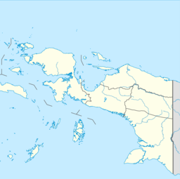 Cenderawasih Bay | |
| Location | Western New Guinea |
| Coordinates | 2°30′00″S 135°20′00″E |
| Type | Bay |
| Native name | Teluk Cenderawasih (Indonesian) |
| Basin countries | |
| Max. width | 450 kilometres (280 mi) |
| Max. depth | 1,627 metres (5,338 ft) |
Geography
Cenderawasih Bay is a large bay to the northwest of the Indonesian province of Papua, north of the province of Central Papua, and east of the province of West Papua, between the Bird's Head Peninsula and the mouth of the Mamberamo River.
The bay is more than 300 kilometers wide. The coastline from Manokwari, in the northwest of the bay, to Cape d'Urville at the mouth of the Mamberamo is more than 700 kilometers long. To the south, the Wandammen peninsula heads north into the bay. Important places along the coast are Manokwari, Ransiki, Wasior and Nabire.
The Wamma River, Tabai River, Warenai River, and Wapoga River empty into the Bay.
History

The Dutch name of the bay was after the frigate De Geelvink with which Jacob Weyland sailed through the bay in 1705. The Dutch frigate was named after Geelvinck family.
The Tidore Sultanate had tributary ties with the region. Seafarers from the area used to regularly pay homage to the sultan.[2]
Marine National park

Teluk Cenderawasih National Park is located in the Teluk Cenderawasih. In the Cenderawasih Bay extensive coral reefs exists. Parts of the area have been declared a protected marine reserve of 1.5 million hectares, the largest natural park in Southeast Asia. The western part of the bay was declared a marine national park in 2002. The Wondiwoi/Wandammen Natural Reserve of 730 km2 protects the great biodiversity of the Wandammen Peninsula.
Islands
In the bay is the archipelago known as the Schouten Islands (also called the Biak Islands, or Geelvink Islands), comprising Biak, the Padaido Islands, Supiori and Numfor (Numfoor). Further south in the bay is the 140 kilometer long island of Yapen (Japen). Smaller islands in the bay are Mios Num (Pulau Num), Rumberpon, Waar (or Meoswaar), Roon and Kurudu. The Mapia Islands lie to the north, and south of Palau.
West Papua Province
- Auri Islands archipelago (Kepulauan Auri)
- Meos Waar
- Rumberpon
- Roon Island
- Meos Angra
Papua Province
- Biak Islands (aka Schouten Islands):
- Yapen Islands
- Yapen
- Mios Num
- Kurudu
- Ambai Islands (Kepulauan Ambai)
- Kuran Islands (Kepulauan Kuran)
Central Papua Province
- Moora Islands archipelago (Kepulauan Moora)
- Anggrameos Island
See also
- Bays of Indonesia
- Cenderawasih languages
References
- Teluk Sarera: Indonesia National Geospatial-Intelligence Agency, Bethesda, MD, USA
- Slama, Martin (2015), "Papua as an Islamic Frontier: Preaching in 'the Jungle' and the Multiplicity of Spatio-Temporal Hierarchisations", From 'Stone-Age' to 'Real-Time': Exploring Papuan Temporalities, Mobilities and Religiosities, ANU Press, pp. 243–270, ISBN 978-1-925022-43-8
Indonesian seas | |
|---|---|
| Ocean |
|
| Sea | |
| Strait |
|
| Gulf | |
Authority control | |
|---|---|
| General |
|
| National libraries | |
На других языках
- [en] Cenderawasih Bay
[ru] Чендравасих (залив)
Чендрава́сих (индон. Teluk Cenderawasih — Залив райской птицы), также Teluk Sarera (залив Сарера), ранее залив Гелвинк[1] (нидерл. Geelvinkbaai) — крупный залив в Северной провинции Папуа и Западном Папуа, Новая Гвинея, Индонезия. Голландское название происходит от названий голландского корабля и семьи Гелвинк.[2] Западная часть залива была объявлен морским национальным парком в 2002 году.Другой контент может иметь иную лицензию. Перед использованием материалов сайта WikiSort.org внимательно изучите правила лицензирования конкретных элементов наполнения сайта.
WikiSort.org - проект по пересортировке и дополнению контента Википедии