geo.wikisort.org - River
The Williams River is a 27.0-mile (43.5 km)[1] river in the US state of Vermont. It is a tributary of the Connecticut River. Its watershed covers 117 square miles; land use is about 80% forested and 4% agricultural, and the upper river supports wild brook trout and brown trout.[2]


The river was named for John Williams of Deerfield, Massachusetts. He preached the first Christian sermon in what would become Vermont near the mouth of the river on March 5, 1704.[3] His text was from Lamentations 1:18: "Hear now, all peoples, And behold my sorrow; My virgins and my young men Have gone into captivity."[4] A historical marker was placed near the site of the sermon in 1912 (see photo). At the time, he and part of his congregation were captives of the French, the Mohawk and the Abenaki after the Deerfield Raid, being marched from Deerfield, MA to Quebec, Canada.[5]
The Williams River rises in the northern part of the town of Andover and flows east through a corner of Ludlow and into Chester, where it turns southeast. The river then flows in a narrow valley near Vermont Route 103 between rolling hills into the town of Rockingham, where it joins the Connecticut River at Herricks Cove. Its major tributaries (from upriver to downriver) include Wheaton Brook, Lovejoy Brook, and Bear Brook in Andover and Ludlow. In Chester, it is joined by the Middle Branch Williams River, which starts in Windham; the tributaries of the Middle Branch include Lyman Brook, Andover Branch, and South Branch Williams River. Named tributaries in Rockingham include Wright Brook, Stearns Brook, Wiley Hill Brook, and Divoll Brook (flowing north), and Skunk Hollow Brook, Petty Brook, Brockways Mills Brook, Lillie Brook, Locke Brook, and O'Brien Brook (flowing south).[2][6] The lower part of Petty Brook (in Bartonsville) was the mainstem of the river until a flood in 1869 changed its course.[7] The Williams River watershed lies south of the Black River watershed, which includes most of Springfield, and north of the Saxtons River watershed.
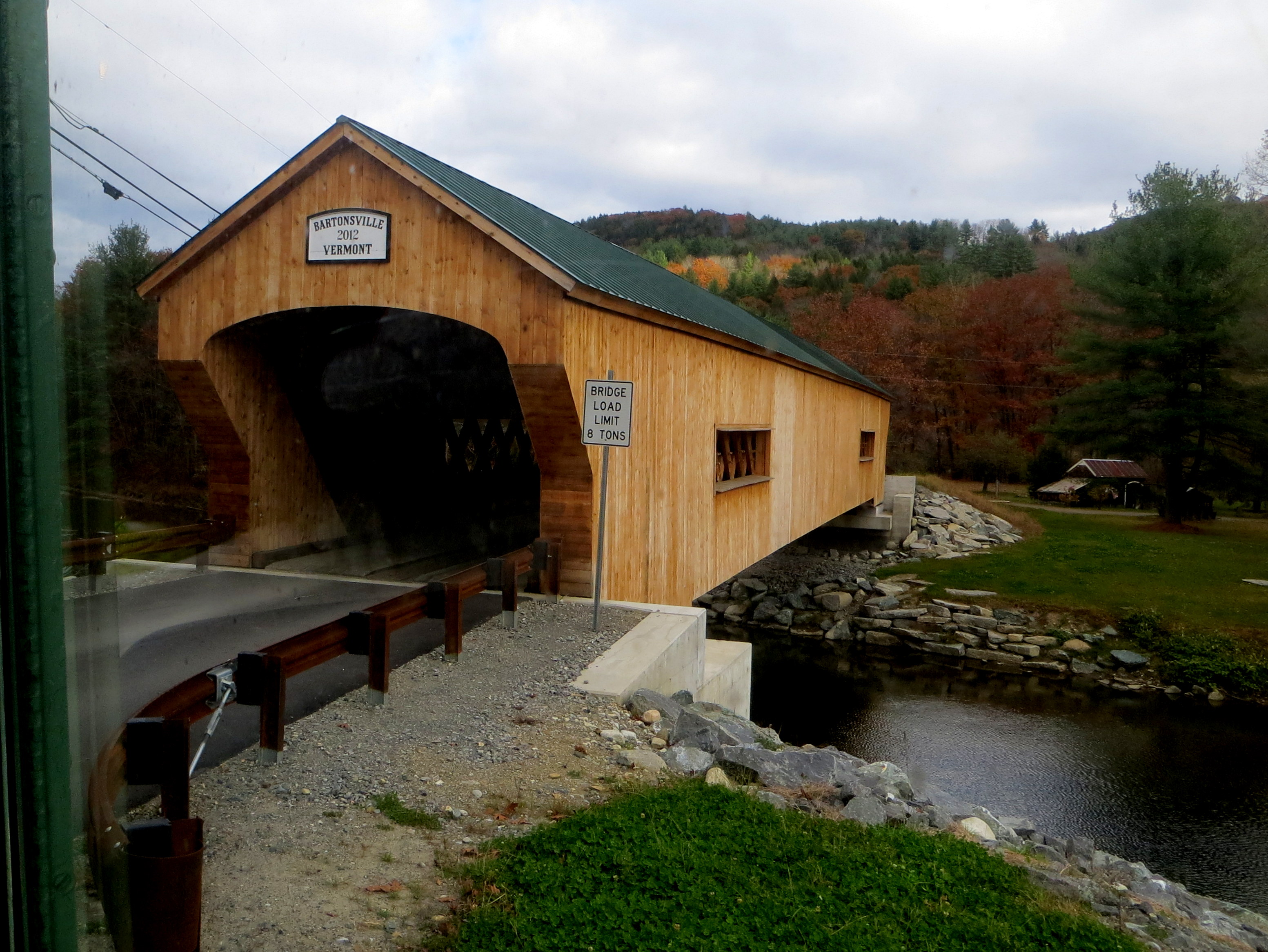
In Rockingham it is crossed by the Bartonsville Covered Bridge that was washed away in Hurricane Irene in August 2011, rebuilt in 2012, and reopened in January 2013,[7] as well as the Worrall Covered Bridge, the only 19th century covered bridge left in town. Below those bridges, it flows over Sokoki Falls, named for the local band of the Abenaki,[8] and through Brockways Mills Gorge.
The river is a target for prospectors who can be seen panning for placer gold, south of the Town of Ludlow, near the site of the Rio Tinto open-pit talc mine.
See also
References
- US Geological Survey. National Hydrography Dataset high-resolution flowline data. The National Map, accessed April 1, 2011
- Williams River basin summary, 2014 http://dec.vermont.gov/sites/dec/files/wsm/mapp/docs/mp_williamsriver.pdf
- Hayes, Lyman S. 1907. History of the Town of Rockingham, Vermont: Including the Villages of Bellows Falls, Saxtons River, Rockingham, Cambridgeport and Bartonsville, 1753-1907, with Family Genealogies. Published by Bellows Falls, VT. Retrieved 6-12-14 at https://play.google.com/books/reader?id=ULmlDG8KLjYC&printsec=frontcover&output=reader&authuser=0&hl=en&pg=GBS.PA2
- Parkman, Francis (1902). The Struggle for a Continent. Little, Brown.
- Williams, Stephen. 1837. A Biographical Memoir of the Rev. John Williams, First Minister of Deerfield, MA. C.J.J. Ingersoll, Greenfield, MA. Retrieved 6-12-14 from https://archive.org/stream/abiographicalme00willgoog#page/n46/mode/2up
- Geographic names Information System search page https://geonames.usgs.gov/apex/f?p=138:1:0:::::
- Bartonsville Covered Bridge History http://www.bartonsvillecoveredbridge.com/history/
- Geographic names Information System, Sokoki Falls https://edits.nationalmap.gov/apps/gaz-domestic/public/search/names/0e37f417-aedc-5852-a71d-cb2cf66ab7b9/summary
- US Geological Survey topographic maps, 1:100,000-scale series, Claremont (NH) quadrangle
- U.S. Geological Survey Geographic Names Information System: Williams River
На других языках
[de] Williams River (Connecticut River)
Der Williams River ist ein rechter Nebenfluss des Connecticut River im US-Bundesstaat Vermont.- [en] Williams River (Vermont)
Другой контент может иметь иную лицензию. Перед использованием материалов сайта WikiSort.org внимательно изучите правила лицензирования конкретных элементов наполнения сайта.
WikiSort.org - проект по пересортировке и дополнению контента Википедии