geo.wikisort.org - River
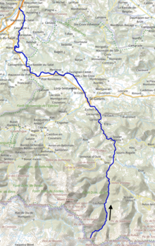
The Salat (French pronunciation: [sala]; Occitan: Salat) is a river in southern France, a right tributary of the Garonne. It is 74.1 km (46.0 mi) long.[1] It rises in nine points above the hamlet Salau in the municipality Couflens, on the slopes of Mont Rouch, central Pyrenees. The former Gascon province of Couserans is based on its valley.
| Salat | |
|---|---|
 In Saint-Girons | |
 | |
| Location | |
| Country | France |
| Physical characteristics | |
| Source | |
| • location | Mont Rouch, Pyrenees |
| • elevation | 2,500 m (8,200 ft) |
| Mouth | |
• location | Garonne |
• coordinates | 43°9′40″N 0°57′58″E |
| Length | 74 km (46 mi) |
| Basin size | 1,570 km2 (610 sq mi) |
| Discharge | |
| • average | 43 m3/s (1,500 cu ft/s) |
| Basin features | |
| Progression | Garonne→ Gironde estuary→ Atlantic Ocean |
Departments and Cities
- Ariège: Saint-Girons
- Haute-Garonne: Salies-du-Salat, Boussens.
Main tributaries
- Alet
- Garbet
- Arac
- Lez
- Baup
- Arbas
References
Wikimedia Commons has media related to Salat River.
Authority control | |
|---|---|
| General |
|
| National libraries | |
На других языках
[de] Salat (Fluss)
Der Salat ist ein Fluss im Pyrenäenvorland in Südfrankreich, der in den Départements Ariège und Haute-Garonne in der Region Okzitanien verläuft.- [en] Salat (river)
[es] Río Salat
El río Salat es un río del sudoeste de Francia. Nace en los Pirineos. Pasa por Saint-Girons y desemboca en el río Garona en Boussens. Tiene 78 kilómetros de longitud.[it] Salat (fiume)
Il Salat è un fiume del sud-ovest della Francia che scorre nell'antica regione del Couserans, dipartimenti dell'Ariège e della Haute-Garonne.Текст в блоке "Читать" взят с сайта "Википедия" и доступен по лицензии Creative Commons Attribution-ShareAlike; в отдельных случаях могут действовать дополнительные условия.
Другой контент может иметь иную лицензию. Перед использованием материалов сайта WikiSort.org внимательно изучите правила лицензирования конкретных элементов наполнения сайта.
Другой контент может иметь иную лицензию. Перед использованием материалов сайта WikiSort.org внимательно изучите правила лицензирования конкретных элементов наполнения сайта.
2019-2026
WikiSort.org - проект по пересортировке и дополнению контента Википедии
WikiSort.org - проект по пересортировке и дополнению контента Википедии