geo.wikisort.org - Río
El río Salat es un río del sudoeste de Francia. Nace en los Pirineos. Pasa por Saint-Girons y desemboca en el río Garona en Boussens. Tiene 78 kilómetros de longitud.
| Río Salat | ||
|---|---|---|
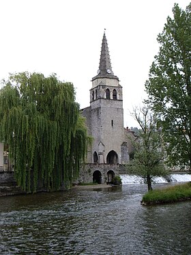 Vista del río Salat en Saint-Girons (Ariège) | ||
| Ubicación geográfica | ||
| Cuenca | Río Garona | |
| Nacimiento | Pirineos | |
| Desembocadura | Río Garona | |
| Coordenadas | 43°09′40″N 0°57′58″E | |
| Ubicación administrativa | ||
| País |
| |
| División |
Departamentos de Ariège y Alto Garona | |
| Cuerpo de agua | ||
| Longitud | 78 km | |
| Superficie de cuenca | 1.570 km² | |
| Caudal medio | 42.60 m³/s | |
| Altitud |
Nacimiento: n/d m Desembocadura: n/d m | |
| Mapa de localización | ||
 | ||
Nace de 9 fuentes diferentes del macizo del monte Valier y discurre por los departamentos de Ariège y Garona.
Sus principales afluentes son los ríos Alet, Garbet, Arac, Lez, Baup y Arbas.
Enlaces externos
| Control de autoridades |
|
|---|
 Datos: Q1094808
 Multimedia: Salat River
На других языках
[de] Salat (Fluss)
Der Salat ist ein Fluss im Pyrenäenvorland in Südfrankreich, der in den Départements Ariège und Haute-Garonne in der Region Okzitanien verläuft.[en] Salat (river)
The Salat (French pronunciation: [sala]; Occitan: Salat) is a river in southern France, a right tributary of the Garonne. It is 74.1 km (46.0 mi) long.[1] It rises in nine points above the hamlet Salau in the municipality Couflens, on the slopes of Mont Rouch, central Pyrenees. The former Gascon province of Couserans is based on its valley.- [es] Río Salat
[it] Salat (fiume)
Il Salat è un fiume del sud-ovest della Francia che scorre nell'antica regione del Couserans, dipartimenti dell'Ariège e della Haute-Garonne.Текст в блоке "Читать" взят с сайта "Википедия" и доступен по лицензии Creative Commons Attribution-ShareAlike; в отдельных случаях могут действовать дополнительные условия.
Другой контент может иметь иную лицензию. Перед использованием материалов сайта WikiSort.org внимательно изучите правила лицензирования конкретных элементов наполнения сайта.
Другой контент может иметь иную лицензию. Перед использованием материалов сайта WikiSort.org внимательно изучите правила лицензирования конкретных элементов наполнения сайта.
2019-2026
WikiSort.org - проект по пересортировке и дополнению контента Википедии
WikiSort.org - проект по пересортировке и дополнению контента Википедии