geo.wikisort.org - River
The Queiq[1] (Modern Standard Arabic: قُوَيْقٌ, Quwayq, [quˈwajq]; northern Syrian Arabic: ʾWēʾ, [ʔwɛːʔ]), with many variant spellings,[5] known in antiquity as the Belus (Greek: Βήλος, Bēlos),[3] Chalos and also known in English as the Aleppo River is a river and valley of the Aleppo Governorate, Syria and Turkey. It is a 129 kilometres (80 mi)-long river that flows through the northern Syrian city of Aleppo. It arises from the southern Aintab plateau in southeastern Turkey. The Akpınar River in the Kilis plain is one of the headwaters of the Queiq. The former town of Qinnasrin lay on its banks.[1] It partly flows along the western rim of the Matah Depression.[6] The valley has been occupied for thousands of years and in ancient times the Queiq valley was noted for its flint industries and pottery.[7]

The river dried up completely in the late 1960s, due to irrigation projects on the Turkish side of the border. Recently, water from the Euphrates has been diverted to revive the dead river, and thus revive agriculture in the plains south of Aleppo, but many Syrians remain bitter towards the Turks over their handling of the river.[8] To revive the river and build irrigation, the Tal Hasel Water Pumping Station was opened in 2008 in rural Aleppo.[9] The station was restored after its damage in 2012 and put into operation again in July 2022.[9]
Gallery
 The flood of Queiq River in February 1922
 The river crossing the Aleppo Public Park in the 1950s
 The river in 2010, downtown Aleppo
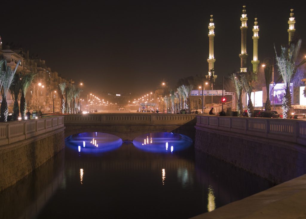
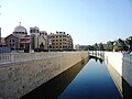 Queiq river in 2011


References
- Phenix, Robert R. (20 December 2008). The sermons on Joseph of Balai of Qenneshrin: rhetoric and interpretation in fifth-century Syriac literature. Mohr Siebeck. p. 53. ISBN 978-3-16-149676-9. Retrieved 30 September 2011.
- Liverani, Mario (1995). Neo-Assyrian geography. Università di Roma, Dipartimento di scienze storiche, archeologiche e antropologiche dell'Antichità. p. 121. Retrieved 30 September 2011.
- Cohen, Getzel M. (2006), Hellenistic Settlements in Syria, the Red Sea Basin, and North Africa, Hellenistic Culture and Society, Vol. 46, Los Angeles: University of California Press, p. 145, ISBN 9780520931022.
- "Aleppo's river of death – Global Public Square - CNN.com Blogs". Globalpublicsquare.blogs.cnn.com. 2013-03-11. Retrieved 2014-08-24.
- Including Qoueiq,[2] Qoueiq,[3] Kweik,[4] and Quweiq.
- Wagner, Wolfgang (25 July 2011). Groundwater in the Arab Middle East. Springer. p. 165. ISBN 978-3-642-19350-7. Retrieved 30 September 2011.
- Peregrine, Peter Neal; Ember, Melvin; inc, Human Relations Area Files (2002). Encyclopedia of Prehistory: South and Southwest Asia. Springer. p. 42. ISBN 978-0-306-46262-7. Retrieved 30 September 2011.
- Gren, Erik (2002). Orientalia Suecana. Almquist & Wiksell Periodical Co. p. 37. Retrieved 30 September 2011.
- Shaza Qreima (8 July 2022). "President al-Assad inaugurates Tal Hasel water pumping plant, Aleppo". SANA. Retrieved 10 July 2022.
| Neighbourhoods |
| ||||||||||||
|---|---|---|---|---|---|---|---|---|---|---|---|---|---|
| Historic landmarks |
| ||||||||||||
| Madrasas |
| ||||||||||||
| Mosques |
| ||||||||||||
| Churches |
| ||||||||||||
| Historic gates |
| ||||||||||||
| Culture and education |
| ||||||||||||
| Entertainment |
| ||||||||||||
| Streets and squares |
| ||||||||||||
| Notable people |
| ||||||||||||
| Nature |
| ||||||||||||
| Sport |
| ||||||||||||
| Historical timeline |
| ||||||||||||
Category:Aleppo | |||||||||||||
| Mediterranean | |
|---|---|
| Persian Gulf |
|
| endorheic | |
На других языках
[de] Quwaiq
Der Quwaiq (auch Qoueiq),[1] Quweiq oder Qoueiq (arabisch قويق, DMG quwayq [.mw-parser-output .IPA a{text-decoration:none}quwajq]; im nordsyrischen Volksmund ʾwēʾ [ʔwɛːʔ]) (altertümlich Chalos), auch Aleppo-Fluss genannt, ist ein Fluss und dessen Tal, der durch das Gouvernement Aleppo Syrien und die Türkei fließt. Am 129 Kilometer langen Fluss liegt auch die nordsyrische Stadt Aleppo. Der Quwaiq entspringt im südlichen Gaziantep-Plateau im Südosten der Türkei. Der Bach Akpınar Deresi in der Ebene von Kilis ist einer der Oberläufe des Quwaiq. Die antike Stadt Chalkis lag an seinen Ufern.[2] Er fließt teilweise entlang des westlichen Randes der Matah-Depression.[3] Das Tal wird seit Tausenden von Jahren besiedelt und im Altertum war das Tal Quwaiq für seine Feuersteinindustrie und Keramik bekannt.[4]- [en] Queiq
[es] Río Queiq
El río Queiq (en árabe Estándar Moderno: قويق, Quwayq, [quˈwajq]; en árabe levantino: ʾWēʾ, [ʔwɛːʔ]), antiguamente conocido como Belus (en griego: Βήλος Bēlos) y en Occidente a veces denominado río Alepo, es un río y valle de la Gobernación de Alepo, en Siria y una pequeña porción de Turquía. Tiene aproximadamente 129 km de largo y su caudal es intermitente.Другой контент может иметь иную лицензию. Перед использованием материалов сайта WikiSort.org внимательно изучите правила лицензирования конкретных элементов наполнения сайта.
WikiSort.org - проект по пересортировке и дополнению контента Википедии